MyTopo
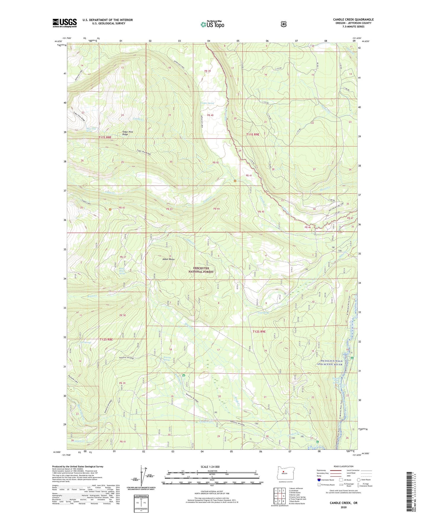
Candle Creek Oregon US Topo Map
Couldn't load pickup availability
Also explore the Candle Creek Forest Service Topo of this same quad for updated USFS data
2023 topographic map quadrangle Candle Creek in the state of Oregon. Scale: 1:24000. Based on the newly updated USGS 7.5' US Topo map series, this map is in the following counties: Jefferson. The map contains contour data, water features, and other items you are used to seeing on USGS maps, but also has updated roads and other features. This is the next generation of topographic maps. Printed on high-quality waterproof paper with UV fade-resistant inks.
Quads adjacent to this one:
West: Marion Lake
Northwest: Mount Jefferson
North: Lionshead
Northeast: Shitike Butte
East: Prairie Farm Spring
Southeast: Little Akawa Butte
South: Black Butte
Southwest: Three Fingered Jack
This map covers the same area as the classic USGS quad with code o44121e6.
Contains the following named places: Abbot Butte, Abbot Butte Spring, Abbot Creek Recreation Site, Allen Springs Recreation Site, Bear Valley Creek, Brush Creek, Cabot Creek, Cabot Lake Trail, Canyon Creek, Canyon Creek Recreation Site, Cold Spring, Cougar Spring, Jefferson Lake Trail, Roaring Creek, Roaring Spring, Sheep Spring Horse Camp, Sugar Pine Ridge, Sugar Pine Ridge Trail, Sugar Pine Spring, Two Springs, Wizard Falls, Wizard Falls Campground, Wizard Falls State Fish Hatchery, Wizzard Falls Spring, ZIP Code: 97730