MyTopo
Little Juniper Mountain Oregon US Topo Map
Couldn't load pickup availability
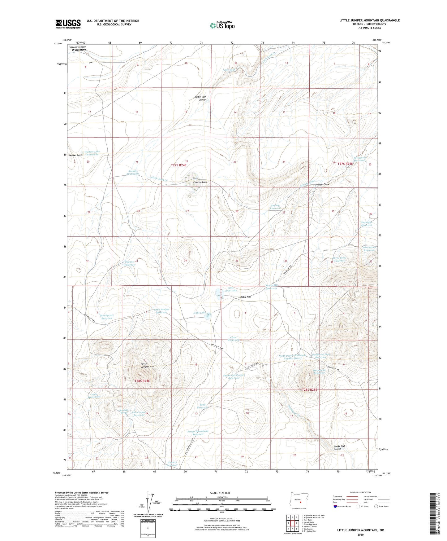
2023 topographic map quadrangle Little Juniper Mountain in the state of Oregon. Scale: 1:24000. Based on the newly updated USGS 7.5' US Topo map series, this map is in the following counties: Harney. The map contains contour data, water features, and other items you are used to seeing on USGS maps, but also has updated roads and other features. This is the next generation of topographic maps. Printed on high-quality waterproof paper with UV fade-resistant inks.
Quads adjacent to this one:
West: Locust Butte
Northwest: Wagontire Mountain West
North: Wagontire Mountain East
Northeast: Alec Butte
East: Goose Egg Butte
Southeast: Dry Valley Rim
South: Cox Canyon
Southwest: Venator Canyon
This map covers the same area as the classic USGS quad with code o43119b7.
Contains the following named places: Bend Reservoir, Brandts Waterhole, Bunchgrass Reservoir, Cabin Waterhole, Clear Waterhole, Cogans Waterhole, Deadhorse Pass Reservoir, Dobie Flat, Five Corners Reservoir, Horsehead Reservoir, Hunters Reservoir, Hutton Waterhole, Jerrys Homestead Reservoir, Linahan Lake, Links Lake, Little Juniper Mountain, Little Juniper Reservoir, Little Juniper Well, Little Links Lake, Little Tank, McDaniels Cabin, North Desert Waterhole Number Eleven, Sandy Bed Reservoir, Settlement Reservoir, Smoke Out Canyon, Smoke Out Canyon Reservoir, Smokeout Creek, Southside Spring, Stormy Reservoir, Stovepipe Reservoir, Three Forks Waterhole, Wagon Draw, Walters Lake Waterhole, Wolter Lake