MyTopo
Dry Valley Rim Oregon US Topo Map
Couldn't load pickup availability
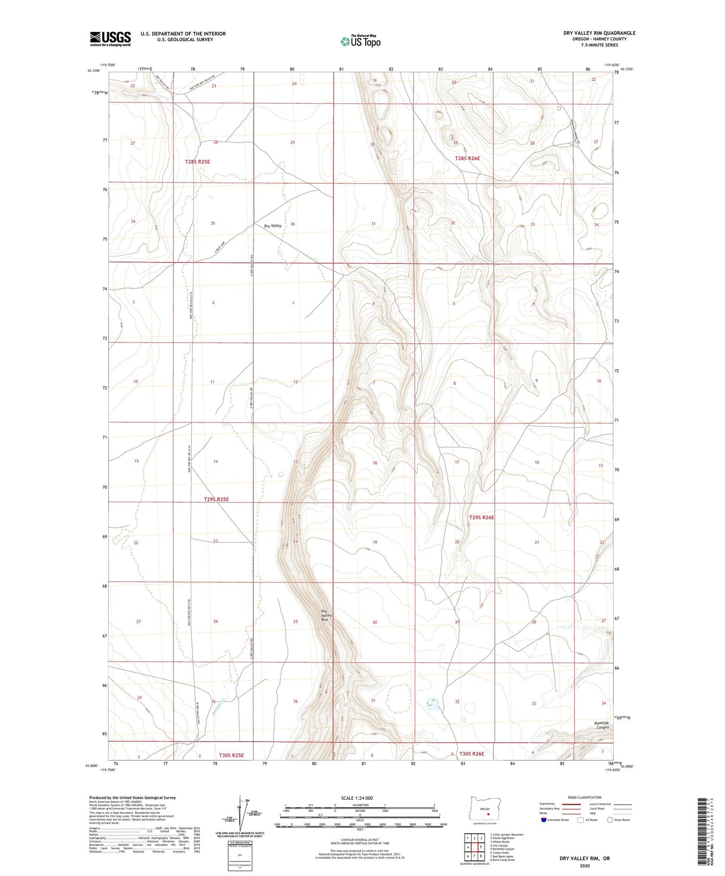
2023 topographic map quadrangle Dry Valley Rim in the state of Oregon. Scale: 1:24000. Based on the newly updated USGS 7.5' US Topo map series, this map is in the following counties: Harney. The map contains contour data, water features, and other items you are used to seeing on USGS maps, but also has updated roads and other features. This is the next generation of topographic maps. Printed on high-quality waterproof paper with UV fade-resistant inks.
Quads adjacent to this one:
West: Cox Canyon
Northwest: Little Juniper Mountain
North: Goose Egg Butte
Northeast: Wilson Butte
East: Rawhide Canyon
Southeast: Rock Camp Draw
South: Red Bank Lakes
Southwest: Turpin Knoll
This map covers the same area as the classic USGS quad with code o43119a6.
Contains the following named places: Boyce Ranch, Dry Valley, Dry Valley Rim, Juniper Creek