MyTopo
Mackey Butte Oregon US Topo Map
Couldn't load pickup availability
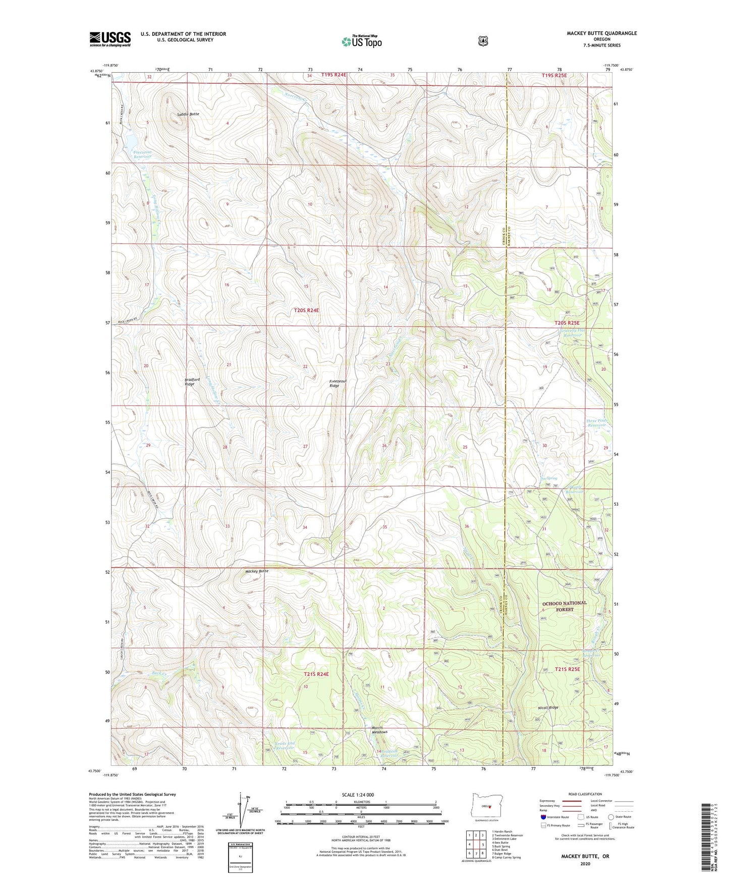
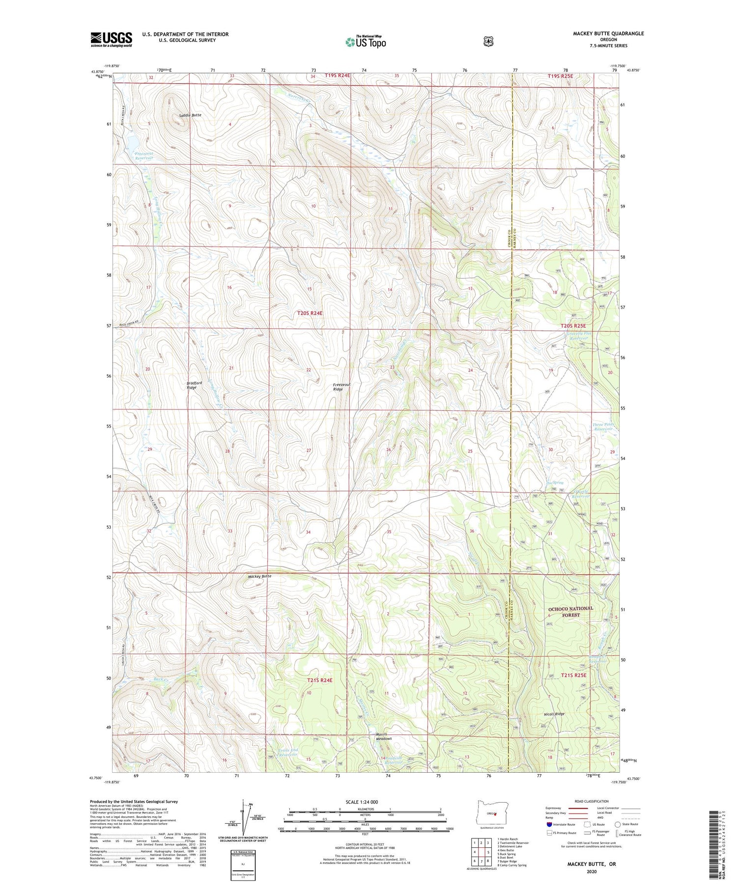
2020 topographic map quadrangle Mackey Butte in the state of Oregon. Scale: 1:24000. Based on the newly updated USGS 7.5' US Topo map series, this map is in the following counties: Crook, Harney. The map contains contour data, water features, and other items you are used to seeing on USGS maps, but also has updated roads and other features. This is the next generation of topographic maps. Printed on high-quality waterproof paper with UV fade-resistant inks.
Quads adjacent to this one:
West: Ibex Butte
Northwest: Hardin Ranch
North: Twelvemile Reservoir
Northeast: Delintment Lake
East: Buck Spring
Southeast: Camp Currey Spring
South: Bulger Ridge
Southwest: Dust Bowl
Contains the following named places: Bradford Ridge, Corral Ridge, Doe Spring, Doe Spring Guard Station, Freezeout Reservoir, Freezeout Ridge, Gravelly Flat Reservoir, Mackey Butte, McIntosh Ranch, Morris Meadows, Nicoll Ridge, O'Keefe Reservoir, Roadside Reservoir, Rough Creek Reservoir, Saddle Butte, Three Pines Reservoir, Trails End Reservoir