MyTopo
Poison Springs Oregon US Topo Map
Couldn't load pickup availability
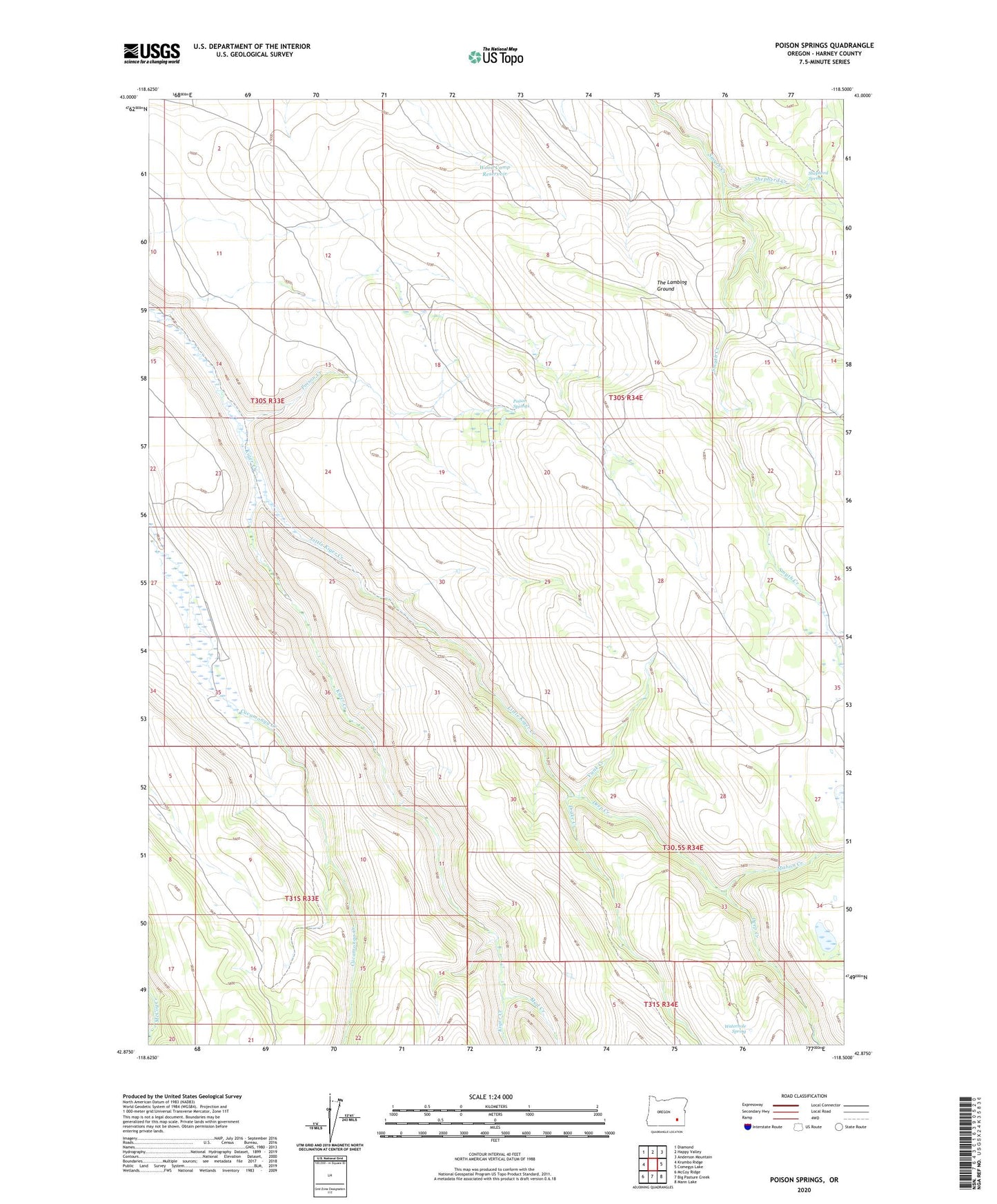
2023 topographic map quadrangle Poison Springs in the state of Oregon. Scale: 1:24000. Based on the newly updated USGS 7.5' US Topo map series, this map is in the following counties: Harney. The map contains contour data, water features, and other items you are used to seeing on USGS maps, but also has updated roads and other features. This is the next generation of topographic maps. Printed on high-quality waterproof paper with UV fade-resistant inks.
Quads adjacent to this one:
West: Krumbo Ridge
Northwest: Diamond
North: Happy Valley
Northeast: Anderson Mountain
East: Comegys Lake
Southeast: Mann Lake
South: Big Pasture Creek
Southwest: McCoy Ridge
This map covers the same area as the classic USGS quad with code o42118h5.
Contains the following named places: Deep Creek, Drake Creek, Frog Creek, Little Kiger Creek, Mahon Creek, Mud Creek, Poison Creek, Poison Springs, Shepherd Creek, Shepherd Spring, Waterhole Spring, Wood Camp Reservoir, Yank Creek