MyTopo
Marion Lake Oregon US Topo Map
Couldn't load pickup availability
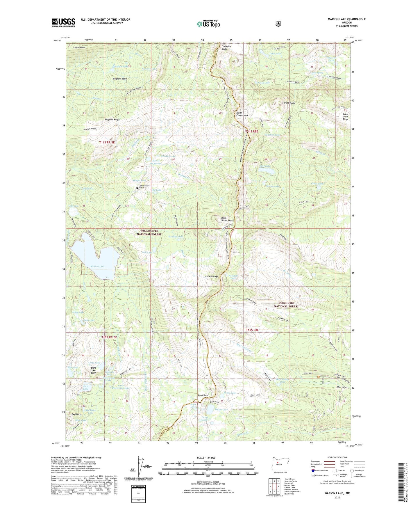
2020 topographic map quadrangle Marion Lake in the state of Oregon. Scale: 1:24000. Based on the newly updated USGS 7.5' US Topo map series, this map is in the following counties: Linn, Jefferson. The map contains contour data, water features, and other items you are used to seeing on USGS maps, but also has updated roads and other features. This is the next generation of topographic maps. Printed on high-quality waterproof paper with UV fade-resistant inks.
Quads adjacent to this one:
West: Marion Forks
Northwest: Mount Bruno
North: Mount Jefferson
Northeast: Lionshead
East: Candle Creek
Southeast: Black Butte
South: Three Fingered Jack
Southwest: Santiam Junction
Contains the following named places: Alice Lake, Bear Valley, Bear Valley Lake, Bingham Basin, Bingham Lake, Bingham Ridge, Bingham Ridge Trail, Blue Lake, Blue Lake Trail, Bowerman Lake, Brush Creek Trail, Cabot Lake, Camp Marion, Carl Lake, Catlin Lake, Chiquito Lake, Eight Lakes Basin, Eight Lakes Creek, Forked Butte, Horse Pasture Creek, Jack Creek, Jefferson Lake, Jenny Lake, John Swallow Grave, Jorn Lake, Junction Lake, Koko Lake, Lake Ann, Lake of the Woods, Lava Spring, Little Bowerman Lake, Lizard Point, Marion Lake, Marion Lake Guard Station, Mazama Creek Campground, Melis Lake, Midget Lake, Minto Lake, Minto Pass, Minto Pass Trail, Mist Creek, Mount Jefferson Wilderness, North Cinder Peak, Papoose Lake, Patsy Lake, Prill Lake, Red Butte, Red Butte Lake, Rockpile Lake, Rockpile Mountain, Sad Lake, Shirley Lake, South Cinder Peak, Summit Trail, Swallow Lake, Swallow Lake Trail, Table Lake, Teto Lake, Wasco Lake, Whiskey Creek, Whiskey Lake