MyTopo
May Lake Oregon US Topo Map
Couldn't load pickup availability
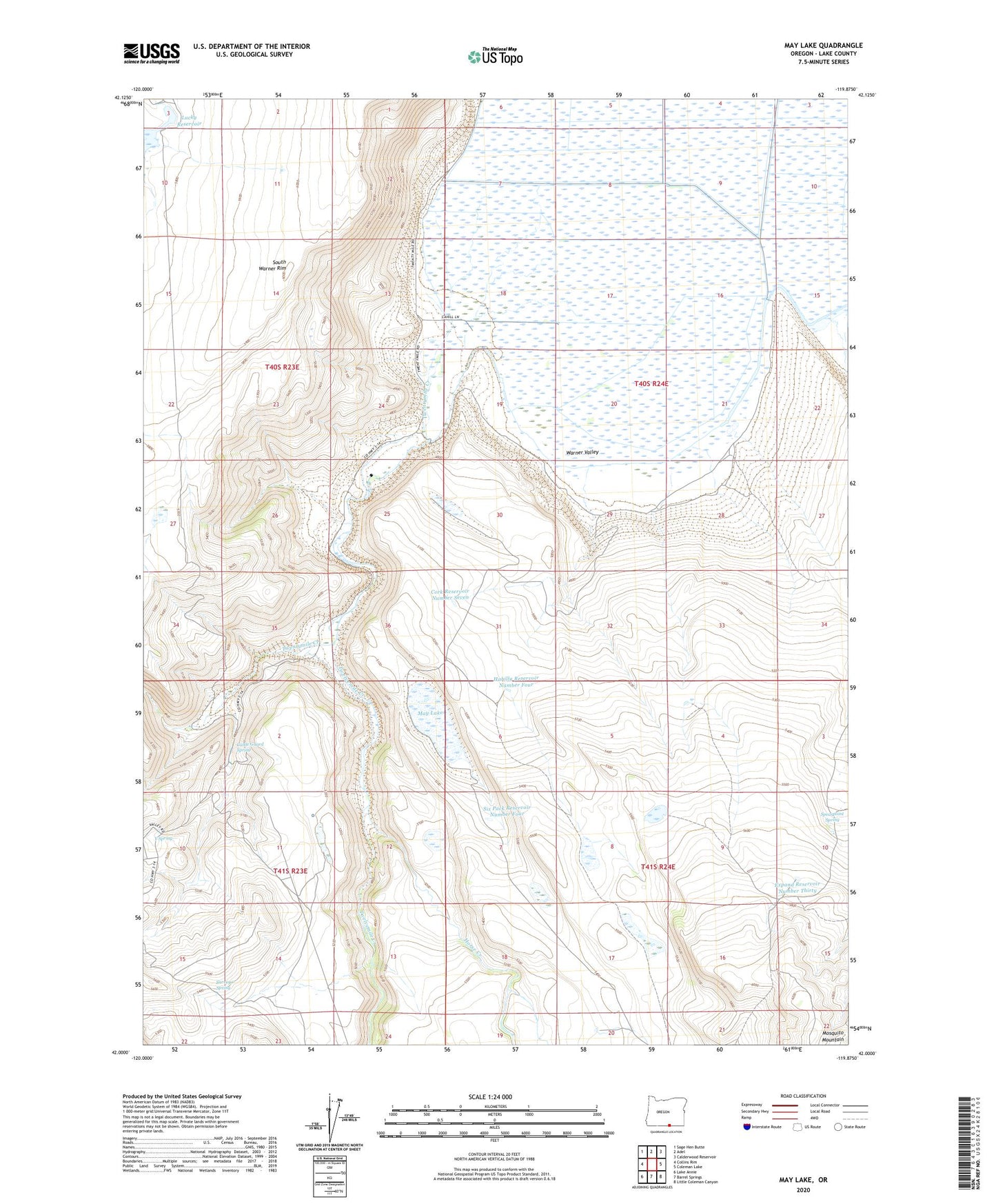
2020 topographic map quadrangle May Lake in the state of Oregon. Scale: 1:24000. Based on the newly updated USGS 7.5' US Topo map series, this map is in the following counties: Lake. The map contains contour data, water features, and other items you are used to seeing on USGS maps, but also has updated roads and other features. This is the next generation of topographic maps. Printed on high-quality waterproof paper with UV fade-resistant inks.
Quads adjacent to this one:
West: Collins Rim
Northwest: Sage Hen Butte
North: Adel
Northeast: Calderwood Reservoir
East: Coleman Lake
Southeast: Little Coleman Canyon
South: Barrel Springs
Southwest: Lake Annie
Contains the following named places: Cattle Guard Spring, Cork Reservoir Number Seven, Expand Reservoir Number Thirty, Hahilly Reservoir Number Four, Horse Creek, James Dyke Place, Lucky Reservoir, May Lake, Six Pack Reservoir Number Four, South Warner Rim, Spearpoint Spring, Surveyor Spring, Twelvemile Creek, Twentymile Creek, Warner Lake, Warner Lake Post Office, Warner Valley, Y Spring