MyTopo
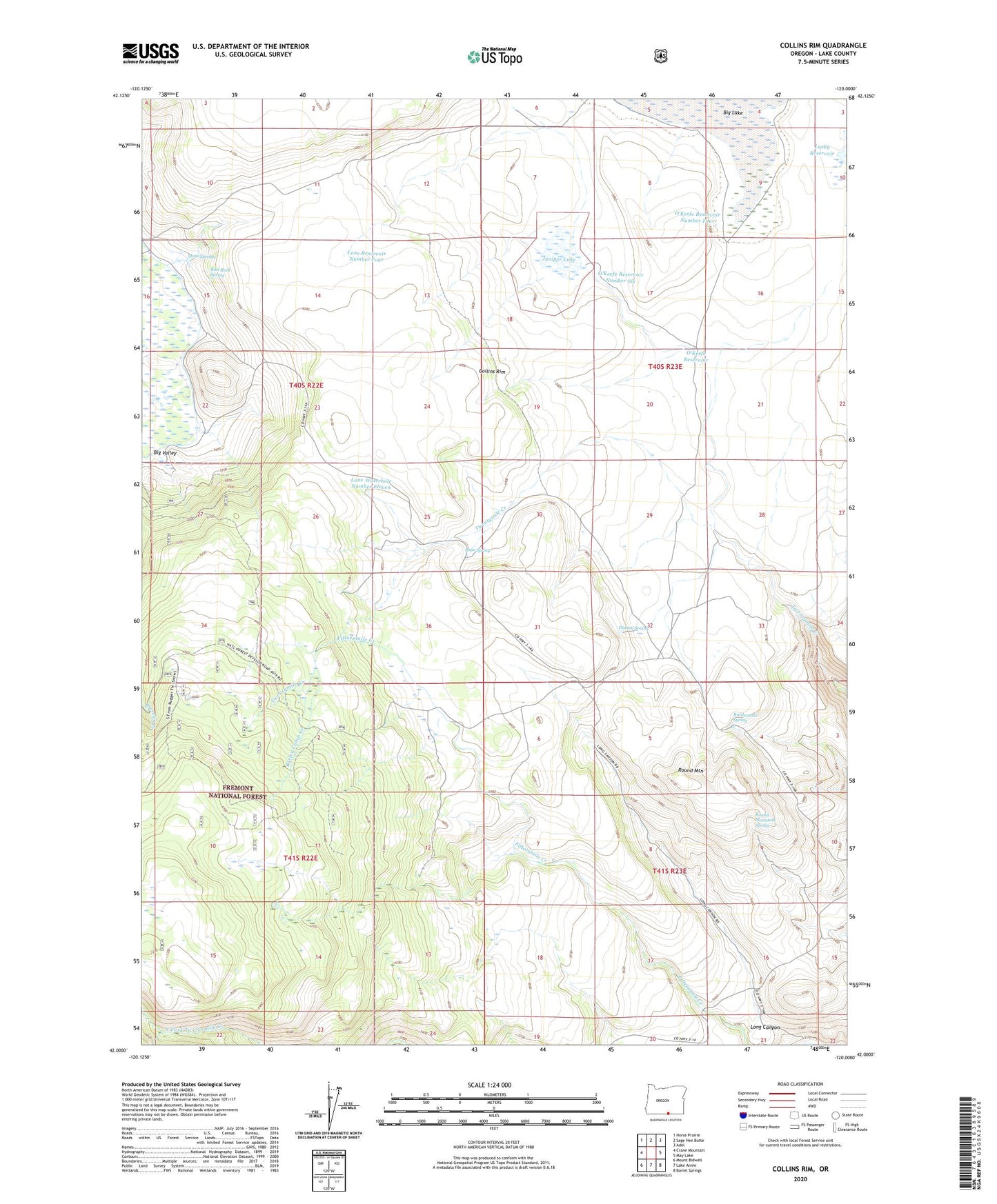
Collins Rim Oregon US Topo Map
Couldn't load pickup availability
Also explore the Collins Rim Forest Service Topo of this same quad for updated USFS data
2023 topographic map quadrangle Collins Rim in the state of Oregon. Scale: 1:24000. Based on the newly updated USGS 7.5' US Topo map series, this map is in the following counties: Lake. The map contains contour data, water features, and other items you are used to seeing on USGS maps, but also has updated roads and other features. This is the next generation of topographic maps. Printed on high-quality waterproof paper with UV fade-resistant inks.
Quads adjacent to this one:
West: Crane Mountain
Northwest: Horse Prairie
North: Sage Hen Butte
Northeast: Adel
East: May Lake
Southeast: Barrel Springs
South: Lake Annie
Southwest: Mount Bidwell
This map covers the same area as the classic USGS quad with code o42120a1.
Contains the following named places: Barley Camp, Barley Camp Creek, Collins Cabin, Collins Rim, Dismal Spring, Frakes Cabin, Haw Cabin, Juniper Lake, Lane Reservoir Number Four, Lane Waterhole Number Eleven, Lane Waterhole Number Twelve, Long Canyon, Mate Cabin, Moss Springs, O'Keefe Reservoir, O'Keefe Reservoir Number Four, O'Keefe Reservoir Number Six, Pope Spring, Rattlesnake Spring, Rim Rock Spring, Round Mountain, Round Mountain Spring