MyTopo
Adel Oregon US Topo Map
Couldn't load pickup availability
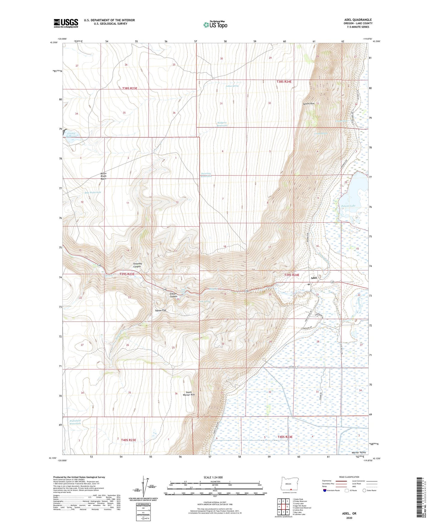
2024 topographic map quadrangle Adel in the state of Oregon. Scale: 1:24000. Based on the newly updated USGS 7.5' US Topo map series, this map is in the following counties: Lake. The map contains contour data, water features, and other items you are used to seeing on USGS maps, but also has updated roads and other features. This is the next generation of topographic maps. Printed on high-quality waterproof paper with UV fade-resistant inks.
Quads adjacent to this one:
West: Sage Hen Butte
Northwest: Drake Peak
North: Priday Reservoir
Northeast: Crump Lake
East: Calderwood Reservoir
Southeast: Coleman Lake
South: May Lake
Southwest: Collins Rim
This map covers the same area as the classic USGS quad with code o42119b8.
Contains the following named places: Adel, Adel Elementary School, Adel Post Office, Bitter Brush Basin, Bug Waterhole, Crump Dam, Crump Ditch, Crump Geyser, Crump Ranch, Crump Reservoir, Crump Spring, Deep Creek Falls, Gibson Canyon, Horse Spring, Indian Spring, Lonely Post Office, Lynchs Rim, M C Ranch, MC Ranch Airport, O'Keefe Ranch, Pelican Lake, Rodgers Reservoir, Rogers Ranch, Squaw Creek, Squaw Flat, Sweeney Canyon, Sweeney Waterhole, Wakefield Waterhole