MyTopo
McIntyre Creek Oregon US Topo Map
Couldn't load pickup availability
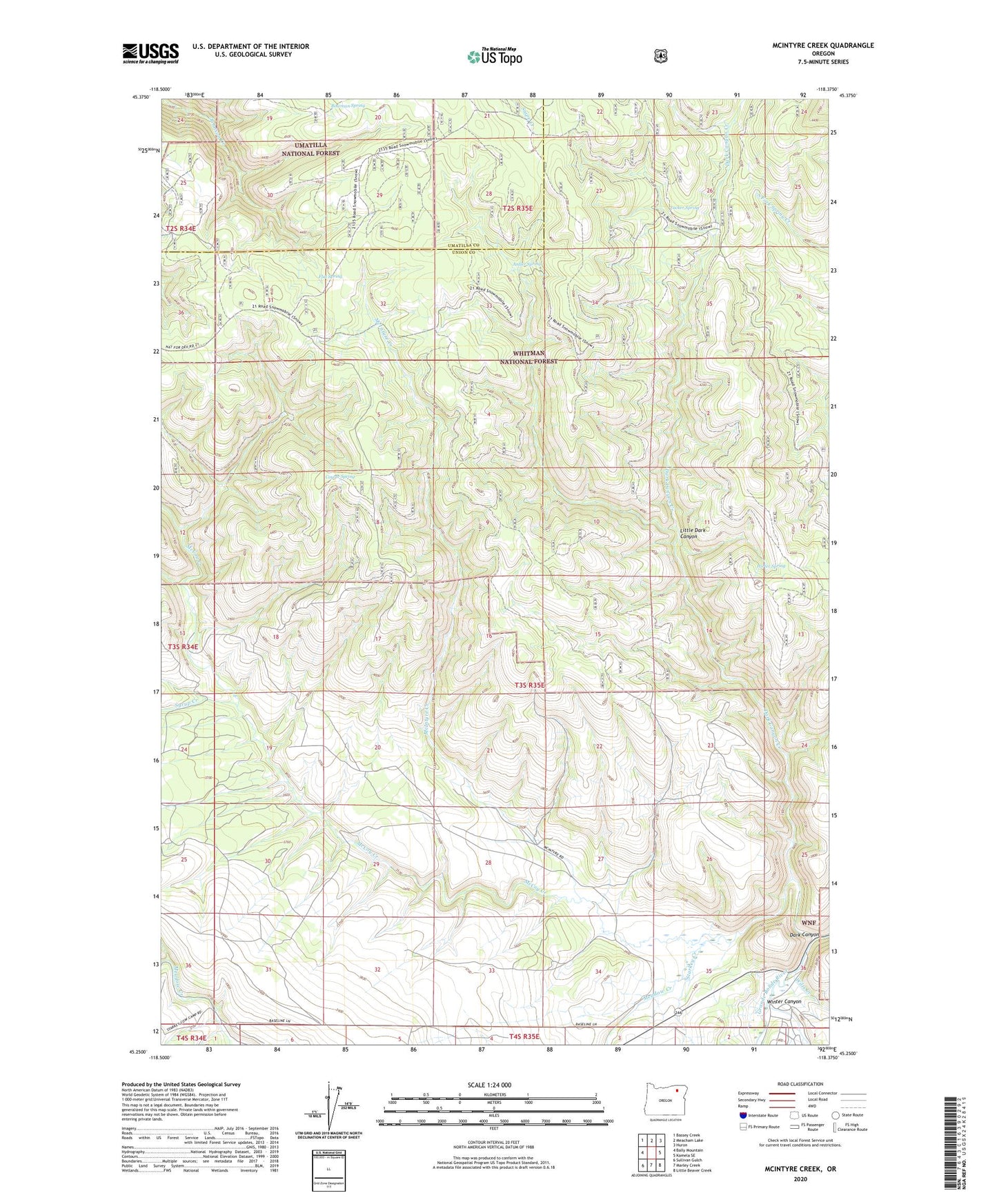
2020 topographic map quadrangle McIntyre Creek in the state of Oregon. Scale: 1:24000. Based on the newly updated USGS 7.5' US Topo map series, this map is in the following counties: Union, Umatilla. The map contains contour data, water features, and other items you are used to seeing on USGS maps, but also has updated roads and other features. This is the next generation of topographic maps. Printed on high-quality waterproof paper with UV fade-resistant inks.
Quads adjacent to this one:
West: Bally Mountain
Northwest: Bassey Creek
North: Meacham Lake
Northeast: Huron
East: Kamela SE
Southeast: Little Beaver Creek
South: Marley Creek
Southwest: Sullivan Gulch
Contains the following named places: Antler Spring, Antler Spring Trail, Bear Creek, Bowman Spring, Coyote Spring, Dark Canyon, Dark Canyon Creek, Dark Canyon Trail, Flat Lake Lookout Tower, Flat Spring, Little Dark Canyon, Little Dark Canyon Trail, McCoy Creek, McIntyre Creek, Meadow Cow Camp, Meadow Creek, Porter Spring, Starkey Creek, Syrup Creek, Tucker Spring, Wilts Creek, Winter Canyon