MyTopo
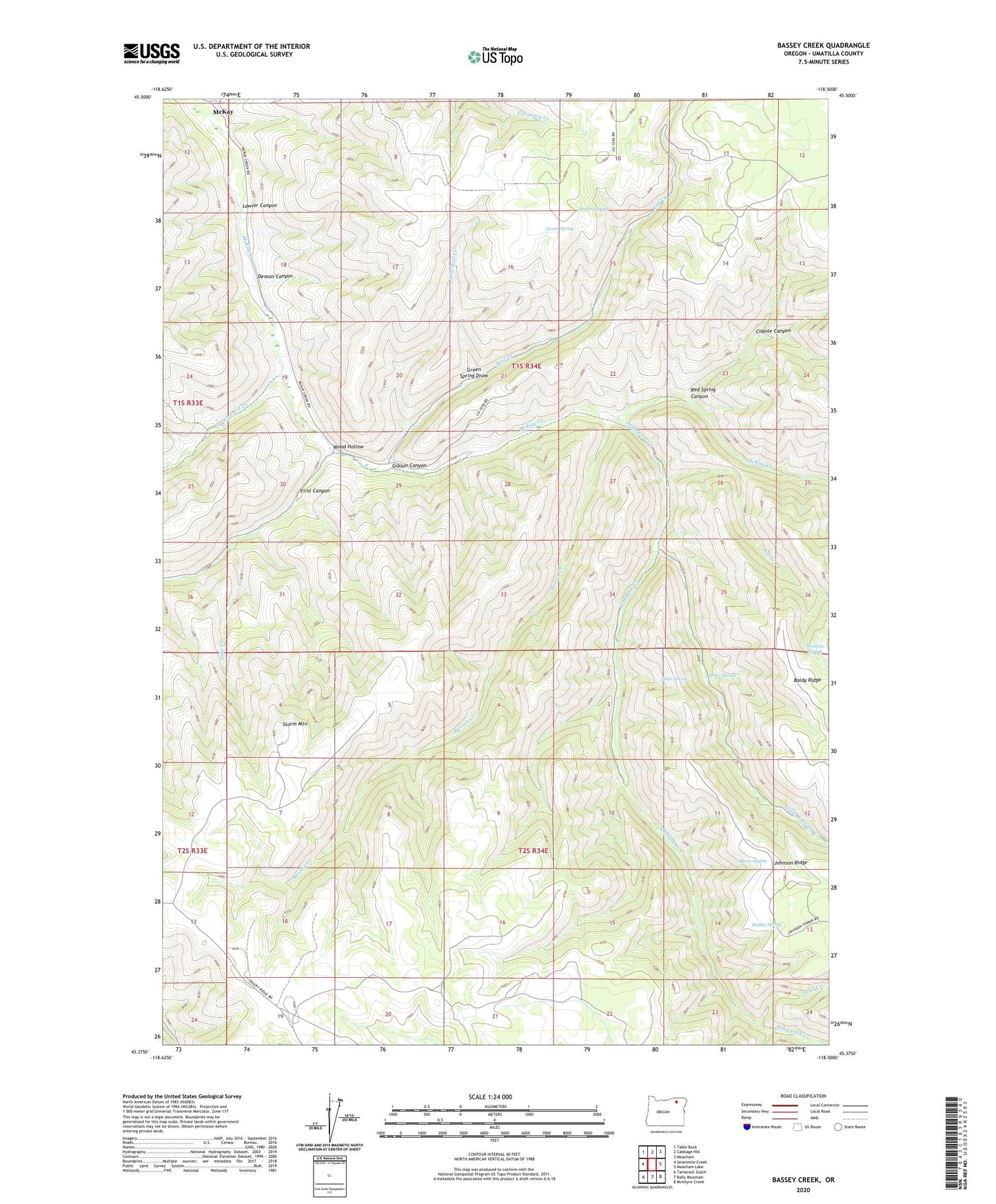
Bassey Creek Oregon US Topo Map
Couldn't load pickup availability
Also explore the Bassey Creek Forest Service Topo of this same quad for updated USFS data
2023 topographic map quadrangle Bassey Creek in the state of Oregon. Scale: 1:24000. Based on the newly updated USGS 7.5' US Topo map series, this map is in the following counties: Umatilla. The map contains contour data, water features, and other items you are used to seeing on USGS maps, but also has updated roads and other features. This is the next generation of topographic maps. Printed on high-quality waterproof paper with UV fade-resistant inks.
Quads adjacent to this one:
West: Sevenmile Creek
Northwest: Table Rock
North: Cabbage Hill
Northeast: Meacham
East: Meacham Lake
Southeast: McIntyre Creek
South: Bally Mountain
Southwest: Tamarack Gulch
This map covers the same area as the classic USGS quad with code o45118d5.
Contains the following named places: Baldy Ridge, Bassey Creek, Bear Creek, Beers Spring, Buckhorn Camp, Coyote Canyon, Denson Canyon, Elder Spring, First Canyon, Gibson Canyon, Green Spring, Green Spring Draw, Johnson Creek, Johnson Ridge, Lake Creek, Lawler Canyon, Little Johnson Creek, Little Rail Creek, Marlin Spring, Mathis Spring, McKay, McKay Post Office, Rail Creek, Red Spring Canyon, Salt Creek, Sevenmile Creek, Spino Spring, Storm Mountain, Watkins Spring, Wood Hollow