MyTopo
Little Beaver Creek Oregon US Topo Map
Couldn't load pickup availability
Also explore the Little Beaver Creek Forest Service Topo of this same quad for updated USFS data
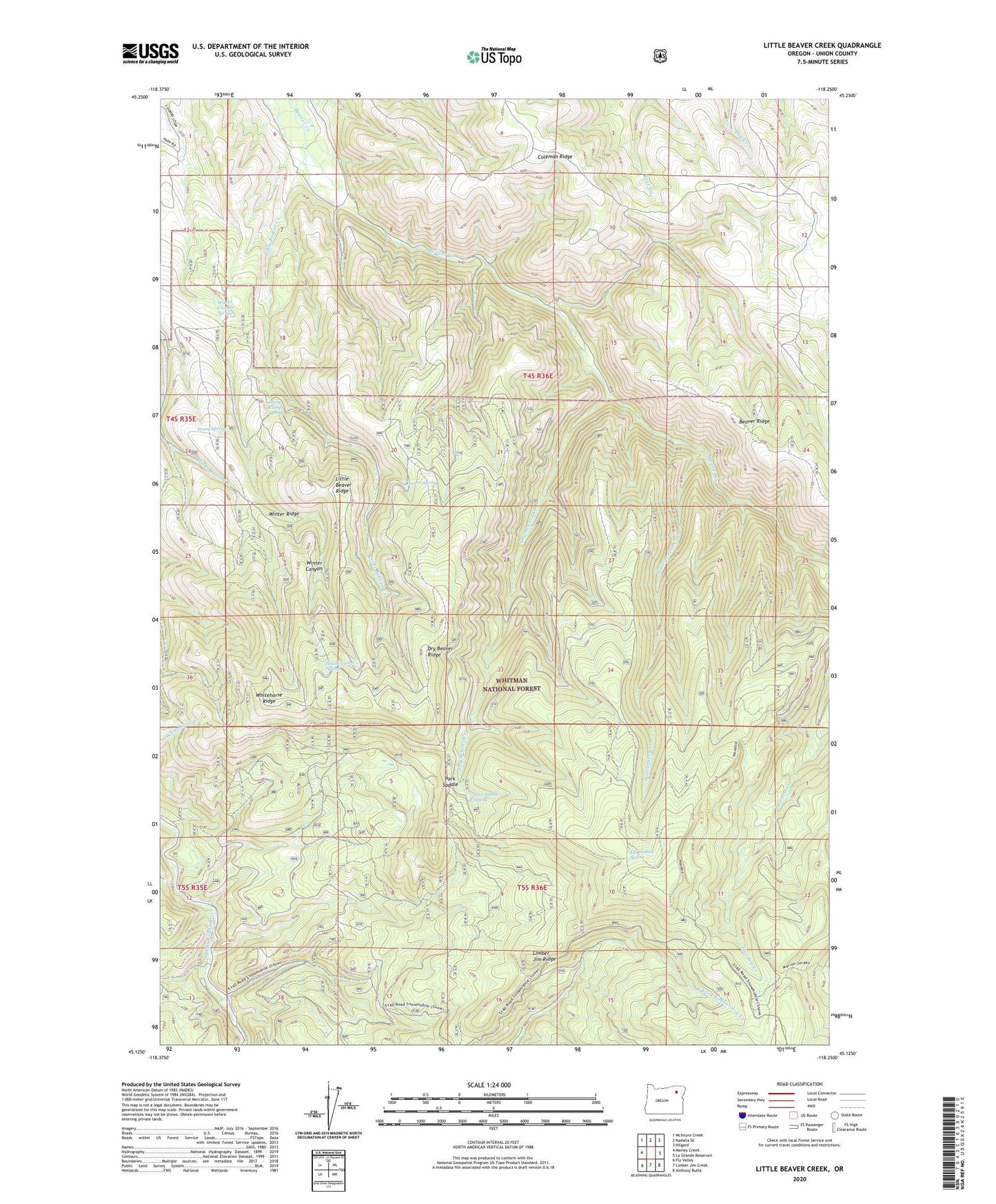
2024 topographic map quadrangle Little Beaver Creek in the state of Oregon. Scale: 1:24000. Based on the newly updated USGS 7.5' US Topo map series, this map is in the following counties: Union. The map contains contour data, water features, and other items you are used to seeing on USGS maps, but also has updated roads and other features. This is the next generation of topographic maps. Printed on high-quality waterproof paper with UV fade-resistant inks.
Quads adjacent to this one:
West: Marley Creek
Northwest: McIntyre Creek
North: Kamela SE
Northeast: Hilgard
East: La Grande Reservoir
Southeast: Anthony Butte
South: Limber Jim Creek
Southwest: Fly Valley
This map covers the same area as the classic USGS quad with code o45118b3.
Contains the following named places: Coleman Ridge, Dry Beaver Creek, Dry Beaver Ridge, Elk Wallow Spring, Grande Ronde Group Camp, Grande Ronde Guard Station, Hoodoo Trail, Hunter Spring, Limber Jim Ridge, Little Beaver Creek, Little Beaver Ridge, Park Saddle, Park Saddle Recreation Site, Park Saddle Spring, Park Saddle Trail, Penny Spring, River Recreation Site, Saddle Camp Spring, Sheep Camp Spring, Starkey Division, Watermelon Creek, Watermelon Trail, Whitehorse Ridge, Winter Canyon Spring, Winter Ridge