MyTopo
Bally Mountain Oregon US Topo Map
Couldn't load pickup availability
Also explore the Bally Mountain Forest Service Topo of this same quad for updated USFS data
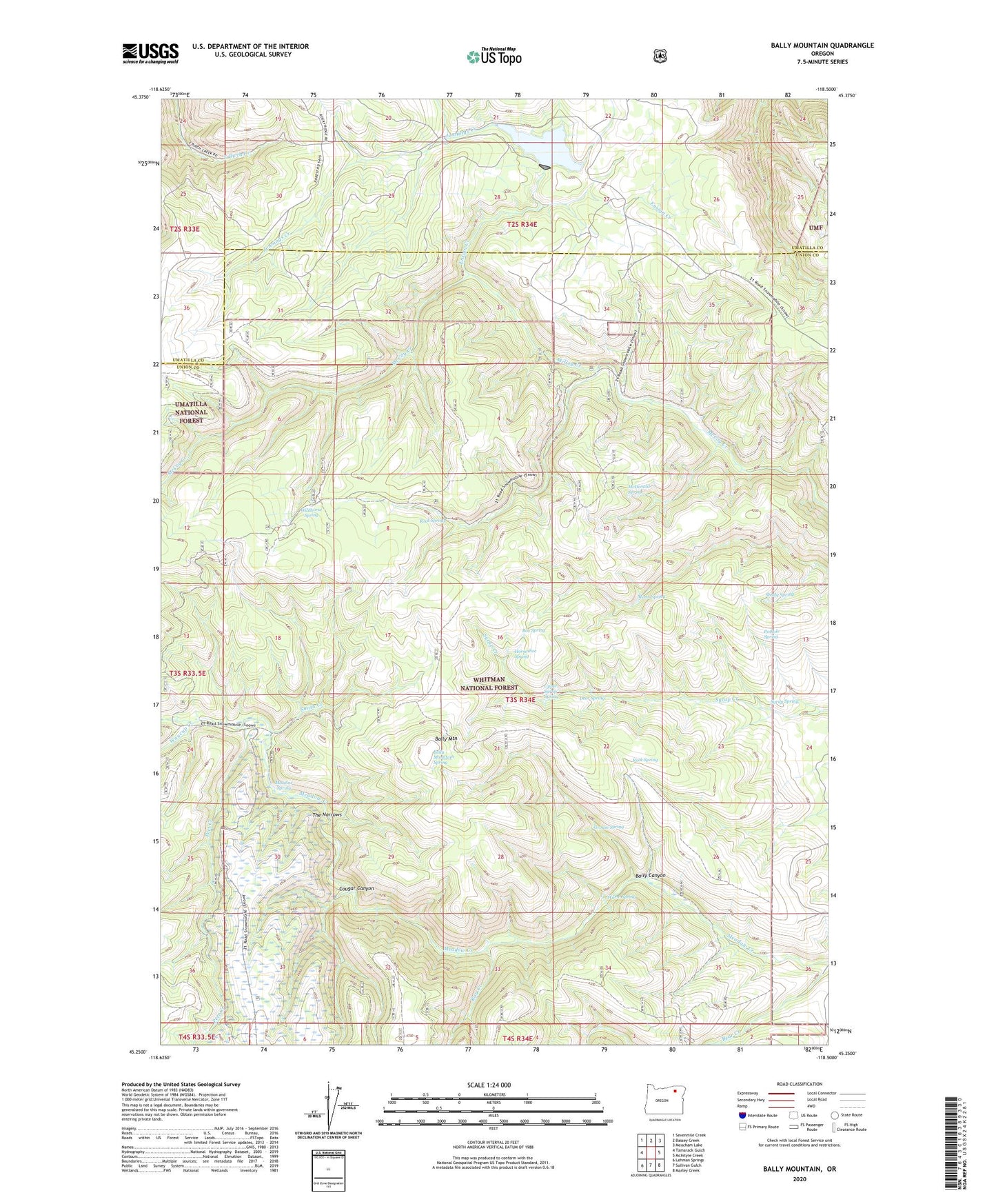
2023 topographic map quadrangle Bally Mountain in the state of Oregon. Scale: 1:24000. Based on the newly updated USGS 7.5' US Topo map series, this map is in the following counties: Union, Umatilla. The map contains contour data, water features, and other items you are used to seeing on USGS maps, but also has updated roads and other features. This is the next generation of topographic maps. Printed on high-quality waterproof paper with UV fade-resistant inks.
Quads adjacent to this one:
West: Tamarack Gulch
Northwest: Sevenmile Creek
North: Bassey Creek
Northeast: Meacham Lake
East: McIntyre Creek
Southeast: Marley Creek
South: Sullivan Gulch
Southwest: Lehman Springs
This map covers the same area as the classic USGS quad with code o45118c5.
Contains the following named places: Bally Camp, Bally Canyon, Bally Mountain, Bally Mountain Spring, Box Spring, Cougar Canyon, Deer Spring, Ensign Creek, Grouse Spring, Horseshoe Spring, Indian Lake, Indian Lake Dam, Indian Lake Recreational Area, Jennings Creek, Mann Spring, McDonald Spring, Meadow Spring, Peet Creek, Pothole Spring, Ray Creek, Rock Spring, Shady Spring, Smith Creek, Syrup Spring, The Narrows, Upper Syrup Spring, Warm Spring, Waucup Creek, Wildhorse Spring