MyTopo
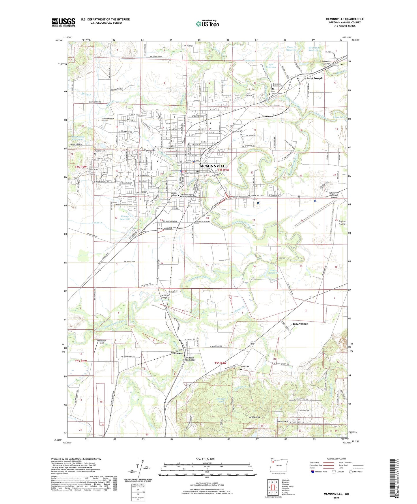
McMinnville Oregon US Topo Map
Couldn't load pickup availability
2023 topographic map quadrangle McMinnville in the state of Oregon. Scale: 1:24000. Based on the newly updated USGS 7.5' US Topo map series, this map is in the following counties: Yamhill. The map contains contour data, water features, and other items you are used to seeing on USGS maps, but also has updated roads and other features. This is the next generation of topographic maps. Printed on high-quality waterproof paper with UV fade-resistant inks.
Quads adjacent to this one:
West: Muddy Valley
Northwest: Fairdale
North: Carlton
Northeast: Dundee
East: Dayton
Southeast: Mission Bottom
South: Amity
Southwest: Ballston
This map covers the same area as the classic USGS quad with code o45123b2.
Contains the following named places: Aebi Reservoir, Airport Park, Amity Hills, Angella Park, Baker Creek, Bend O River Mini Park, Berry Creek, Bethel Christian School, Bourland Reservoir, Braley Street, Brandt, Carlson Park, Center Post Office, Chemeketa Community College, Church of Jesus Christ of Latter Day Saints, City of McMinnville, Columbus Elementary School, Cook Elementary School, Cozine Creek, Crestwood Park, Dayton Prairie, Dayton-Amity Division, Department of Motor Vehicles McMinnville, Discovery Meadows Community Park, Duniway Middle School, Eola Village, Evergreen Aviation and Space Museum, Evergreen Memorial Park, First United Presbyterian Church, Gallery Theatre, Grandhaven Elementary School, Grub College School, Happy Acres Memorial Hospital, Hawn Creek Dam, Hawn Creek Reservoir, Heather Glen Park, Holmes, International Community School, James Park, Jandina Park, Joe Dancer Park, Johnson Creek, Kauer Reservoir, KCYX-AM, Kingwood Mini Park, Kiwanis Marine Park, KSLC-FM, Linfield College, Linfield College Barbara and Wendell Marshall Theatre, Linfield College Jim Wright Stadium, Linfield College Maxwell Field, Linfield College Post Office, Linfield College Ted Wilson Gymnasium, Masonic Cemetery, McMinnville, McMinnville Adventist Christian School, McMinnville City Hall, McMinnville City Park, McMinnville Division, McMinnville Fire Department, McMinnville Foursquare Church, McMinnville Grange Hall, McMinnville High School, McMinnville Hospital, McMinnville Municipal Airport, McMinnville Municipal Courthouse, McMinnville Police Department, McMinnville Post Office, McMinnville Public Library, McMinnville Public Works, McMinnville Reservoirs, McMinnville Sewage Treatment Plant, Media Arts Communication Academy, Memorial Elementary School, Michelbrook Country Club, Miss Kittys Strip, Monroe Landing County Park Boat Launch, Newby Elementary School, North Branch Cozine Creek, North Evans Mini Park, North Yamhill River, Oregon State Police Department - McMinnville Area Command, Panther Creek, Patton Middle School, Peavey Reservoir, Quarry Park, Saint James Catholic Schools, Saint James Cemetery, Saint Joe Crossing, Saint John Lutheran Church, Saint John Lutheran School and Little Lamb Preschool, Saint Joseph, Saint Joseph Post Office, Salt Creek, Seitters, Sight, South Yamhill River, Stringer Pond, Sue Buel Elementary School, Sully, Tall Oaks Park, Taylor Cemetery, Taylor Park, Thompson Park, Tice Park, Town Center Shopping Center, Tustin Lake, United Methodist Church of McMinnville, Valley Baptist Church, Valley Medical Center Heliport, Walnut Hill, Westvale Park, Whiteson, Whiteson Bridge, Whiteson Dip Bridge, Whiteson Post Office, Willamette Valley Medical Center, Wortman Park, Yamhill County Courthouse, Yamhill County Fair and Rodeo Grounds, Yamhill County Juvenile Detention Center, Yamhill County Public Health Department, Yamhill County Public Works, Yamhill County Sheriff's Office, Yamhill County Transit and Community Action Partnership, Yamhill Valley Heritage Center


