MyTopo
Meacham Lake Oregon US Topo Map
Couldn't load pickup availability
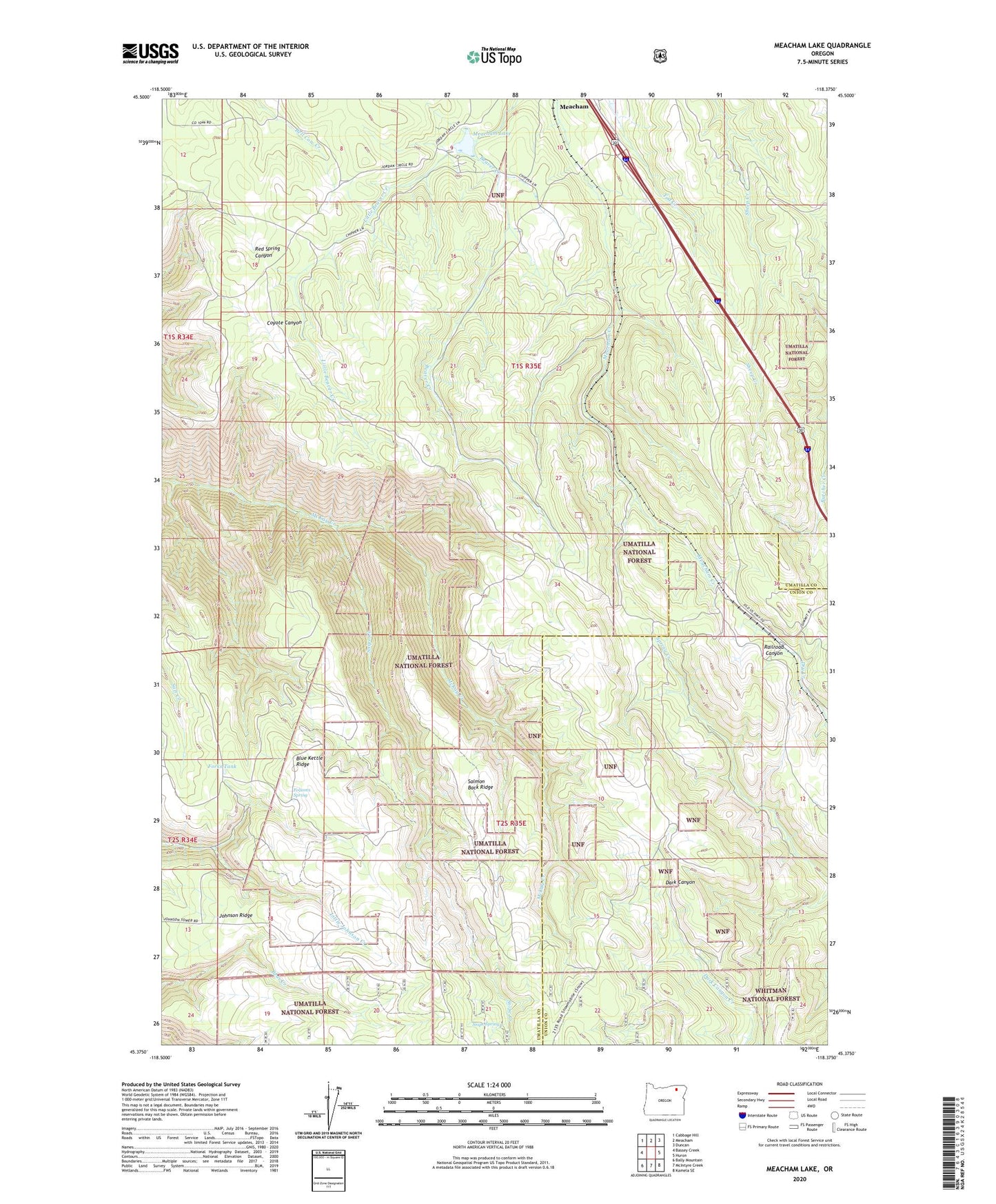
2020 topographic map quadrangle Meacham Lake in the state of Oregon. Scale: 1:24000. Based on the newly updated USGS 7.5' US Topo map series, this map is in the following counties: Umatilla, Union. The map contains contour data, water features, and other items you are used to seeing on USGS maps, but also has updated roads and other features. This is the next generation of topographic maps. Printed on high-quality waterproof paper with UV fade-resistant inks.
Quads adjacent to this one:
West: Bassey Creek
Northwest: Cabbage Hill
North: Meacham
Northeast: Duncan
East: Huron
Southeast: Kamela SE
South: McIntyre Creek
Southwest: Bally Mountain
Contains the following named places: Blue Kettle Ridge, Blue Mountain Forest State Scenic Corridor, Folsoms Spring, Forks Tank, Kamela, Kamela Guard Station, Kamela Post Office, Little Beaver Creek, Meacham Lake, Nibley, Nordeen, Ross, Salmon Back Ridge, Snipe Creek, Snipe Spring, Tip Top Lookout Tower, United States Weather Bureau Station