MyTopo
Molalla Oregon US Topo Map
Couldn't load pickup availability
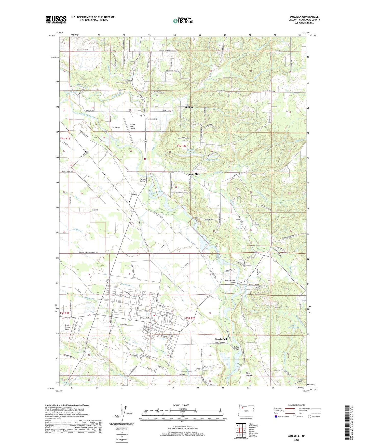
2023 topographic map quadrangle Molalla in the state of Oregon. Scale: 1:24000. Based on the newly updated USGS 7.5' US Topo map series, this map is in the following counties: Clackamas. The map contains contour data, water features, and other items you are used to seeing on USGS maps, but also has updated roads and other features. This is the next generation of topographic maps. Printed on high-quality waterproof paper with UV fade-resistant inks.
Quads adjacent to this one:
West: Yoder
Northwest: Canby
North: Oregon City
Northeast: Redland
East: Colton
Southeast: Fernwood
South: Wilhoit
Southwest: Scotts Mills
This map covers the same area as the classic USGS quad with code o45122b5.
Contains the following named places: Assembly of God, Baty Cemetery, Beaver Creek, Beaver Post Office, Big Rock Lake, Buckner Creek, C C Porter Dam, C C Porter Reservoir, Cedar Creek, Cedar Grove Lake, Charman Creek, Church of Jesus Christ of Latter Day Saints, City of Molalla, Clarkes United Methodist Church, Country Christian School, Crescent Lake Reservoir, Cutting Family Graves, Dickey Bridge, Eby School, Eldorado School, Fallsview, Feyer County Park, Feyrer Park Boat Ramp, Foothills Community Church, Four Corners, Helitradewinds Heliport, Hillside Reservoir, Hooter Creek, Howard, Huntley, Kayler, Liberal, Liberal Post Office, Little Cedar Creek, Meadowbrook Bridge, Meadowbrook Community Church, Meadowbrook Post Office, Meadowbrook School, Molalla, Molalla Buckeroo Rodeo Grounds, Molalla Christian Church, Molalla Church of Christ, Molalla Church of the Nazarene, Molalla City Hall, Molalla Elementary School, Molalla High School, Molalla Municipal Court, Molalla Municipal Water Treatment Plant, Molalla Museum Complex, Molalla Police Department, Molalla Post Office, Molalla Prairie, Molalla Public Library, Molalla Public Works, Molalla River Middle School, Molalla River School District 35, Molalla Rural Fire Protection District 73 Mulino Station, Molalla Rural Fire Protection District Number 73 Station 85, Molalla Sewage Treatment Plant, Molalla United Methodist Church, Mount Hope School, Mulino, Mulino Census Designated Place, Mulino Division, Mulino Elementary School, Mulino Grace Community Church, Mulino Post Office, Mulino State Airport, New Beginnings Foursquare Church, New Martyrs of Russia Orthodox Church, North Liberal, Patrol, Rames, Richard, Saint James Catholic Church, Shady Dell, Skydive Oregon Airport, Sorenson Creek, South Oak Grove School, The Country Christian Church, The Evangelical Community Chapel at Liberal, Union Mills, Union Mills Post Office, W V S Crossing, Wagon Wheel Park Boat Ramp, Wagonwheel Park, Woodcock Creek, Wright Creek, Wrights Bridge, ZIP Code: 97042