MyTopo
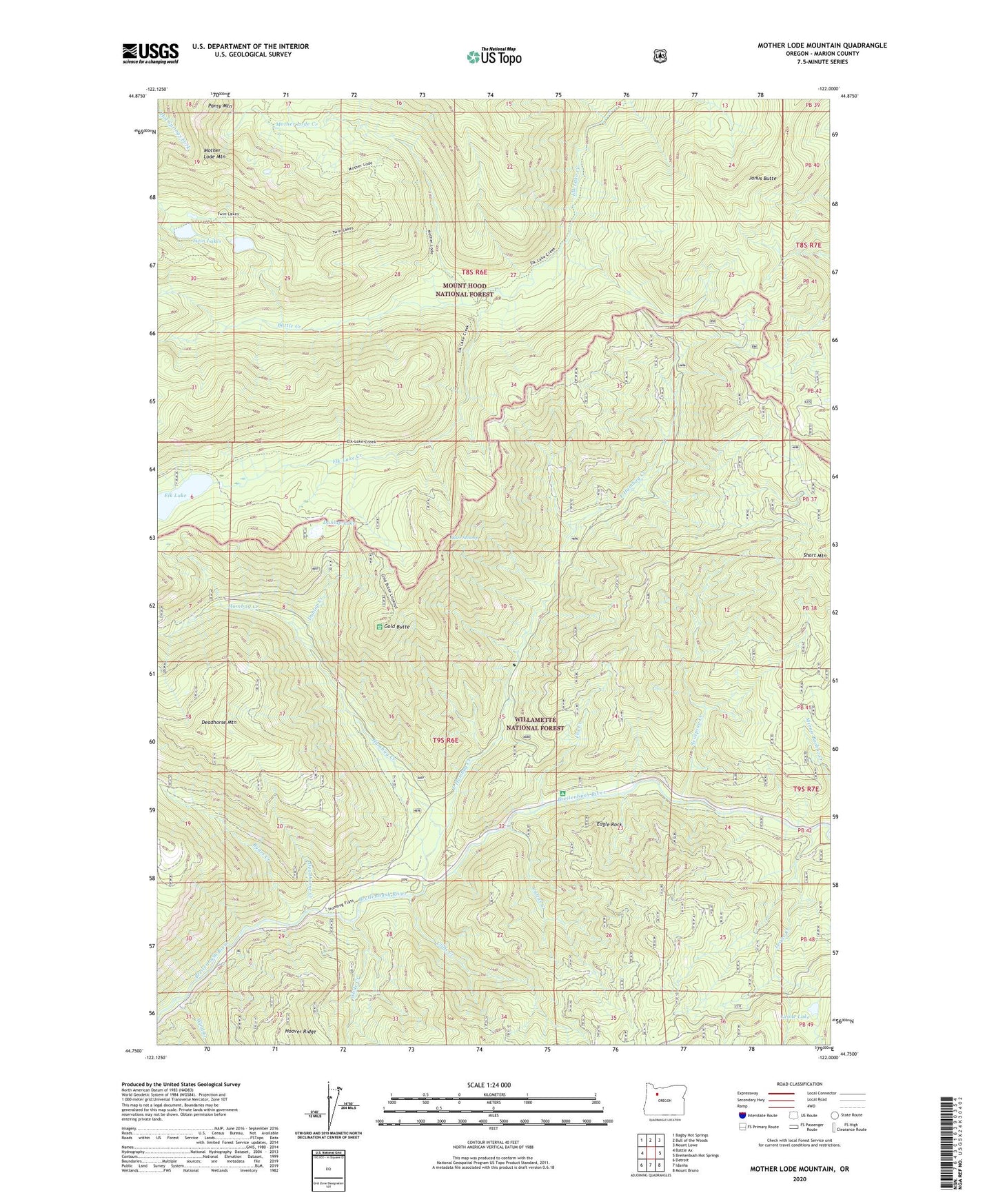
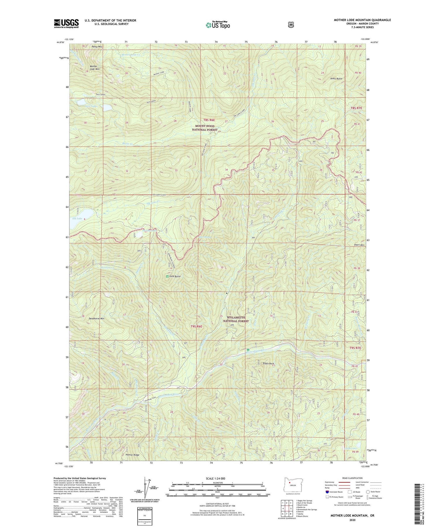
Mother Lode Mountain Oregon US Topo Map
Couldn't load pickup availability
2020 topographic map quadrangle Mother Lode Mountain in the state of Oregon. Scale: 1:24000. Based on the newly updated USGS 7.5' US Topo map series, this map is in the following counties: Marion. The map contains contour data, water features, and other items you are used to seeing on USGS maps, but also has updated roads and other features. This is the next generation of topographic maps. Printed on high-quality waterproof paper with UV fade-resistant inks.
Quads adjacent to this one:
West: Battle Ax
Northwest: Bagby Hot Springs
North: Bull of the Woods
Northeast: Mount Lowe
East: Breitenbush Hot Springs
Southeast: Mount Bruno
South: Idanha
Southwest: Detroit
Contains the following named places: Alder Swamp, Battle Creek, Battle Creek Shelter, Byars Creek, Cliffs Creek, Cultus Creek, Deadhorse Creek, Deadhorse Mountain, Dunlap Creek, Dunlap Lake, Dunlap Lake Boat Launch, Eagle Rock, East Humbug Creek, East Marion Division, Elk Lake, Elk Lake Trail, Fox Creek, Fox Creek Trail, Gold Butte, Humbug Creek, Humbug Recreation Site, Humbug Ridge Trail, Janus Butte, Leone Creek, Leone Lake, Mother Lode Creek, Mother Lode Mountain, Mother Lode Trail, Scorpion Creek, Scorpion Mountain Trail, Scorpion Ridge Trail, Short Mountain, Slide Creek, Twin Lakes, Twin Lakes Trail, Welcome Lakes Ridge Trail, Wind Creek