MyTopo
Mount Defiance Oregon US Topo Map
Couldn't load pickup availability
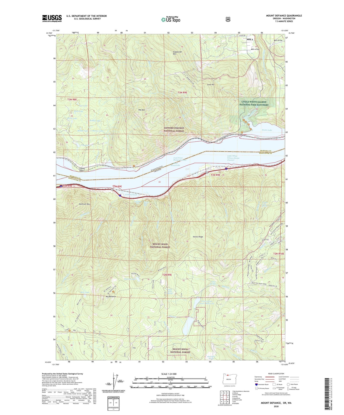
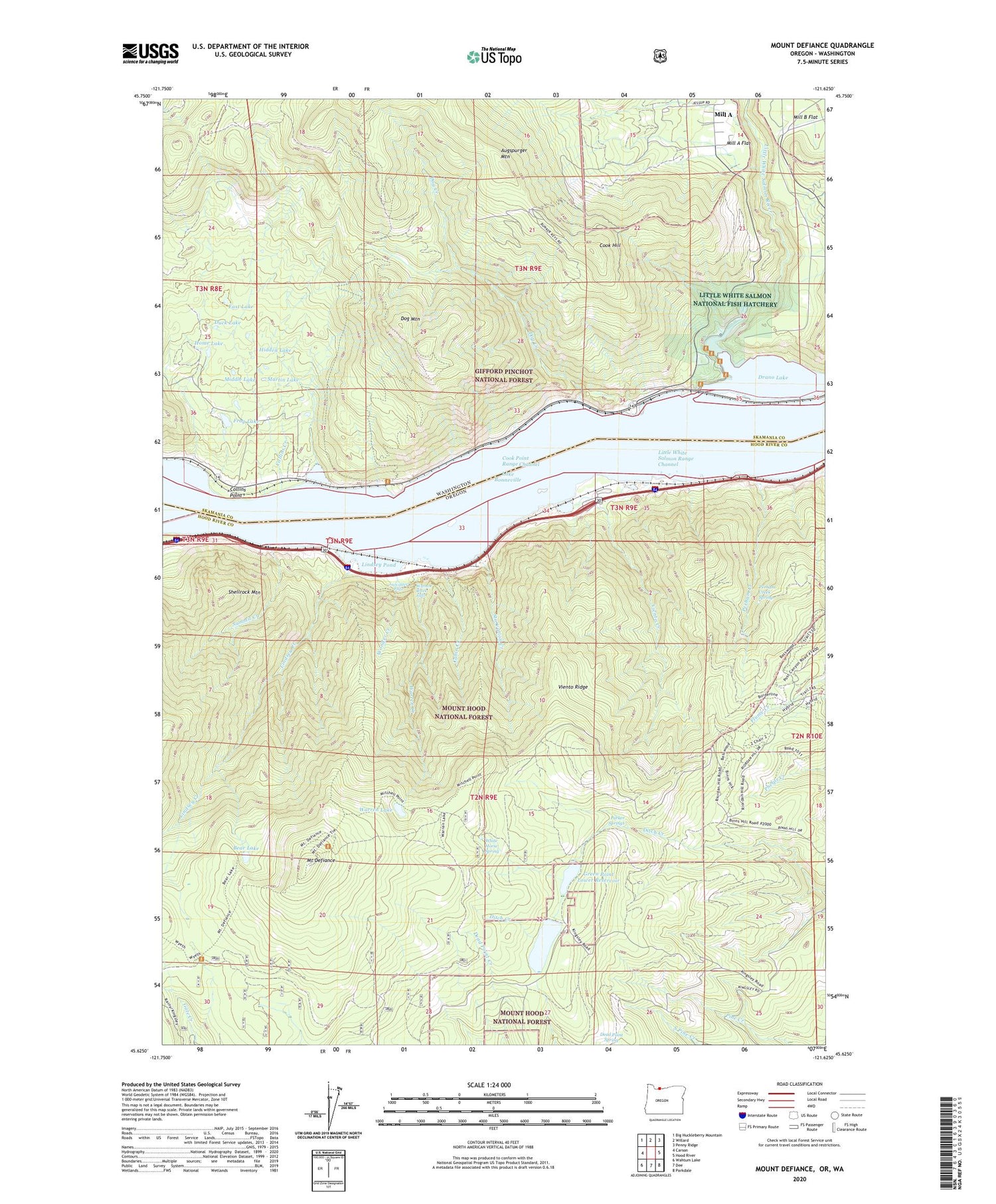
2020 topographic map quadrangle Mount Defiance in the states of Oregon, Washington. Scale: 1:24000. Based on the newly updated USGS 7.5' US Topo map series, this map is in the following counties: Hood River, Skamania. The map contains contour data, water features, and other items you are used to seeing on USGS maps, but also has updated roads and other features. This is the next generation of topographic maps. Printed on high-quality waterproof paper with UV fade-resistant inks.
Quads adjacent to this one:
West: Carson
Northwest: Big Huckleberry Mountain
North: Willard
Northeast: Penny Ridge
East: Hood River
Southeast: Parkdale
South: Dee
Southwest: Wahtum Lake
Contains the following named places: Augspurger Mountain, Bear Lake, Cabin Creek, Camp Wind Mountain, Camp Yallani, Collins, Collins Creek, Collins Point, Cook, Cook Hill, Cook Point Range Channel, Cooks Treaty Fishing Access Site, Dog Creek, Dog Mountain, Dog Mountain Lookout, Drano Lake, Duck Lake, East Lake, Frog Lake, Green Point Lower Reservoir, Green Point Upper Reservoir, Hidden Lake, Home Lake, Kingley Campground Boat Ramp, Kingsley Reservoir County Park, Lancaster Falls, Lindsey, Lindsey Creek, Lindsey Creek State Park, Lindsey Pond, Little White Salmon Fish Hatchery Reservoir, Little White Salmon Hatchery Dam, Little White Salmon National Fish Hatchery, Little White Salmon Range Channel, Little White Salmon River, Long Lake, Lower Green Point Dam, Martin Lake, Middle Lake, Mill A Flat, Mount Defiance, New Lake, Old Wagon Road Historical Area, Parker Springs, Perham Creek, Perham Creek Spring, Rock Creek, Shellrock Mountain, Starvation Creek, Starvation Creek State Park, Summit Creek, Twin Lakes, Upper Green Point Dam, Viento, Viento Creek, Viento Post Office, Viento Ridge, Viento State Park, Vinzenz Lausmann Memorial State Natural Area, Warren Creek, Warren Creek Falls, Warren Lake, White Horse Spring, Wonder Creek, Wygant State Natural Area, Wygant Trail