MyTopo
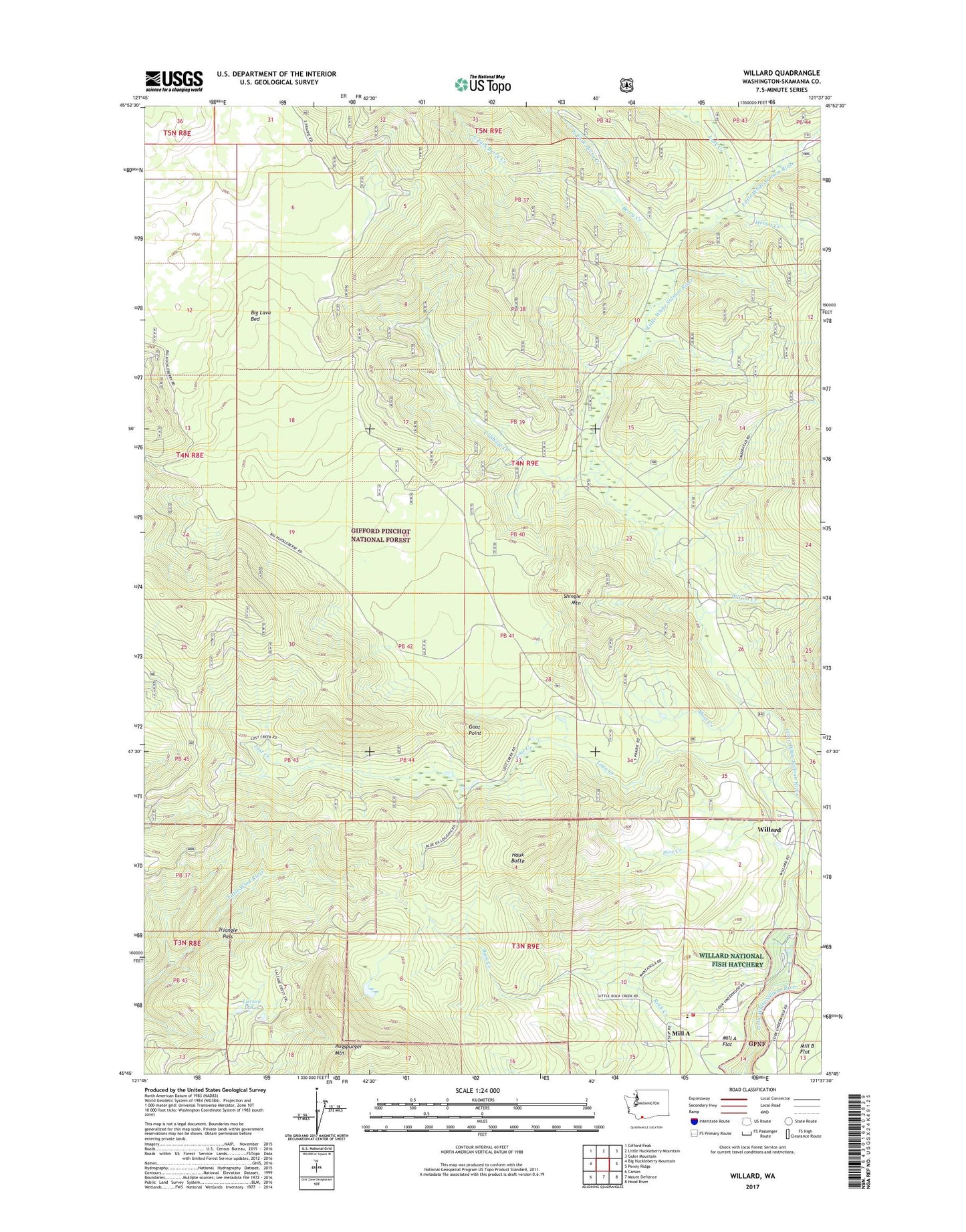
Willard Washington US Topo Map
Couldn't load pickup availability
Also explore the Willard Forest Service Topo of this same quad for updated USFS data
2023 topographic map quadrangle Willard in the state of Washington. Scale: 1:24000. Based on the newly updated USGS 7.5' US Topo map series, this map is in the following counties: Skamania. The map contains contour data, water features, and other items you are used to seeing on USGS maps, but also has updated roads and other features. This is the next generation of topographic maps. Printed on high-quality waterproof paper with UV fade-resistant inks.
Quads adjacent to this one:
West: Big Huckleberry Mountain
Northwest: Gifford Peak
North: Little Huckleberry Mountain
Northeast: Guler Mountain
East: Penny Ridge
Southeast: Hood River
South: Mount Defiance
Southwest: Carson
This map covers the same area as the classic USGS quad with code o45121g6.
Contains the following named places: Berry Creek, Big Cedars County Park, Cabbage Creek, Carson-Underwood Division, Goat Point, Goat Point Trail, Hauk Butte, Homes Creek, Lapham Creek, Larson Lakes, Lava Creek, Little Wind River Camp, Lost Creek, Lusk Creek, Mill A, Mill A School, Mill A Volunteer Fire Department, Moss Creek, Moss Creek Campground, Nestor Peak Trail, North Fork Berry Creek, Pine Creek, Shingle Mountain, South Fork Berry Creek, Triangle Pass, Willard, Willard National Fish Hatchery, Willard Work Center, Wilson Creek, Zone II Engineering Station, ZIP Code: 98605