MyTopo
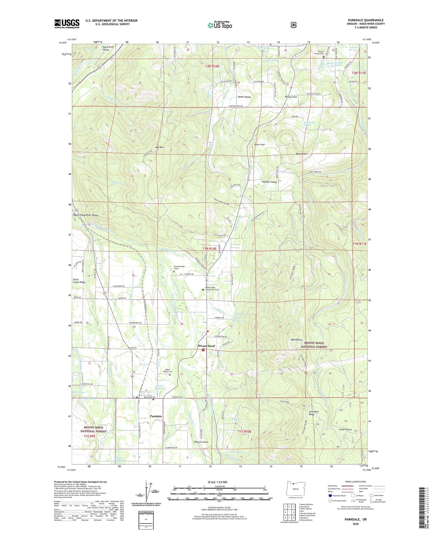
Parkdale Oregon US Topo Map
Couldn't load pickup availability
Also explore the Parkdale Forest Service Topo of this same quad for updated USFS data
2023 topographic map quadrangle Parkdale in the state of Oregon. Scale: 1:24000. Based on the newly updated USGS 7.5' US Topo map series, this map is in the following counties: Hood River. The map contains contour data, water features, and other items you are used to seeing on USGS maps, but also has updated roads and other features. This is the next generation of topographic maps. Printed on high-quality waterproof paper with UV fade-resistant inks.
Quads adjacent to this one:
West: Dee
Northwest: Mount Defiance
North: Hood River
Northeast: White Salmon
East: Ketchum Reservoir
Southeast: Fivemile Butte
South: Dog River
Southwest: Mount Hood North
This map covers the same area as the classic USGS quad with code o45121e5.
Contains the following named places: Alder Creek, Aubert Reservoir, Bald Butte, Baldwin Creek, Bear Wallow Springs, Booth Hill, Camp 1, Central Lateral, Collins Creek, Davis Spring, Dukes Valley, East Fork Main Canal, Emil Creek, Emil Creek Reservoir, English Spring, Evans Creek, Fir Post Office, Graham Creek, Graham Spring, Griswell Creek, Hanel Field, Highline Lateral, Holstein, Homesteader Grave, Hood River County Library Parkdale Branch, Hood River Ranger Station, Huston Museum, Hutson Gulch, Kershaw Creek, Lone Pine Spring, Long Prairie, Mid Valley Elementary School, Middle Mountain, Middle Valley, Mount Hood, Mount Hood Canal, Mount Hood Census Designated Place, Mount Hood Community Cemetery, Mount Hood Parkdale Post Office, Mount Hood Post Office, Neal Creek Orchard and Gardens, Odell Division, Parkdale, Parkdale Baptist Church, Parkdale Census Designated Place, Parkdale Church of the Nazarene, Parkdale Cold Spring, Parkdale Elementary School, Parkdale Fire Department, Parkdale Post Office, Parkdale Rural Fire Protection District Station 2, Parkdale Sewer Treatment Plant, Pine Creek, Poplar Spring, Rogers Creek, Rogers Spring, Shelley Family Cemetery, Shelley Springs, Straightsburg Post Office, Surveyors Ridge, Toll Bridge County Park, Trout Creek, Trout Creek Ridge, Tucker Spring, United States Forest Service Hood River Ranger District, Upper Valley Cemetery, Willow Flat, Wisehart Creek, Woodworth, Yellowjacket Creek, Ziba Dimmick State Park