MyTopo
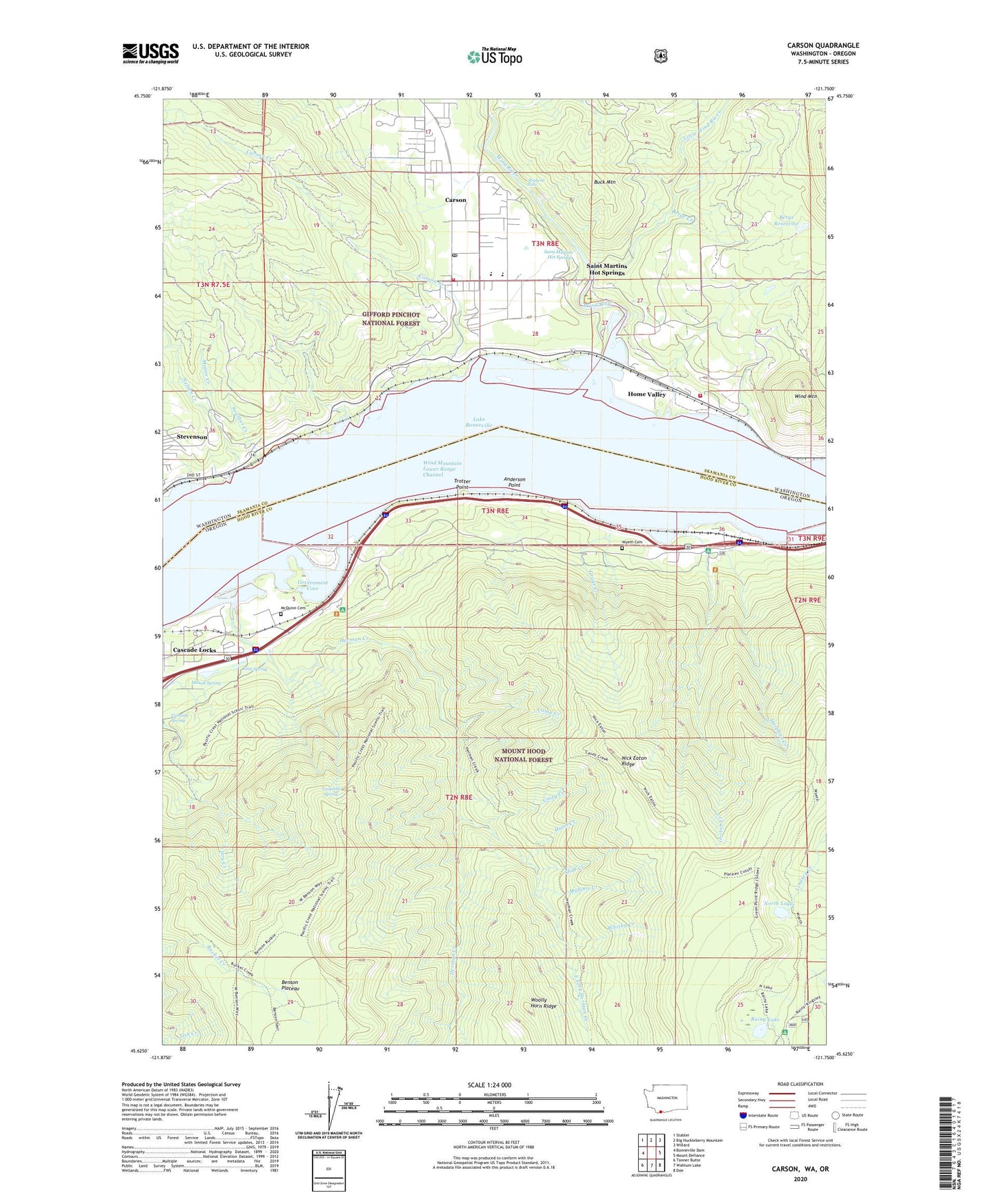
Carson Washington US Topo Map
Couldn't load pickup availability
Also explore the Carson Forest Service Topo of this same quad for updated USFS data
2023 topographic map quadrangle Carson in the states of Oregon, Washington. Scale: 1:24000. Based on the newly updated USGS 7.5' US Topo map series, this map is in the following counties: Skamania, Hood River. The map contains contour data, water features, and other items you are used to seeing on USGS maps, but also has updated roads and other features. This is the next generation of topographic maps. Printed on high-quality waterproof paper with UV fade-resistant inks.
Quads adjacent to this one:
West: Bonneville Dam
Northwest: Stabler
North: Big Huckleberry Mountain
Northeast: Willard
East: Mount Defiance
Southeast: Dee
South: Wahtum Lake
Southwest: Tanner Butte
This map covers the same area as the classic USGS quad with code o45121f7.
Contains the following named places: Anderson Point, Benson Plateau, Berge Creek, Berge Reservoir, Berge Reservoir Dam, Brush Creek, Buck Mountain, C L Lumber Company, Camp Creek, Carson, Carson Census Designated Place, Carson Creek, Carson Elementary School, Carson Post Office, Cascade Locks Division, Cascade Locks Waste Water Treatment, Cascade Spring, Casey Creek, City of Cascade Locks, Columbia Gorge Work Center, Deadwood Camp, East Fork Herman Creek, East Spring, Farley, Gorton Creek, Government Cove, Grays Creek, Harphan Creek, Hazel Creek, Herman Creek, Herman Creek Horse Camp, Herman Creek Trail, Home Valley, Hunters Camp, Lang Forest State Park Wayside, Little Herman Creek, Little Wind River, McQuinn Cemetery, Minott Spring, Moore Creek, Mullinix Creek, Nelson Creek, Nick Eaton Ridge, North Lake, Oxbow Hatchery, Rainy Lake, Rainy Lake Recreation Site, Ridge Camp, Saint Martins Hot Springs, Shell Rock, Shell Rock Post Office, Shipherd Falls, Skamania County Fire District 1 Station 1 Carson, Skamania County Fire District 1 Station 2 Carson, Slide Creek, Souther Creek, Teakettle Spring, Trotter Point, Whisky Creek, Wind Mountain, Wind Mountain Lower Range Channel, Wind River, Wind River Middle School, Wind River Treaty Fishing Access Site, Wyeth, Wyeth Cemetery, Wyeth Post Office, Wyeth Recreation Site, Wyeth State Park, Wyeth Trail