MyTopo
Mount Emily Oregon US Topo Map
Couldn't load pickup availability
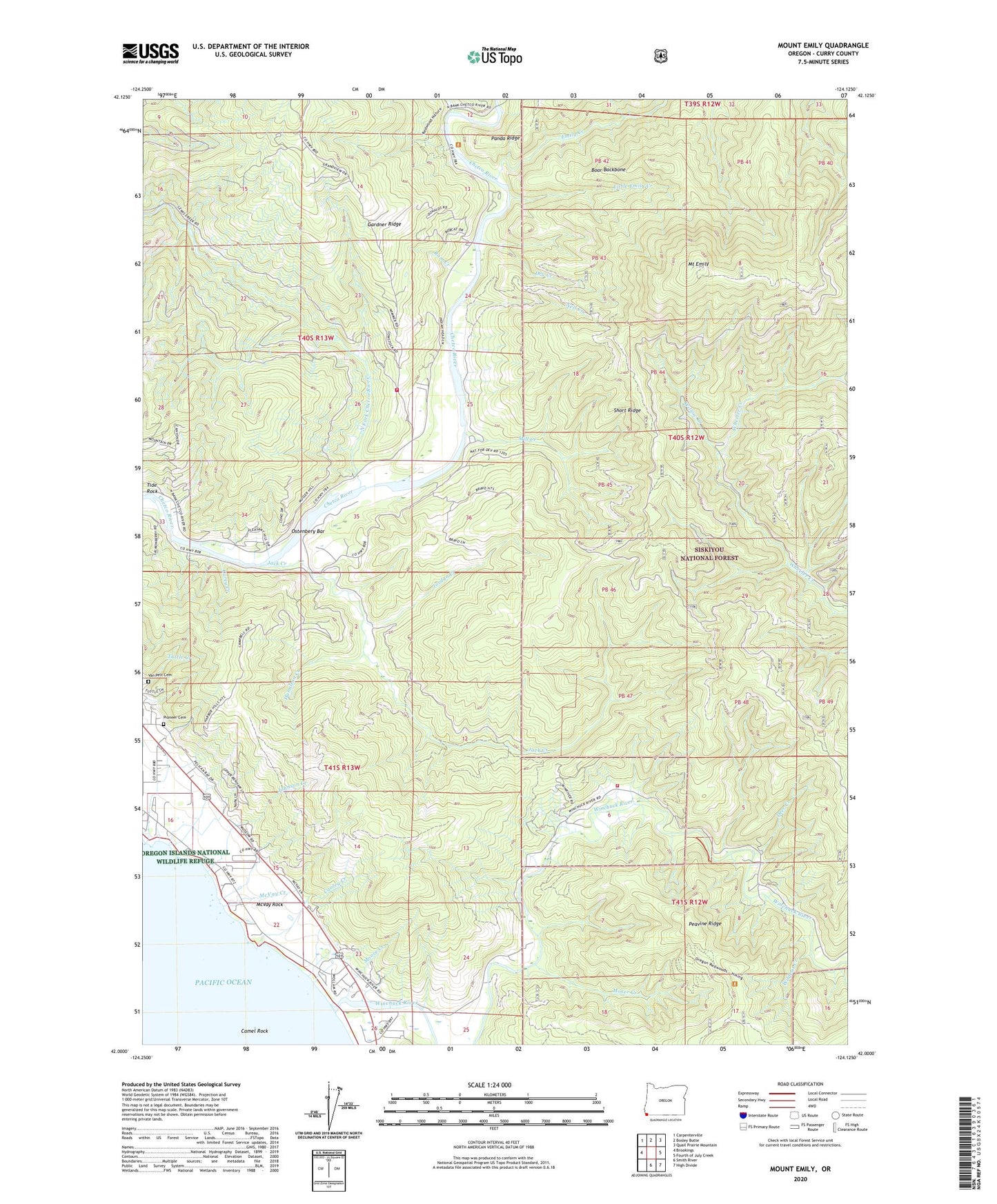
2020 topographic map quadrangle Mount Emily in the state of Oregon. Scale: 1:24000. Based on the newly updated USGS 7.5' US Topo map series, this map is in the following counties: Curry. The map contains contour data, water features, and other items you are used to seeing on USGS maps, but also has updated roads and other features. This is the next generation of topographic maps. Printed on high-quality waterproof paper with UV fade-resistant inks.
Quads adjacent to this one:
West: Brookings
Northwest: Carpenterville
North: Bosley Butte
Northeast: Quail Prairie Mountain
East: Fourth of July Creek
Southeast: High Divide
South: Smith River
Contains the following named places: Alfred A Loeb State Park, Alfred A Loeb State Park Boat Launch, Boar Backbone, Camel Rock, Carey Creek, Chetco, Chetco Post Office, Chetco Valley Historical Museum, Cooley Creek, Crissey Field State Park, Deer Creek, Dry Creek, Elk Creek, Elk Mountain Trail, Emily Creek, Gardner Ridge, Hamilton Creek, Jack Creek, Johnson Creek, Jordan Creek, Little Emily Creek, McVay Creek, McVay Rock, McVay Rock State Park, Mill Creek, Moore Creek, Moser Creek, Mount Emily, Nell Creek, North Fork Chetco River, Ostenbery Bar, Peavine Ridge, Pioneer Cemetery, Ram Creek, Short Ridge, Social Security Bar Boat Launch, Tamba Ranch, Tide Rock, Upper Chetco Charter School, Upper Chetco Rural Fire Protection District, Van Pelt Cemetery, Wildcat Creek, Willow Creek, Winchuck Post Office, Winchuck River, Winchuck Rural Fire Protection District, Winchuck State Park, ZIP Code: 97415