MyTopo
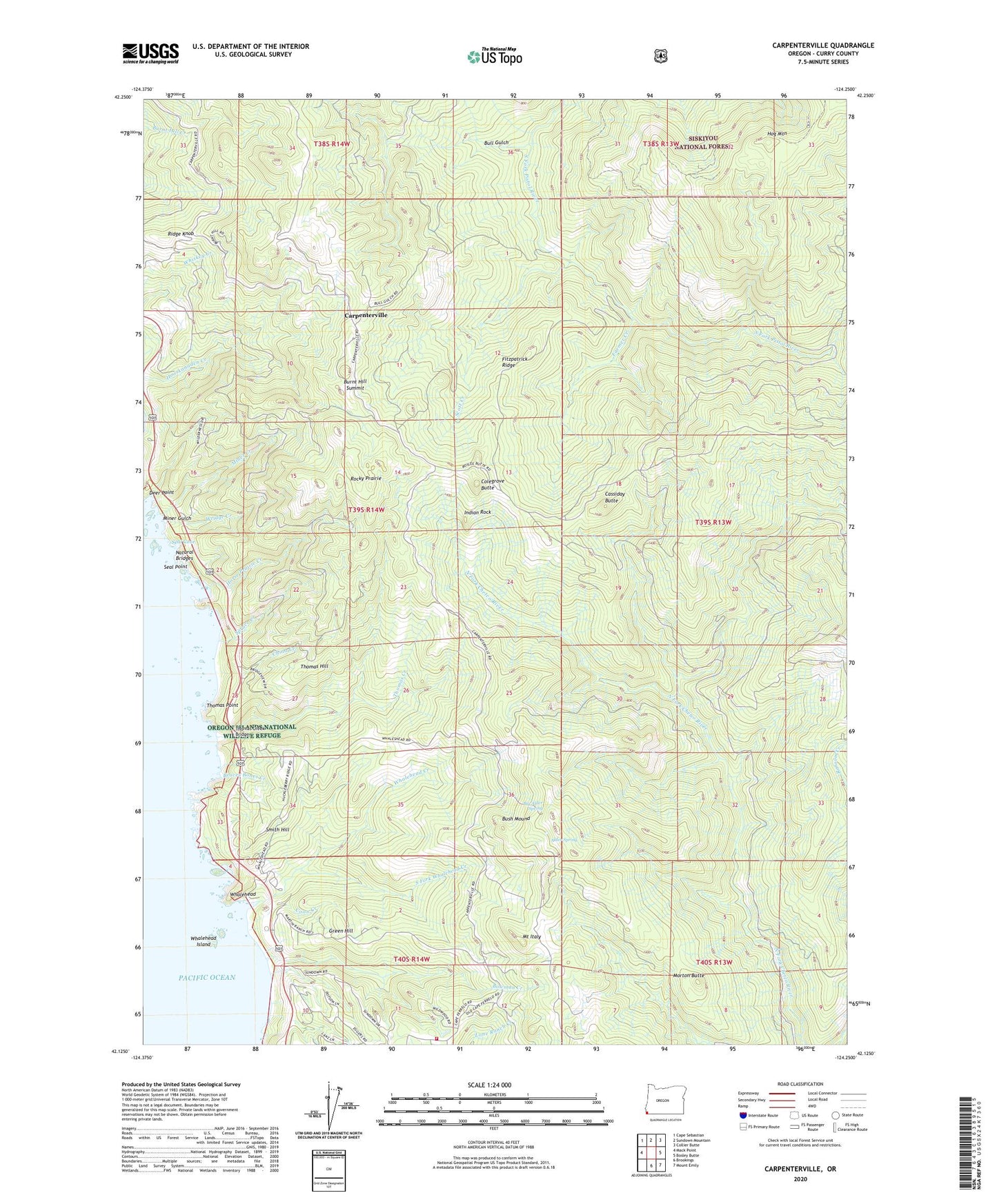
Carpenterville Oregon US Topo Map
Couldn't load pickup availability
Also explore the Carpenterville Forest Service Topo of this same quad for updated USFS data
2024 topographic map quadrangle Carpenterville in the state of Oregon. Scale: 1:24000. Based on the newly updated USGS 7.5' US Topo map series, this map is in the following counties: Curry. The map contains contour data, water features, and other items you are used to seeing on USGS maps, but also has updated roads and other features. This is the next generation of topographic maps. Printed on high-quality waterproof paper with UV fade-resistant inks.
Quads adjacent to this one:
West: Mack Point
Northwest: Cape Sebastian
North: Sundown Mountain
Northeast: Collier Butte
East: Bosley Butte
Southeast: Mount Emily
South: Brookings
This map covers the same area as the classic USGS quad with code o42124b3.
Contains the following named places: Alder Spring, Big Alder Spring, Bowman Creek, Bruces Bones Creek, Bull Gulch, Burnt Hill Summit, Bush Mound, Cape Ferrelo Rural Fire Protection District, Carpenterville, Carpenterville Brookings Wayside, Carpenterville Post Office, Cassiday Butte, China Creek, Colegrove Butte, Coon Creek, Deer Point, Farmer Creek, Fitzpatrick Ridge, Green Hill, Hog Mountain, Horse Prairie Creek, Indian Rock, Irma Post Office, Joe Hostler Camp, Miner Creek, Miner Gulch, Morton Butte, Mount Italy, Natural Bridges, Patrick Creek, Ridge Knob, Rocky Prairie, Scott Creek, Seal Cove, Seal Point, Smith Hill, South Fork Pistol River, South Fork Whalehead Creek, Spruce Creek, Thomas Creek, Thomas Creek Bridge, Thomas Creek Rest Area, Thomas Hill, Thomas Point, Whalehead, Whalehead Creek, Whalehead Island, Wridge Creek