MyTopo
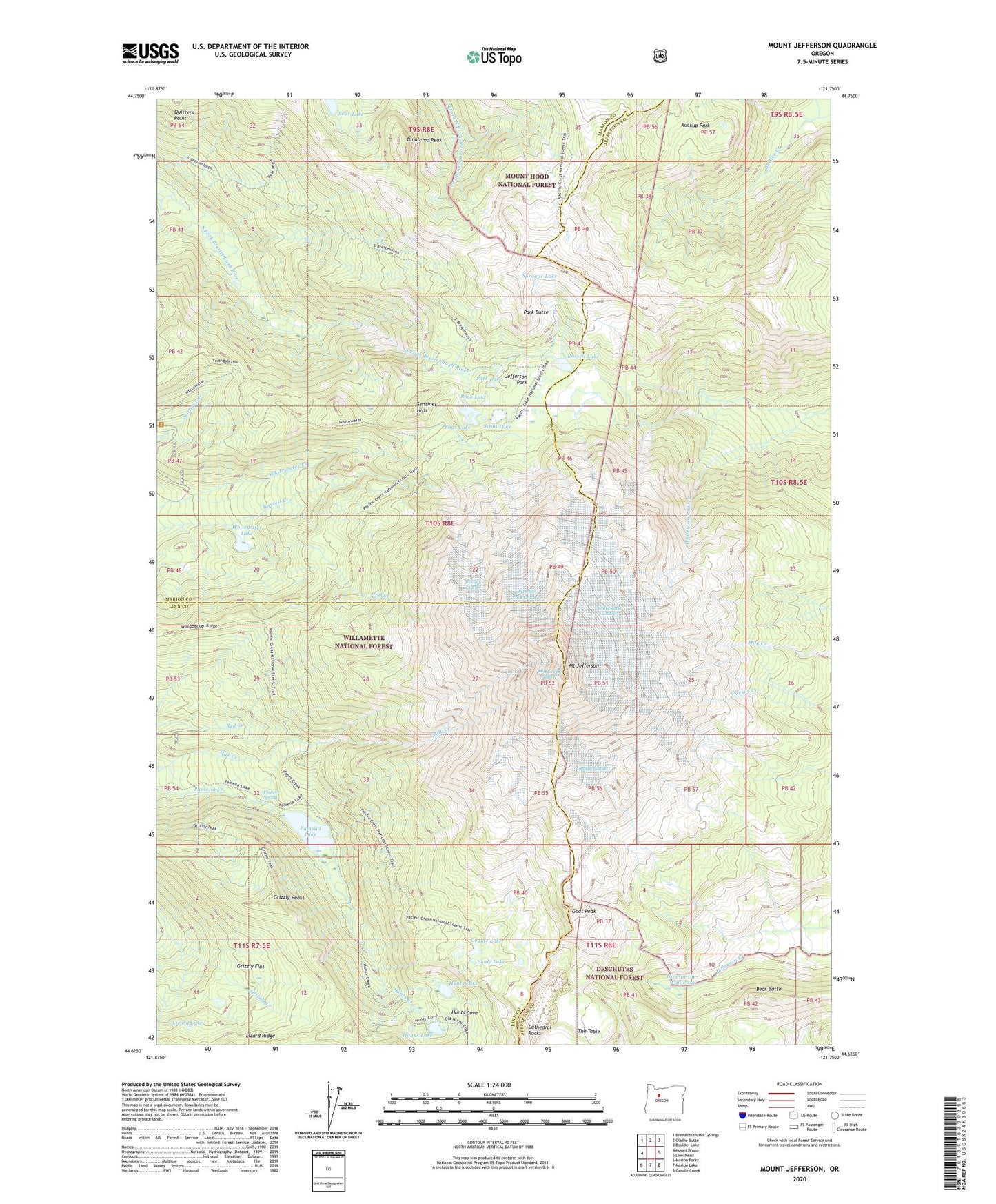
Mount Jefferson Oregon US Topo Map
Couldn't load pickup availability
2020 topographic map quadrangle Mount Jefferson in the state of Oregon. Scale: 1:24000. Based on the newly updated USGS 7.5' US Topo map series, this map is in the following counties: Marion, Jefferson, Linn. The map contains contour data, water features, and other items you are used to seeing on USGS maps, but also has updated roads and other features. This is the next generation of topographic maps. Printed on high-quality waterproof paper with UV fade-resistant inks.
Quads adjacent to this one:
West: Mount Bruno
Northwest: Breitenbush Hot Springs
North: Olallie Butte
Northeast: Boulder Lake
East: Lionshead
Southeast: Candle Creek
South: Marion Lake
Southwest: Marion Forks
Contains the following named places: Bays Lake, Bear Butte, Bear Lake, Cathedral Rocks, Coyote Lake, Dinah-mo Peak, Flapper Springs, Flapper Springs Guard Station, Goat Peak, Grizzly Flat, Grizzly Peak, Hanks Lake, Hole-in-the-Wall Park, Hunts Cove, Hunts Creek, Hunts Lake, Jeff Creek, Jefferson Creek Trail, Jefferson Park, Jefferson Park Glacier, Jefferson Park Trail, Kuckup Park, Lizard Lake, Lizard Ridge, Milk Creek Glacier, Mount Jefferson, Pamelia Lake, Pamelia Lake Trail, Park Butte, Park Lake, Quitters Point, Rock Lake, Russell Glacier, Russell Lake, Scout Lake, Sentinel Hills, Shale Lake, Sprague Lake, The Table, Toto's Meadow, Waldo Glacier, Whitewater Glacier, Whitewater Lake, ZIP Code: 97350