MyTopo
Neskowin OE W Oregon US Topo Map
Couldn't load pickup availability
Also explore the Neskowin OE W Forest Service Topo of this same quad for updated USFS data
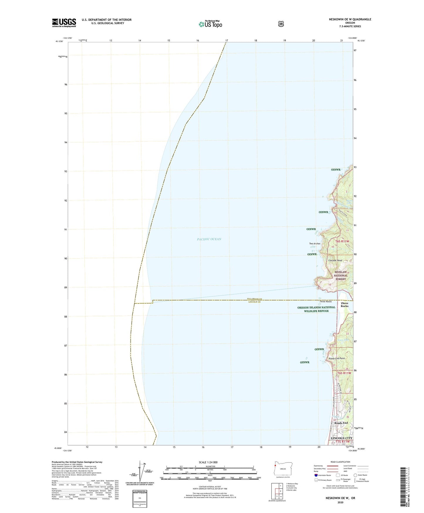
2024 topographic map quadrangle Neskowin OE W in the state of Oregon. Scale: 1:24000. Based on the newly updated USGS 7.5' US Topo map series, this map is in the following counties: Tillamook, Lincoln. The map contains contour data, water features, and other items you are used to seeing on USGS maps, but also has updated roads and other features. This is the next generation of topographic maps. Printed on high-quality waterproof paper with UV fade-resistant inks.
Quads adjacent to this one:
Northeast: Nestucca Bay
East: Neskowin
Southeast: Devils Lake
South: Lincoln City
Contains the following named places: Camp Westwind, Cascade Head, Chitwood Creek, Cliff Creek, Coon Lake, Harts Cove, Logan Creek, Logan Road County Wayside, Roads End, Roads End Point, Roads End State Recreation Site, Salmon River, Teal Creek, Three Rocks, Two Arches