MyTopo
Nestucca Bay Oregon US Topo Map
Couldn't load pickup availability
Also explore the Nestucca Bay Forest Service Topo of this same quad for updated USFS data
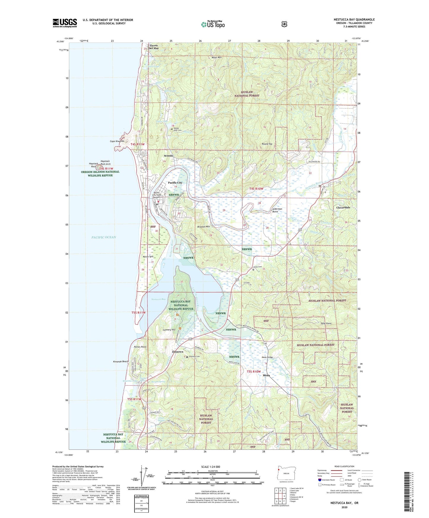
2024 topographic map quadrangle Nestucca Bay in the state of Oregon. Scale: 1:24000. Based on the newly updated USGS 7.5' US Topo map series, this map is in the following counties: Tillamook. The map contains contour data, water features, and other items you are used to seeing on USGS maps, but also has updated roads and other features. This is the next generation of topographic maps. Printed on high-quality waterproof paper with UV fade-resistant inks.
Quads adjacent to this one:
Northwest: Sand Lake OE W
North: Sand Lake
Northeast: Beaver
East: Hebo
Southeast: Dolph
South: Neskowin
Southwest: Neskowin OE W
This map covers the same area as the classic USGS quad with code o45123b8.
Contains the following named places: Alderman Butte, Arstell Creek, Austin Creek, Bailey Farms, Bob Straub State Park, Bower Creek, Brooten Mountain, Camp Winema, Cannery Hill, Cape Kiwanda, Cape Kiwanda County Boat Launch, Cape Kiwanda County Park, Cape Kiwanda State Natural Area, Clear Creek, Cloverdale, Cloverdale Boat Ramp, Cloverdale Census Designated Place, Cloverdale Post Office, Cloverdale Sanitary District Treatment Plant, Commons Creek, Dawson Creek, Deep Creek, Fall Creek, Fisher Landing, Fishers Point County Drift Boat Launch, Fletcher Spring, Hartley Creek, Haystack Rock, Haystack Rock Arch, Horn Creek, Jensen Springs, Kellow Creek, Kiawanda Community Center Park and Ride, Kiwanda Beach, Little Nestucca County Boat Launch, Little Nestucca County Park, Little Nestucca River, Meadow View Daries, Meda, Meda Bridge, Meda Post Office, Miles Creek, Miles Lake, Miles Mountain, Morgan Spring, Mugg County Park, Neskowin Division, Nestucca Bay, Nestucca Bay National Wildlife Refuge, Nestucca Bobb Creek, Nestucca Country Sporting Goods Boat Launch, Nestucca High School, Nestucca River, Nestucca Rural Fire Protection District Station 82 Pacific City, Nestucca Valley Elementary, Nestucca Valley Presbyterian Church, North Spit, Oretown, Oretown Cemetery, Oretown Post Office, Pacific City, Pacific City Census Designated Place, Pacific City County Boat Launch, Pacific City Joint Water Sanitary Authority, Pacific City Post Office, Pacific City State Airport, Pacific Coast Bible Church, Porter Point, Queens Creek, Raines Resort Dock, Ray Creek, Round Top, Saint Josephs Catholic Church, Salal Point, Sand Creek, Sanders Creek, Sears Lake, Smith Creek, South Tillamook County Branch Library, Three Rivers, Tillamook County General Hospital Pacific City Station, Tillamook County South District Public Works, Town Creek, Town Lake, Town Lake Boat Ramp, Union Cemetery, Upton Creek, Upton Slough, Webb County Park, Winema Christian Church, Winema Creek, Winema Lake, Woods, Woods County Park, Woods IOOF Cemetery, Woods Post Office, ZIP Code: 97135