MyTopo
Ochoco Butte Oregon US Topo Map
Couldn't load pickup availability
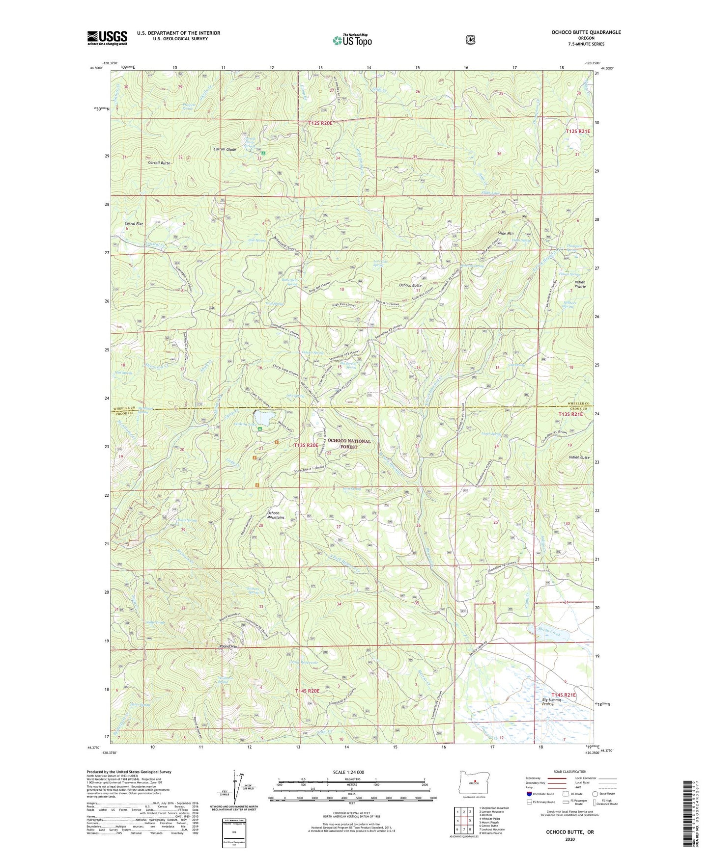
2020 topographic map quadrangle Ochoco Butte in the state of Oregon. Scale: 1:24000. Based on the newly updated USGS 7.5' US Topo map series, this map is in the following counties: Wheeler, Crook. The map contains contour data, water features, and other items you are used to seeing on USGS maps, but also has updated roads and other features. This is the next generation of topographic maps. Printed on high-quality waterproof paper with UV fade-resistant inks.
Quads adjacent to this one:
West: Whistler Point
Northwest: Stephenson Mountain
North: Lawson Mountain
Northeast: Mitchell
East: Mount Pisgah
Southeast: Williams Prairie
South: Lookout Mountain
Southwest: Gerow Butte
Contains the following named places: Ahalt Creek, Arthur Creek Camp, Bacon Reservoir, Big Spread Spring, Butterfield Spring, Cady Creek, Camp Creek, Carroll Butte, Carroll Glade, Carroll Glade Springs, Cole Spring, Corral Flat, Cram Reservoir, Crystal Springs Organization Camp, Cup Spring, Davis Spring, Dunn Spring, East Fork Howard Creek, Fisher Spring, Hellbore Spring, Howard Spring, Indian Butte, Indian Prairie, Judy Spring, King Dam, Lake Spring, Lava Spring, Lost Lake Spring, Lunch Spring, Mayflower Mining Settlement, McAllister Creek, McAllister Spring, Merritt Creek, Mud Spring, Ochoco Butte, Ochoco Mine, Ochoco Post Office, Ochoco Spring, Old Kelly Mill, Poison Spring, Prospect Spring, Round Mountain, Round Mountain Mine, Scissors Spring, Scissorsville, Sheep Corrals, Simpson Place, Slide Lake, Slide Mountain, South Fork Howard Creek, Thompson Spring, Thronson Creek, Trail Spring, Walton Lake, Walton Lake Boat Ramp, Walton Lake Campground, Walton Lake Recreation Site, West Fork Howard Creek, Wildhorse Spring, Wildwood Recreation Site