MyTopo
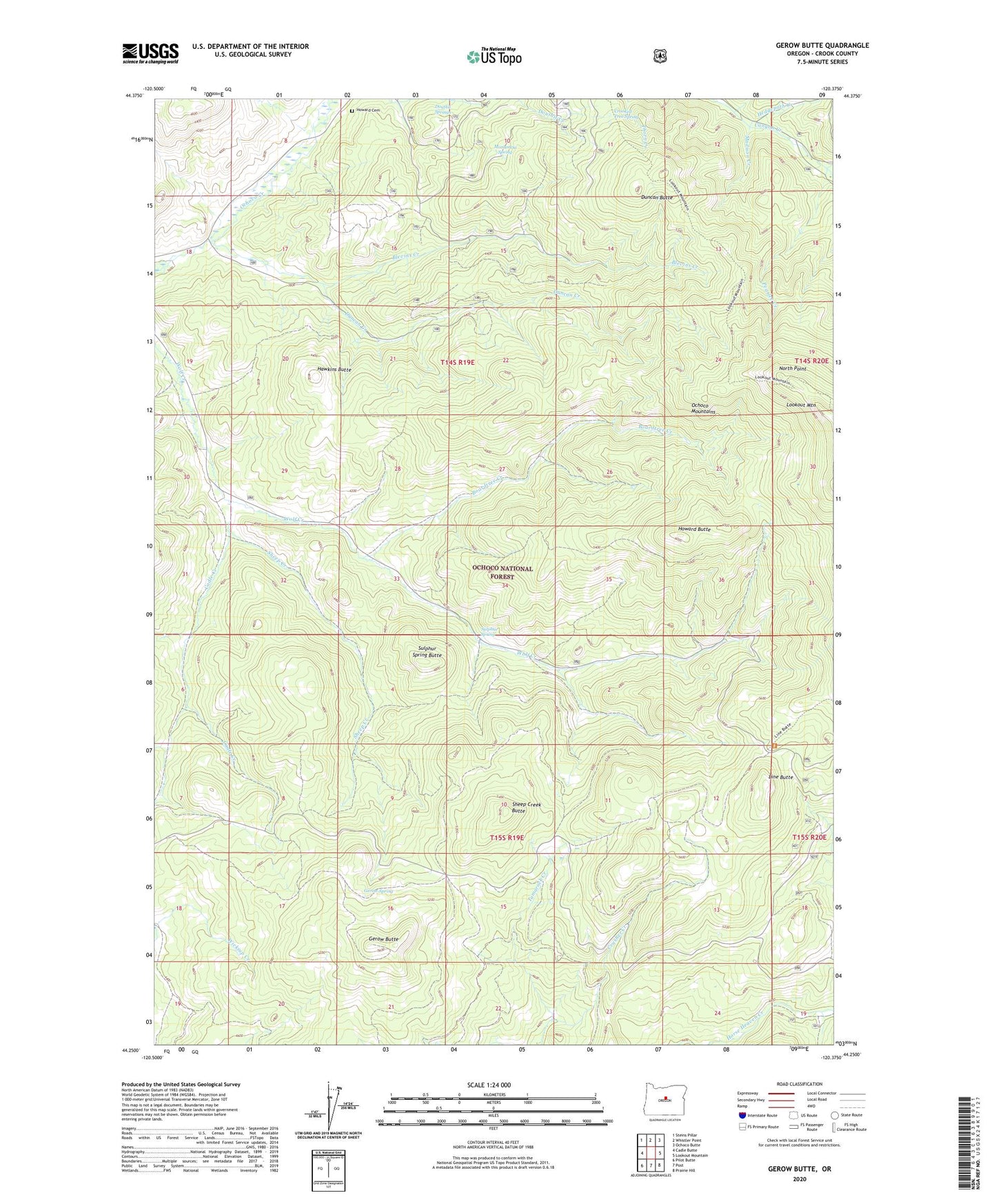
Gerow Butte Oregon US Topo Map
Couldn't load pickup availability
Also explore the Gerow Butte Forest Service Topo of this same quad for updated USFS data
2023 topographic map quadrangle Gerow Butte in the state of Oregon. Scale: 1:24000. Based on the newly updated USGS 7.5' US Topo map series, this map is in the following counties: Crook. The map contains contour data, water features, and other items you are used to seeing on USGS maps, but also has updated roads and other features. This is the next generation of topographic maps. Printed on high-quality waterproof paper with UV fade-resistant inks.
Quads adjacent to this one:
West: Cadle Butte
Northwest: Steins Pillar
North: Whistler Point
Northeast: Ochoco Butte
East: Lookout Mountain
Southeast: Prairie Hill
South: Post
Southwest: Pilot Butte
This map covers the same area as the classic USGS quad with code o44120c4.
Contains the following named places: Blevins Creek, Boardtree Creek, Cadle Creek, Crooked Tree Spring, Crusher Creek, Douthit Springs, Duncan Butte, Duncan Creek, Gerow Butte, Gerow Butte Lookout Tower, Gerow Spring, Hawkins Butte, Hedgepath Creek, Howard Butte, Howard Cemetery, Kyle Creek, Line Butte, Madison Creek, Monument Spring, Nelson Monument, North Point, Peaslee Creek, Sheep Creek, Sheep Creek Butte, Sulphur Spring, Sulphur Spring Butte