MyTopo
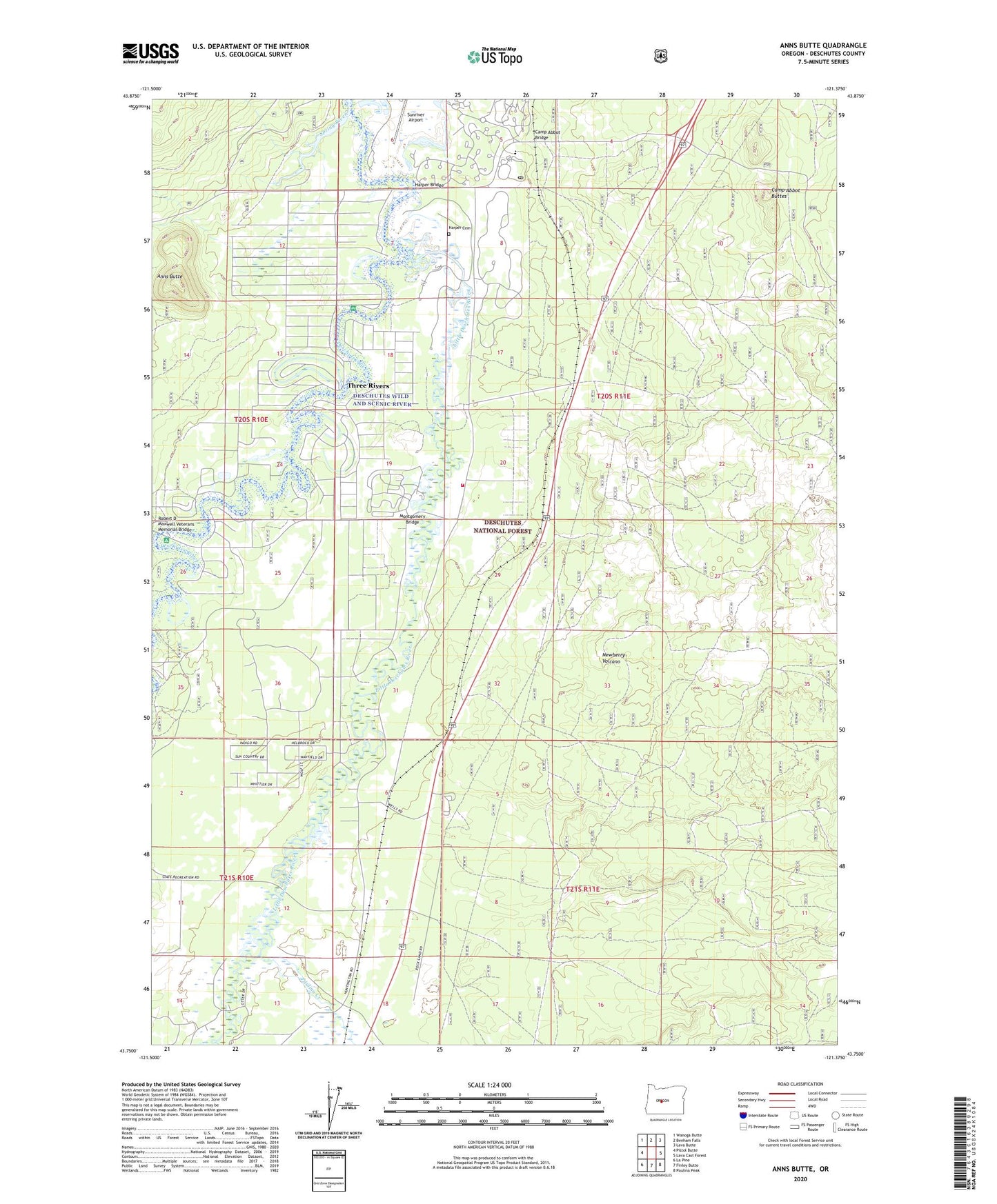
Anns Butte Oregon US Topo Map
Couldn't load pickup availability
Also explore the Anns Butte Forest Service Topo of this same quad for updated USFS data
2023 topographic map quadrangle Anns Butte in the state of Oregon. Scale: 1:24000. Based on the newly updated USGS 7.5' US Topo map series, this map is in the following counties: Deschutes. The map contains contour data, water features, and other items you are used to seeing on USGS maps, but also has updated roads and other features. This is the next generation of topographic maps. Printed on high-quality waterproof paper with UV fade-resistant inks.
Quads adjacent to this one:
West: Pistol Butte
Northwest: Wanoga Butte
North: Benham Falls
Northeast: Lava Butte
East: Lava Cast Forest
Southeast: Paulina Peak
South: Finley Butte
Southwest: La Pine
This map covers the same area as the classic USGS quad with code o43121g4.
Contains the following named places: Anns Butte, Big River Campground Boat Ramp, Big River Recreation Site, Camp Abbot, Camp Abbot Bridge, Camp Abbot Buttes, Carlisle Post Office, Crater Post Office, Crosswater Golf Course, General Patch Bridge, Harper, Harper Bridge, Harper Cemetery, Harpers Bridge Boat Launch, La Pine Fire Department Station 102, Lava Post Office, Little Deschutes River, Montgomery Bridge, Montgomery Ranch, Oregon Water Wonderland Unit II Sanitary District Lagoon, Paulina Creek, Robert D. Maxwell Veterans Memorial Bridge, Shevlin, Shevlin Hixon Junction, Spring River, Stearns, Stearns Airfield, Sunriver Area Public Library, Sunriver Post Office, Sunriver Resort Great Hall Conference Center, Three Rivers, Three Rivers Census Designated Place, Three Rivers Elementary School, Vandevert Ranch, Wanoga Siding, ZIP Code: 97707