MyTopo
Pine Mountain Oregon US Topo Map
Couldn't load pickup availability
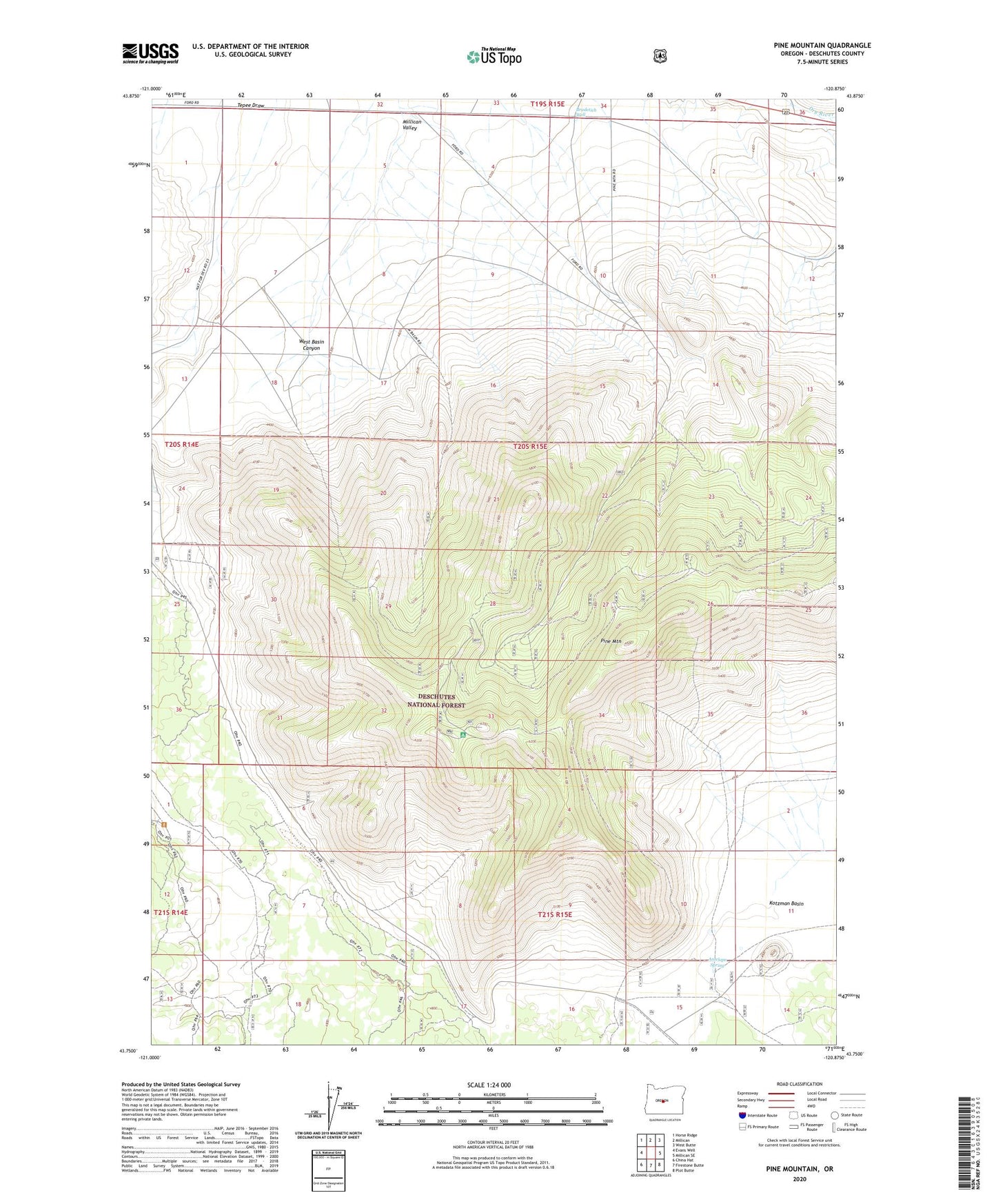
2023 topographic map quadrangle Pine Mountain in the state of Oregon. Scale: 1:24000. Based on the newly updated USGS 7.5' US Topo map series, this map is in the following counties: Deschutes. The map contains contour data, water features, and other items you are used to seeing on USGS maps, but also has updated roads and other features. This is the next generation of topographic maps. Printed on high-quality waterproof paper with UV fade-resistant inks.
Quads adjacent to this one:
West: Evans Well
Northwest: Horse Ridge
North: Millican
Northeast: West Butte
East: Millican SE
Southeast: Plot Butte
South: Firestone Butte
Southwest: China Hat
This map covers the same area as the classic USGS quad with code o43120g8.
Contains the following named places: Antelope Spring, Bradetich Well, Deep Well, Gogaka Draw, Goge Draw, Millican Valley, Pine Mountain, Pine Mountain Observatory, Pine Mountain Recreation Site, Spencer Well, West Basin Canyon, West Basin Well, Whitaker Post Office