MyTopo
Quail Prairie Mountain Oregon US Topo Map
Couldn't load pickup availability
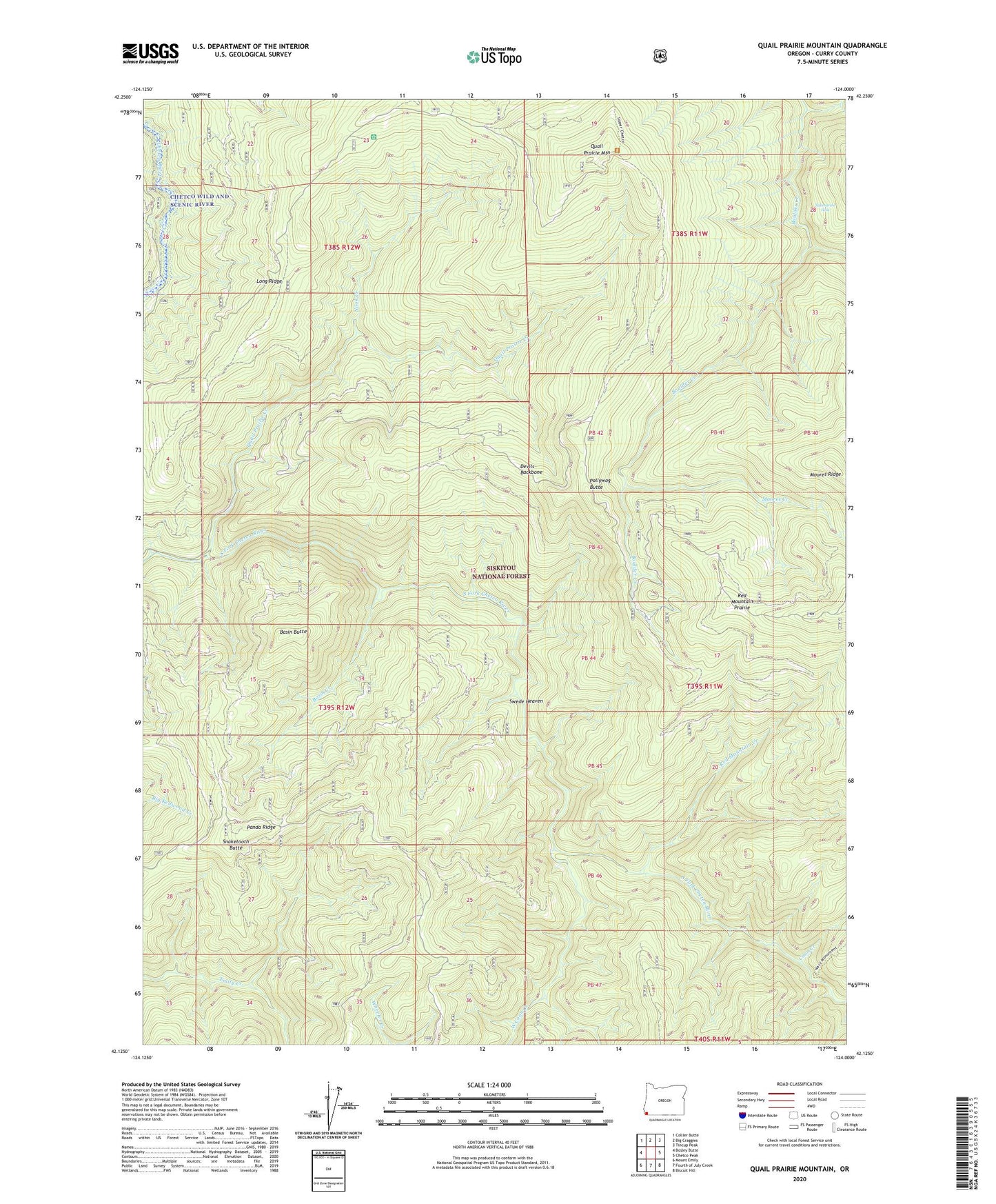
2020 topographic map quadrangle Quail Prairie Mountain in the state of Oregon. Scale: 1:24000. Based on the newly updated USGS 7.5' US Topo map series, this map is in the following counties: Curry. The map contains contour data, water features, and other items you are used to seeing on USGS maps, but also has updated roads and other features. This is the next generation of topographic maps. Printed on high-quality waterproof paper with UV fade-resistant inks.
Quads adjacent to this one:
West: Bosley Butte
Northwest: Collier Butte
North: Big Craggies
Northeast: Tincup Peak
East: Chetco Peak
Southeast: Biscuit Hill
South: Fourth of July Creek
Southwest: Mount Emily
Contains the following named places: Basin Butte, Basin Creek, Boulder Creek, Coon Creek, Devils Backbone, Grass Lake, Long Ridge, Long Ridge Campground, Moores Creek, Nook Creek, Packers Cabin Group Camp, Panda Ridge, Pollywog Butte, Quail Prairie Creek, Quail Prairie Mountain, Red Mountain Creek, Red Mountain Prairie, Snaketooth Butte, Snaketooth Way, Submarine Hole, Swede Heaven, West Coon Creek