MyTopo
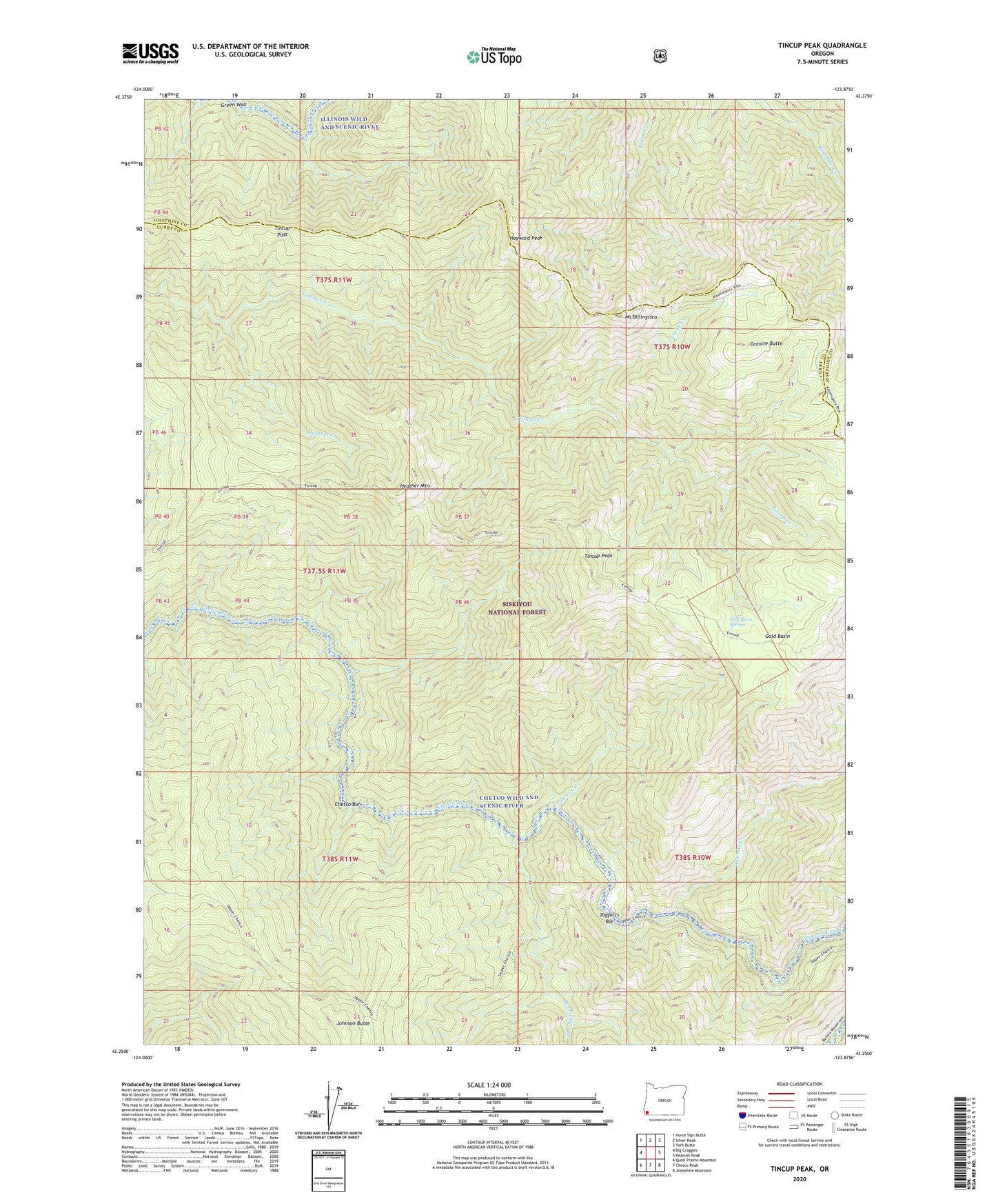
Tincup Peak Oregon US Topo Map
Couldn't load pickup availability
Also explore the Tincup Peak Forest Service Topo of this same quad for updated USFS data
2023 topographic map quadrangle Tincup Peak in the state of Oregon. Scale: 1:24000. Based on the newly updated USGS 7.5' US Topo map series, this map is in the following counties: Curry, Josephine. The map contains contour data, water features, and other items you are used to seeing on USGS maps, but also has updated roads and other features. This is the next generation of topographic maps. Printed on high-quality waterproof paper with UV fade-resistant inks.
Quads adjacent to this one:
West: Big Craggies
Northwest: Horse Sign Butte
North: Silver Peak
Northeast: York Butte
East: Pearsoll Peak
Southeast: Josephine Mountain
South: Chetco Peak
Southwest: Quail Prairie Mountain
This map covers the same area as the classic USGS quad with code o42123c8.
Contains the following named places: Box Canyon Creek, Cedar Camp, Chetco Bar, Gold Basin, Gold Basin Springs, Granite Butte, Granite Creek, Green Wall, Hayward Peak, Heather Creek, Heather Mountain, Johnson Butte, Kalmiopsis Wilderness, Lucky Creek, Mount Billingslea, Sluice Creek, Taggarts Bar, Tincup Pass, Tincup Peak, Upper Chetco Trail