MyTopo
Quines Creek Oregon US Topo Map
Couldn't load pickup availability
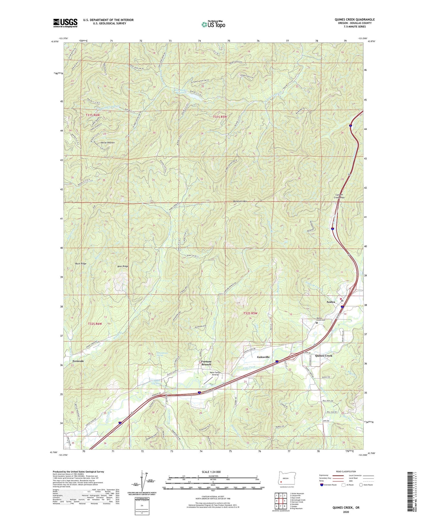
2024 topographic map quadrangle Quines Creek in the state of Oregon. Scale: 1:24000. Based on the newly updated USGS 7.5' US Topo map series, this map is in the following counties: Douglas. The map contains contour data, water features, and other items you are used to seeing on USGS maps, but also has updated roads and other features. This is the next generation of topographic maps. Printed on high-quality waterproof paper with UV fade-resistant inks.
Quads adjacent to this one:
West: McCullough Creek
Northwest: Nickel Mountain
North: Canyonville
Northeast: Days Creek
East: Starvout Creek
Southeast: King Mountain
South: Golden
Southwest: Glendale
This map covers the same area as the classic USGS quad with code o42123g3.
Contains the following named places: Azalea, Azalea Post Office, Azalea Rural Fire Protection District, Barton Park, Bear Creek, Bear Ridge, Blue Creek, Buck Ridge, Buckhorn Mountain, Bull Run, Camp Elliff, Canyon Creek Pass, Cow Creek Safety Rest Area, Fernvale, Fernvale Post Office, Fort Smith, Fortune Branch, Galesville, Galesville Post Office, Glendale Junction, Horse Heaven, Little Bull Run, McCollum Creek, Mynott Creek, Nace Family Airstrip, Quines Creek, Quines Creek Cemetery, Saint John Creek, Schoolhouse Spring, Shoestring Trail, South Canyonville, Swamp Creek, Vaughn Log Pond, Wildcat Creek, Win Walker Reservoir, Windy Creek County Wayside, Woodford Creek