MyTopo
Golden Oregon US Topo Map
Couldn't load pickup availability
Also explore the Golden Forest Service Topo of this same quad for updated USFS data
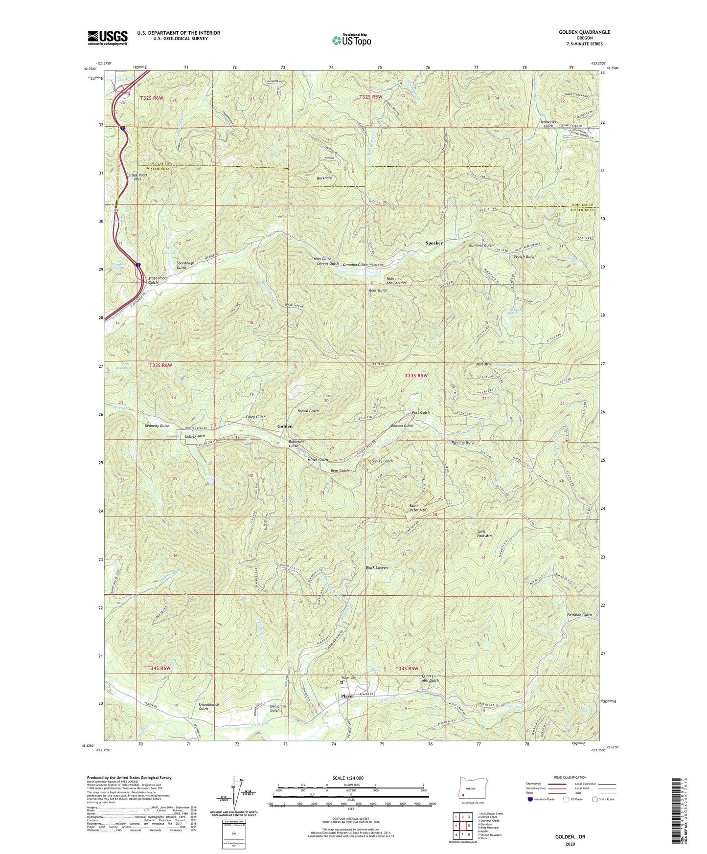
2024 topographic map quadrangle Golden in the state of Oregon. Scale: 1:24000. Based on the newly updated USGS 7.5' US Topo map series, this map is in the following counties: Josephine, Douglas. The map contains contour data, water features, and other items you are used to seeing on USGS maps, but also has updated roads and other features. This is the next generation of topographic maps. Printed on high-quality waterproof paper with UV fade-resistant inks.
Quads adjacent to this one:
West: Glendale
Northwest: McCullough Creek
North: Quines Creek
Northeast: Starvout Creek
East: King Mountain
Southeast: Wimer
South: Sexton Mountain
Southwest: Merlin
This map covers the same area as the classic USGS quad with code o42123f3.
Contains the following named places: Anaconda Mine, Bear Gulch, Benjamin Gulch, Benson Gulch, Big Slide Lode, Big Spring, Black Canyon, Blue Channel Placer, Board Tree Creek, Brown Gulch, Browning Spring, Buckhorn, Bummer Gulch, China Gulch, Colby Gulch, Columbia Placer, Cougar Mine, Cougar Spring, Coyote Mine, Dorothea Mine, Eastman Gulch, Fandora Mine, Florene Mine, Foley Gulch, Gold Cup Placer, Golden, Golden Post Office, Golden Ring Mine, Grandpa Gulch, Greenback, Greenback Mine, Greenback Post Office, Hole in the Ground, Horseshoe Lode, Jackpot Mine, Jim Blaine Mine, Kennedy Gulch, King Mountain Truck Trail, Lehman Reservoir, Levens Gulch, MacAbee Mine, Martha Mine, McCourtney Creek, Miller Gulch, Morning Mine, Mountain Spring, Oro Grande Mine, Panning Gulch, Payne Placer, Placer, Placer Cemetery, Placer Post Office, Poe Spring, Post Gulch, Post Mountain, Quartz Mill Gulch, Reed Mine, Robinson Gulch, Saint Paul Mountain, Saint Peter Mountain, Scholey Gulch, Schoolhouse Gulch, Secesh Gulch, Secesh Reservoir, Shanks Creek, Shot Mine, Silent Friend Mine, Slagle Creek, Sluter Mine, Sourdough Gulch, Speaker, Speaker Placer, Speaker Post Office, Spotted Fawn Mine, Stage Coach Forest State Park, Stage Road Gulch, Stage Road Pass, Star Mine, Still Creek, Stites, Strong Dam, Strong Reservoir, Sunset Mine, Tennessee Gulch, Tom East Creek, Victor Mine, Whiskey Bottle Creek, Yellowhorn Mine