MyTopo
Quinton Oregon US Topo Map
Couldn't load pickup availability
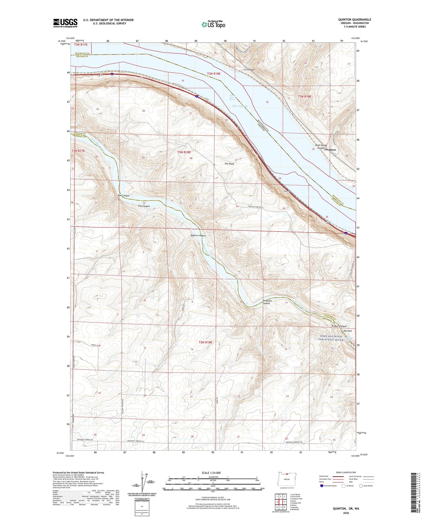
2023 topographic map quadrangle Quinton in the states of Oregon, Washington. Scale: 1:24000. Based on the newly updated USGS 7.5' US Topo map series, this map is in the following counties: Gilliam, Sherman, Klickitat. The map contains contour data, water features, and other items you are used to seeing on USGS maps, but also has updated roads and other features. This is the next generation of topographic maps. Printed on high-quality waterproof paper with UV fade-resistant inks.
Quads adjacent to this one:
West: Rufus
Northwest: Luna Butte
North: Luna Gulch
Northeast: Goodnoe Hills
East: Sundale NW
Southeast: McDonald
South: Klondike
Southwest: Wasco
Contains the following named places: Albert Philippi Park, Biglow Canyon, Biglow Post Office, Box Canyon, Draper Canyon, Early, Early Post Office, Emigrant, Emigrant Canyon, Fox Canyon, Goodnoe, Goodnoe Treaty Fishing Access Site, Hook, Indian Rapids, J U Canyon, Narrows, Pasture Point Treaty Fishing Access Site, Philippi Park Marina, Quinook Post Office, Quinton, Sand Spring Canyon, Squally Hook Rapids, The Nook, Tumwater Falls