MyTopo
Rabbit Mountain Oregon US Topo Map
Couldn't load pickup availability
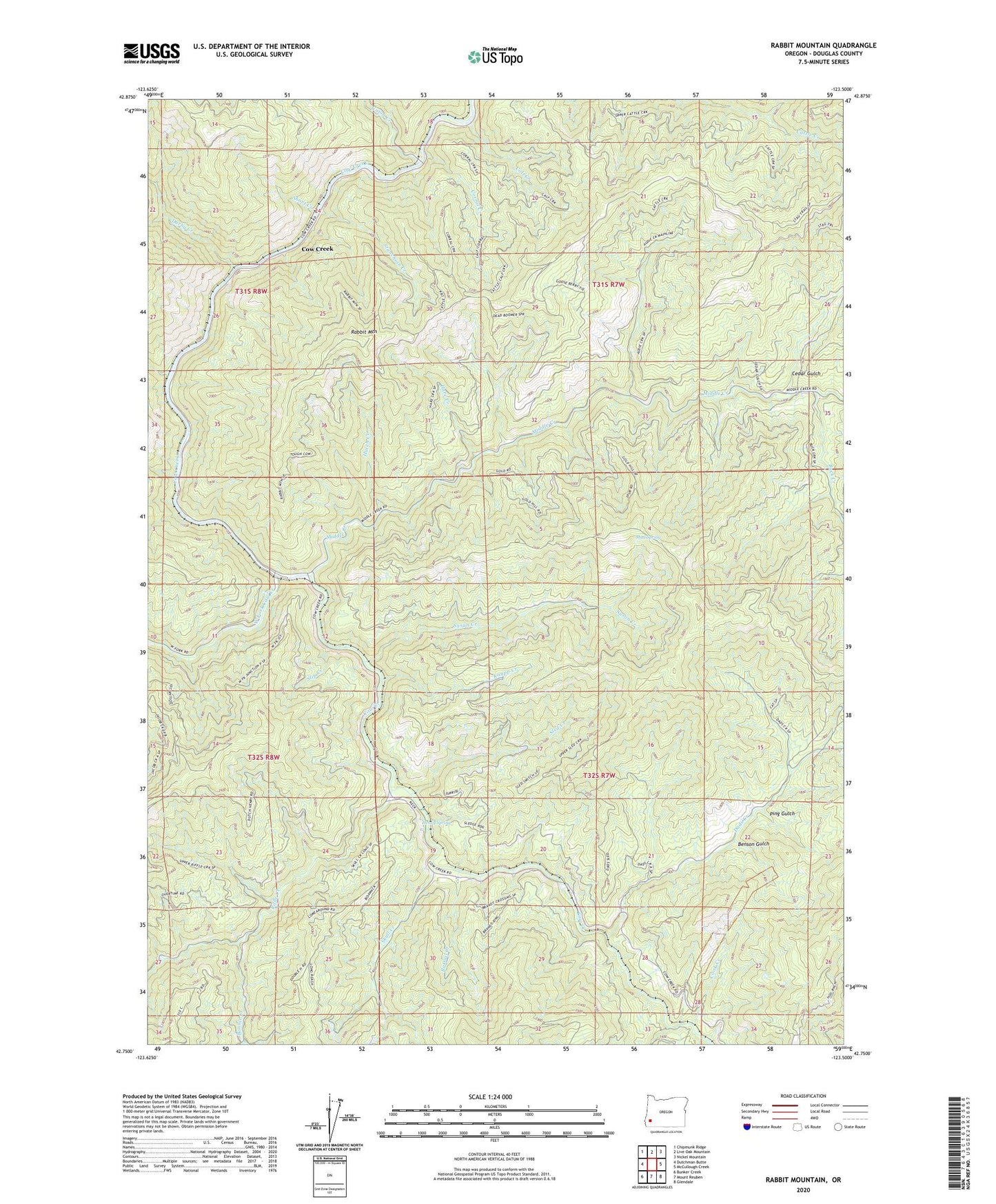
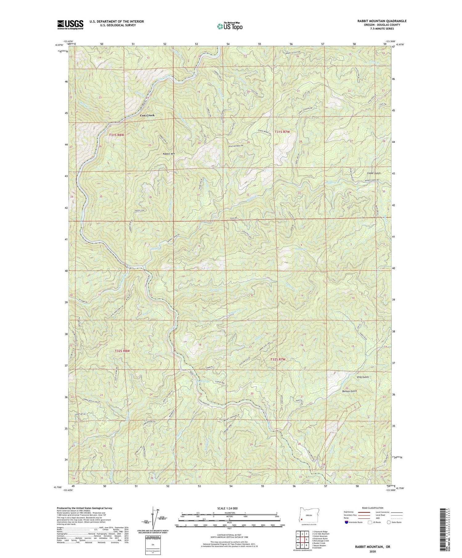
2020 topographic map quadrangle Rabbit Mountain in the state of Oregon. Scale: 1:24000. Based on the newly updated USGS 7.5' US Topo map series, this map is in the following counties: Douglas. The map contains contour data, water features, and other items you are used to seeing on USGS maps, but also has updated roads and other features. This is the next generation of topographic maps. Printed on high-quality waterproof paper with UV fade-resistant inks.
Quads adjacent to this one:
West: Dutchman Butte
Northwest: Chipmunk Ridge
North: Live Oak Mountain
Northeast: Nickel Mountain
East: McCullough Creek
Southeast: Glendale
South: Mount Reuben
Southwest: Bunker Creek
Contains the following named places: Argil, Benson Gulch, Bonnie Creek, Boulder Creek, Brandt, Buck Creek, Calf Creek, Cedar Gulch, Cook Creek, Corral Creek, Cow Creek, Dads Creek, Darby Creek, Devils Punch Bowl, Dothan Post Office, Dutchman Creek, Hare Creek, Henry Spring, Herman Post Office, Hutch Creek, Isabell, Knupp Creek, Langdon, Middle Creek, Middle Creek Warden Station, Mud Spring, Ping Gulch, Rabbit Mountain, Rattail Creek, Riffle Creek, Short Creek, Skull Creek, Sled Creek, Slip Creek, Stanchion Creek, Sullivan Creek, Susan Creek, Tuller Creek, Union Creek, West Fork, West Fork Cow Creek