MyTopo
Chipmunk Ridge Oregon US Topo Map
Couldn't load pickup availability
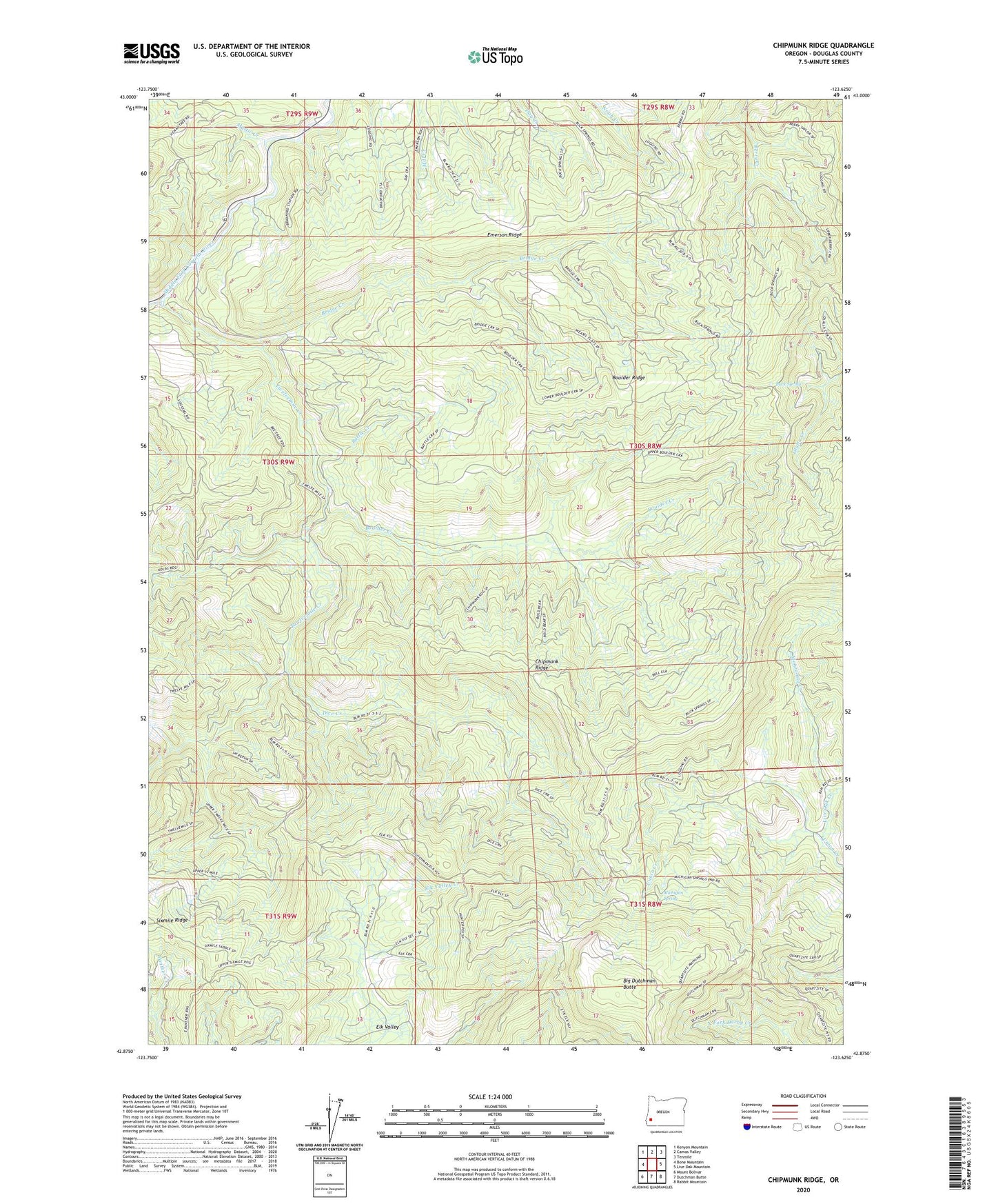
2024 topographic map quadrangle Chipmunk Ridge in the state of Oregon. Scale: 1:24000. Based on the newly updated USGS 7.5' US Topo map series, this map is in the following counties: Douglas. The map contains contour data, water features, and other items you are used to seeing on USGS maps, but also has updated roads and other features. This is the next generation of topographic maps. Printed on high-quality waterproof paper with UV fade-resistant inks.
Quads adjacent to this one:
West: Bone Mountain
Northwest: Kenyon Mountain
North: Camas Valley
Northeast: Tenmile
East: Live Oak Mountain
Southeast: Rabbit Mountain
South: Dutchman Butte
Southwest: Mount Bolivar
This map covers the same area as the classic USGS quad with code o42123h6.
Contains the following named places: Battle Creek, Big Dutchman Butte, Boulder Creek, Boulder Ridge, Bradford Warden Station, Bridge Creek, Buck Spring, Chipmunk Ridge, Dice Creek, Elk Valley, Emerson Ridge, Live Oak Creek, Manzanita Creek, Michigan Spring, Mystic Creek, Twelvemile Creek