MyTopo
Reston Oregon US Topo Map
Couldn't load pickup availability
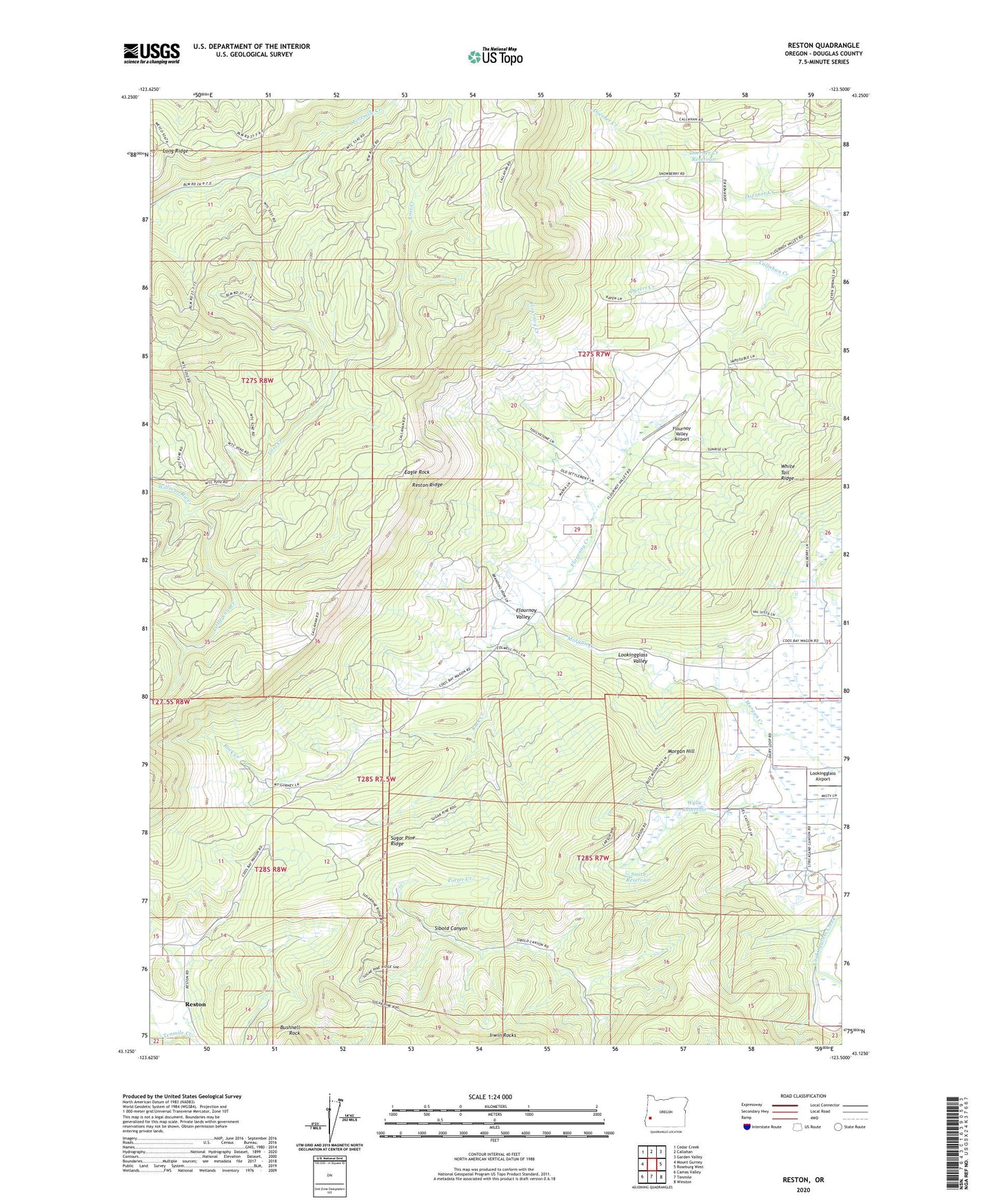
2020 topographic map quadrangle Reston in the state of Oregon. Scale: 1:24000. Based on the newly updated USGS 7.5' US Topo map series, this map is in the following counties: Douglas. The map contains contour data, water features, and other items you are used to seeing on USGS maps, but also has updated roads and other features. This is the next generation of topographic maps. Printed on high-quality waterproof paper with UV fade-resistant inks.
Quads adjacent to this one:
West: Mount Gurney
Northwest: Cedar Creek
North: Callahan
Northeast: Garden Valley
East: Roseburg West
Southeast: Winston
South: Tenmile
Southwest: Camas Valley
Contains the following named places: Bushnell Rock, Doerner Creek Reservoir, Dysert Creek, Eagle Rock, East Fork Byron Creek, Flournoy Creek, Flournoy Valley, Flournoy Valley Airport, Fort Flournoy, Little Cow Creek, Long Ridge, Lookingglass Airport, Lost Creek, Morgan Hill, Reston, Reston Post Office, Reston Ridge, Rock Creek, Smith Reservoir, Sugar Pine Ridge, White Tail Ridge, Wylie Reservoir, Yew Camp