MyTopo
Camas Valley Oregon US Topo Map
Couldn't load pickup availability
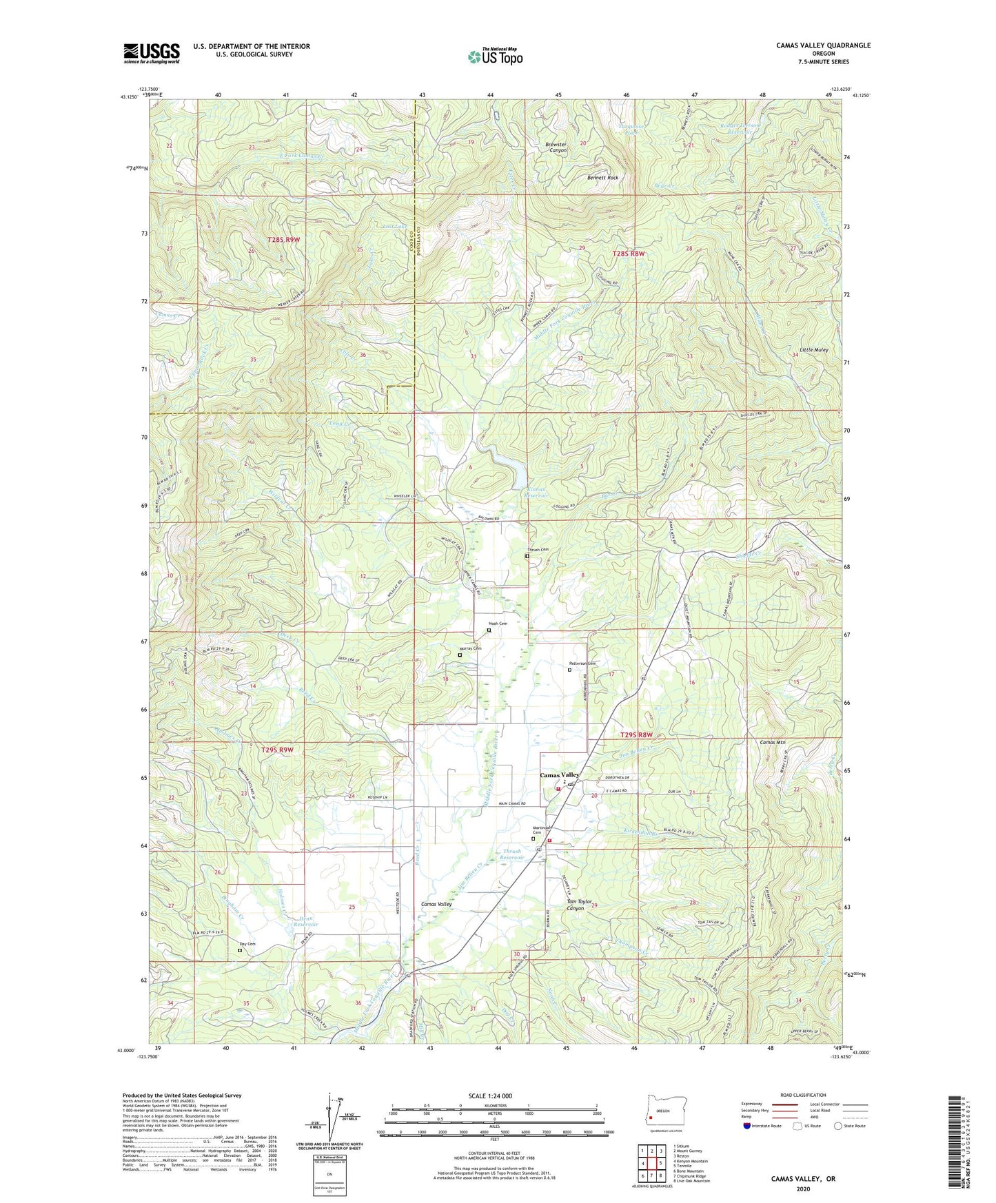
2024 topographic map quadrangle Camas Valley in the state of Oregon. Scale: 1:24000. Based on the newly updated USGS 7.5' US Topo map series, this map is in the following counties: Douglas, Coos. The map contains contour data, water features, and other items you are used to seeing on USGS maps, but also has updated roads and other features. This is the next generation of topographic maps. Printed on high-quality waterproof paper with UV fade-resistant inks.
Quads adjacent to this one:
West: Kenyon Mountain
Northwest: Sitkum
North: Mount Gurney
Northeast: Reston
East: Tenmile
Southeast: Live Oak Mountain
South: Chipmunk Ridge
Southwest: Bone Mountain
This map covers the same area as the classic USGS quad with code o43123a6.
Contains the following named places: Bar Creek, Barnhart Reservoir, Bennett Rock, Big Burn Camp, Bingham Creek, Camas Mountain, Camas Mountain State Park, Camas Valley, Camas Valley Fire Department Station 1, Camas Valley Fire Department Station 2, Camas Valley High School, Camas Valley Post Office, Camas Valley School, Cole Creek, Combs Reservoir, Day Cemetery, Day Creek, Deep Creek, Denn Reservoir, Estes Creek, Holmes Creek, Jim Belieu Creek, Kinnan Dam, Kinnan Reservoir, Kirkendall Branch, Lake Creek, Little Muley, Long Creek, Lost Lake, Martindale Cemetery, Mill Creek, Murray Cemetery, Noah Cemetery, Noah Creek, Patterson Cemetery, Reed Creek, Rodger Iverson Dam, Rodger Iverson Reservoir, Thompson Creek, Thrush Cemetery, Thrush Reservoir, Tom Taylor Canyon, Turquoise Pond, Wildcat Creek, ZIP Code: 97416