MyTopo
Callahan Oregon US Topo Map
Couldn't load pickup availability
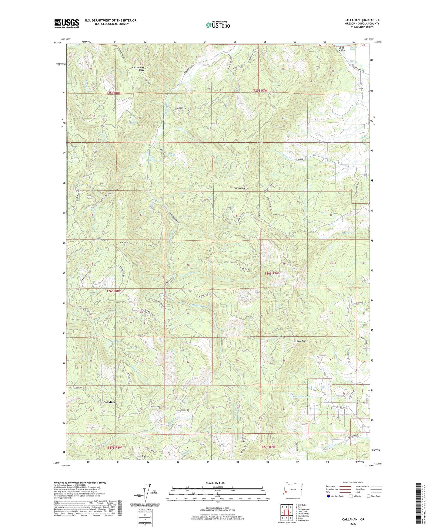
2023 topographic map quadrangle Callahan in the state of Oregon. Scale: 1:24000. Based on the newly updated USGS 7.5' US Topo map series, this map is in the following counties: Douglas. The map contains contour data, water features, and other items you are used to seeing on USGS maps, but also has updated roads and other features. This is the next generation of topographic maps. Printed on high-quality waterproof paper with UV fade-resistant inks.
Quads adjacent to this one:
West: Cedar Creek
Northwest: Kelly Butte
North: Tyee
Northeast: Tyee Mountain
East: Garden Valley
Southeast: Roseburg West
South: Reston
Southwest: Mount Gurney
This map covers the same area as the classic USGS quad with code o43123c5.
Contains the following named places: Baughaman Lookout, Baughman, Bear Creek, Bear Ridge, Blood Camp, Britt Nichols County Park, Buffalo Creek, Callahan, Callahan Guard Station, Camp Creek, Churchill Rapids, Cole Creek, Coles Valley, Coles Valley Post Office, Day Creek, Green Butte, Grier Reservoir, Hawkins Lake, Lost Lake, Melrose Division, Mill Creek, Rock Creek, Willow Creek