MyTopo
Ryegrass Butte Oregon US Topo Map
Couldn't load pickup availability
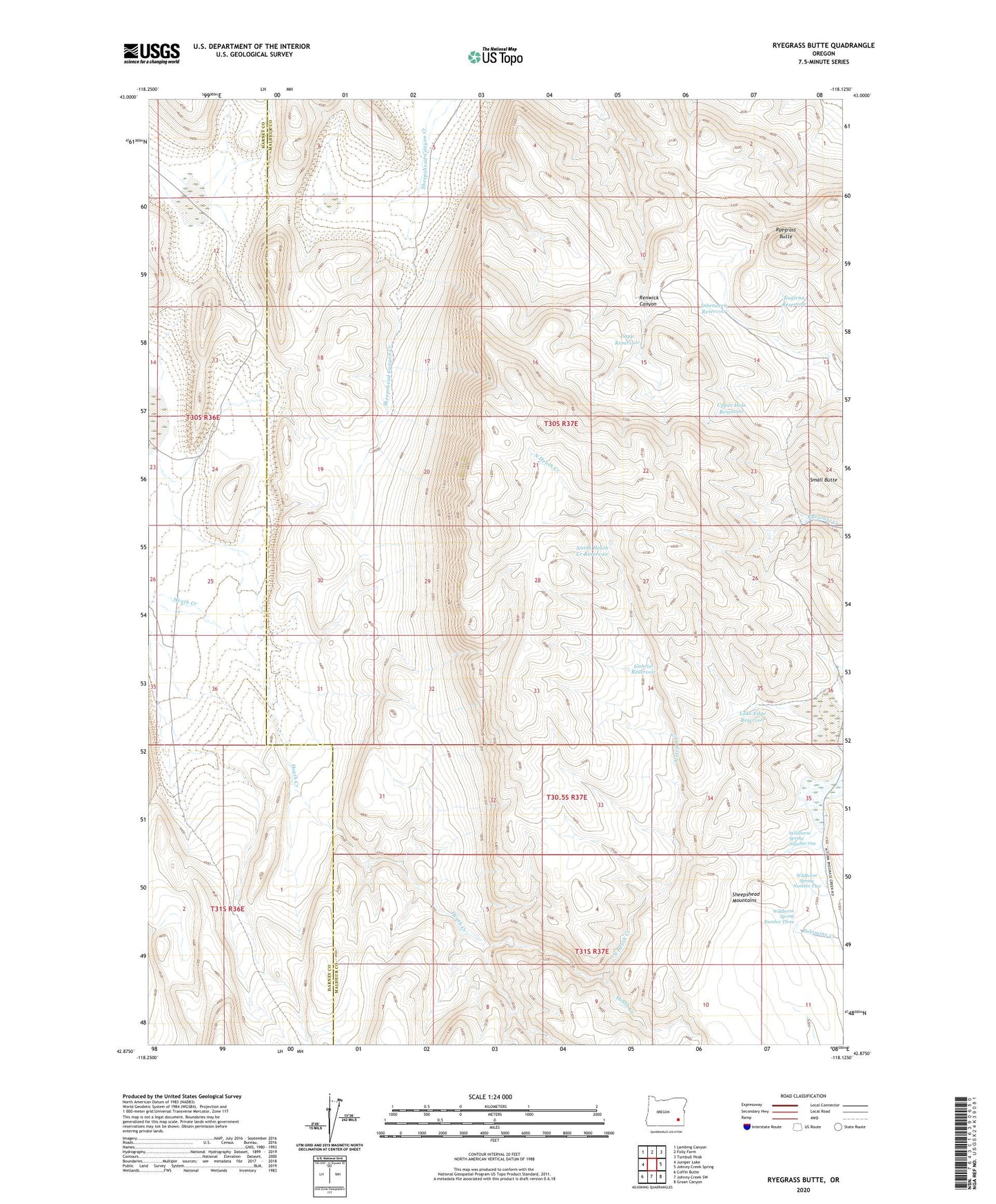
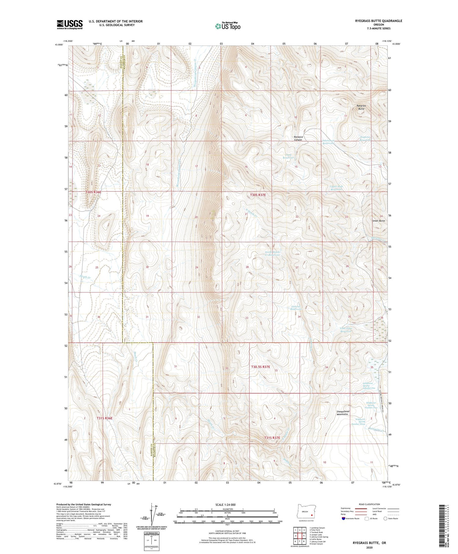
2020 topographic map quadrangle Ryegrass Butte in the state of Oregon. Scale: 1:24000. Based on the newly updated USGS 7.5' US Topo map series, this map is in the following counties: Malheur, Harney. The map contains contour data, water features, and other items you are used to seeing on USGS maps, but also has updated roads and other features. This is the next generation of topographic maps. Printed on high-quality waterproof paper with UV fade-resistant inks.
Quads adjacent to this one:
West: Juniper Lake
Northwest: Lambing Canyon
North: Folly Farm
Northeast: Turnbull Peak
East: Johnny Creek Spring
Southeast: Groan Canyon
South: Johnny Creek SW
Southwest: Coffin Butte
Contains the following named places: Capp Reservoir, Euglena Reservoir, Gabriel Reservoir, Heath Creek, Inbetween Reservoir, Lake Edge Reservoir, North Heath Creek, North Heath Creek Reservoir, Ryegrass Butte, Sheepshead Mountains, Small Butte, Upper Hole Reservoir, Wildhorse Spring Number One, Wildhorse Spring Number Three, Wildhorse Spring Number Two