MyTopo
Saint Patrick Mountain Oregon US Topo Map
Couldn't load pickup availability
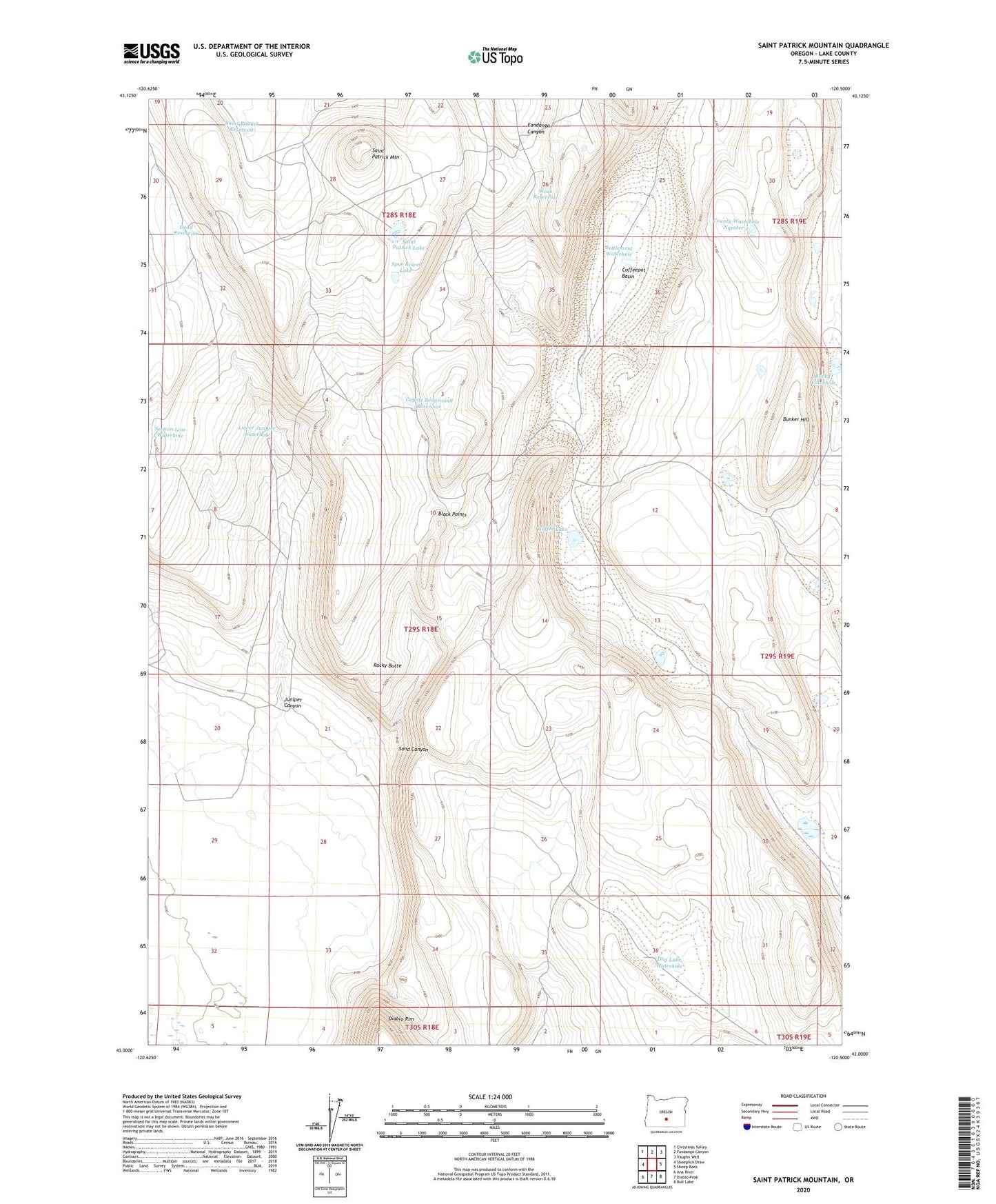
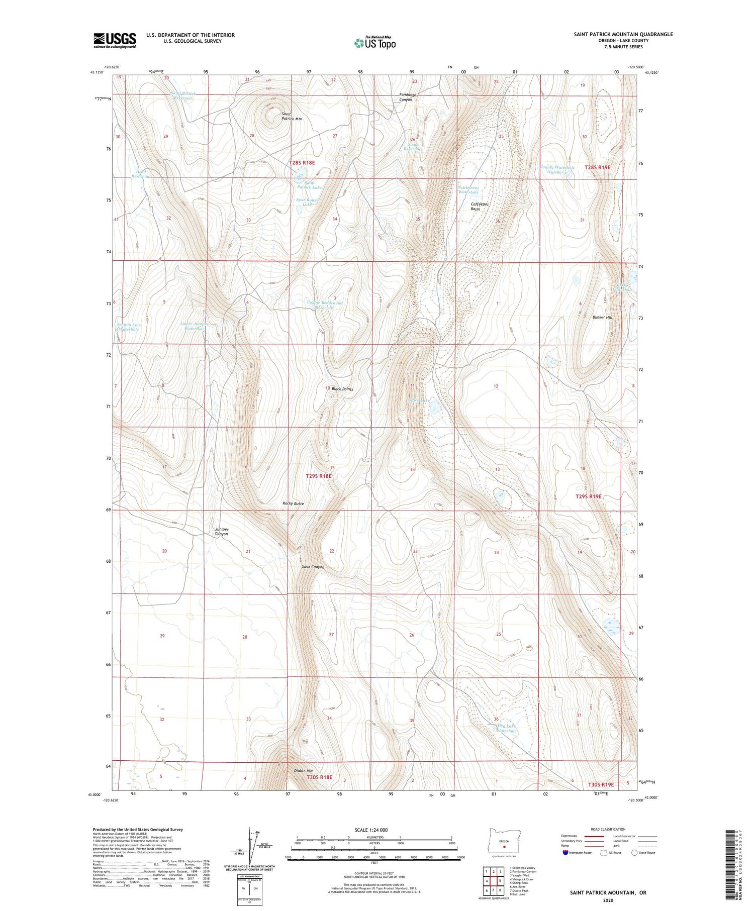
2020 topographic map quadrangle Saint Patrick Mountain in the state of Oregon. Scale: 1:24000. Based on the newly updated USGS 7.5' US Topo map series, this map is in the following counties: Lake. The map contains contour data, water features, and other items you are used to seeing on USGS maps, but also has updated roads and other features. This is the next generation of topographic maps. Printed on high-quality waterproof paper with UV fade-resistant inks.
Quads adjacent to this one:
West: Sheeplick Draw
Northwest: Christmas Valley
North: Fandango Canyon
Northeast: Vaughn Well
East: Sheep Rock
Southeast: Bull Lake
South: Diablo Peak
Southwest: Ana River
Contains the following named places: Black Points, Bunker Hill, Coffee Lake, Coffeepot Basin, County Waterhole Number 11, County Waterhole Number 2, County Waterhole Number 4, County Waterhole Number 7, County Waterhole Number 9, Coyote Bedground Reservoir, Dead Reservoir, Dog Lake Waterhole, Emery Well, Juniper Canyon, Lower Juniper Waterhole, Rocky Butte, Rocky Waterhole, Saint Patrick Lake, Saint Patrick Mountain, Saint Patrick Mountain Reservoir Number Two, Saint Patrick Reservoir, Sand Canyon, Section Line Waterhole, Settlement Waterhole, Sioux Reservoir, Spur Rowel Lake, State Game Reservoir Number 6, State Game Reservoir Number 7