MyTopo
Sandy Oregon US Topo Map
Couldn't load pickup availability
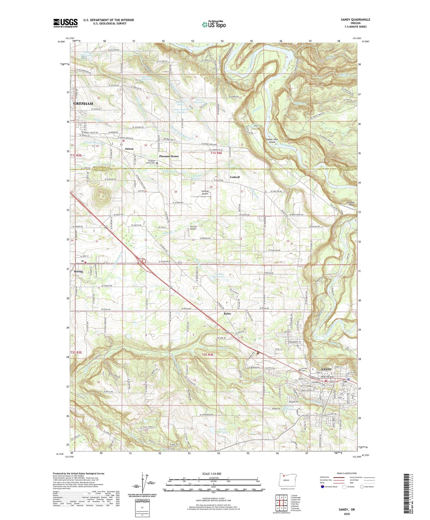
2023 topographic map quadrangle Sandy in the state of Oregon. Scale: 1:24000. Based on the newly updated USGS 7.5' US Topo map series, this map is in the following counties: Clackamas, Multnomah. The map contains contour data, water features, and other items you are used to seeing on USGS maps, but also has updated roads and other features. This is the next generation of topographic maps. Printed on high-quality waterproof paper with UV fade-resistant inks.
Quads adjacent to this one:
West: Damascus
Northwest: Camas
North: Washougal
Northeast: Bridal Veil
East: Bull Run
Southeast: Cherryville
South: Estacada
Southwest: Redland
This map covers the same area as the classic USGS quad with code o45122d3.
Contains the following named places: Belchers Reservoir, Boring, Boring Census Designated Place, Boring Post Office, Buck Creek, Bull Frog Reservoir, Cedar Creek, Cedar Ridge Middle School, Church of Jesus Christ of Latter Day Saints, City of Sandy, Clackamas Fire District Number 1 Boring Community Fire Station Number 14, Cloud Cap Farms, Cottrell, Cottrell Elementary School, Cottrell Post Office, Cottrell Station, Department of Motor Vehicles Sandy, Doane Creek, Dodge Park, Dolan Creek, East Orient Elementary School, Fields Reservoirs, Fir Hill Cemetery, Fly JLA Airport, Flying K Bar J Ranch Airport, Gavins Pond, Gillis, Glendale Pond, Good Shepherd Community Church, Good Shepherd School, Gordon Creek, Gospel of Our Savior Community Chapel, Gresham Fire and Emergency Services Station 76, Gresham Little Theatre, Hessel Reservoir, Immanuel Lutheran Church, Indian John Island, Indian John Island Park, Kelso, Kelso Elementary School, Kelso Post Office, Latourette Park, Lights, Living Word Fellowship, Lusted Creek, Lusted Reservoir, Mabery, Mayberry, Meinig Memorial Park, Meining Park Amphitheater, Middle Fork Beaver Creek, Mount Hood National Forest Headquarters, North Fork Beaver Creek, Orient, Orient Census Designated Place, Orient Drive Baptist Church, Orient Post Office, Oxbow Regional Park, Paynesville Post Office, Peterson Crossroads, Pioneer Park, Pleasant Home, Pleasant Home Cemetery, Pleasant Home Post Office, Portland Water Supply, Powell Valley Covenant Church, Sam Barlow High School, Sandy, Sandy Area Historical Museum, Sandy Area Metro Assembly of God Church Park and Ride, Sandy Area Metro Avamere Assisted Living Park and Ride, Sandy Baptist Church, Sandy City Hall, Sandy Division, Sandy Foursquare Church, Sandy Grade School, Sandy High School, Sandy Intermediate School, Sandy Marketplace Shopping Center, Sandy Municipal Court, Sandy Police Department, Sandy Post Office, Sandy Public Library, Sandy Public Works, Sandy Reservoirs, Sandy Ridge, Sandy River Scenic Waterway, Sandy Rural Fire Protection District Station 71, Sandy Wastewater Treatment Plant, Scandinavian Cemetery, Scenic, Schmidt Airport, Sester Dam Number 1, Sester Reservoir Number 1, Sester Reservoirs, South Fork Beaver Creek, South Fork Tickle Creek, Stargazer Field, Tickle Creek, Trout Creek, Trout Creek Camp, Unavilla Post Office, Welling Reservoir, West Orient Middle School, ZIP Code: 97009