MyTopo
Santiam Junction Oregon US Topo Map
Couldn't load pickup availability
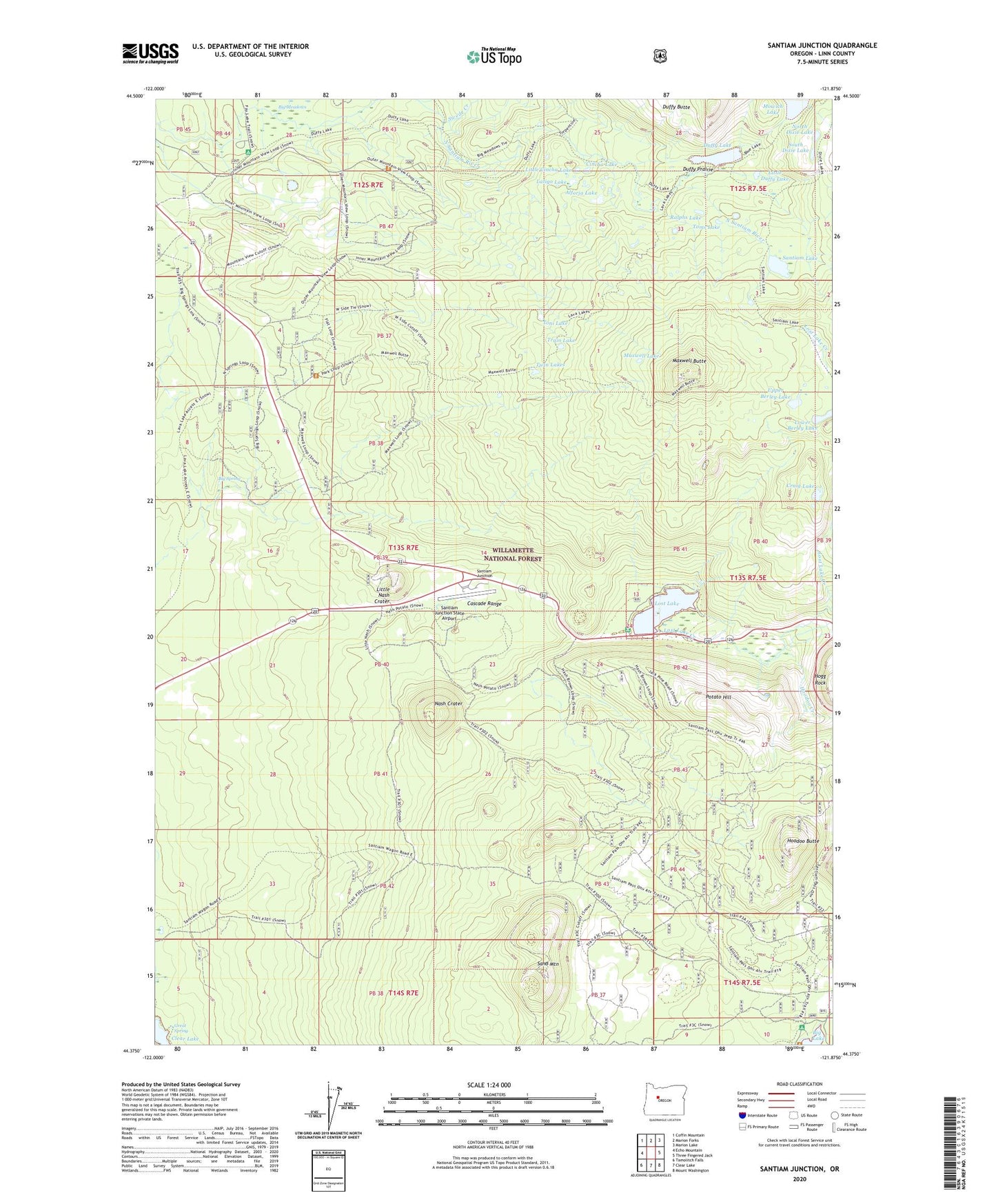
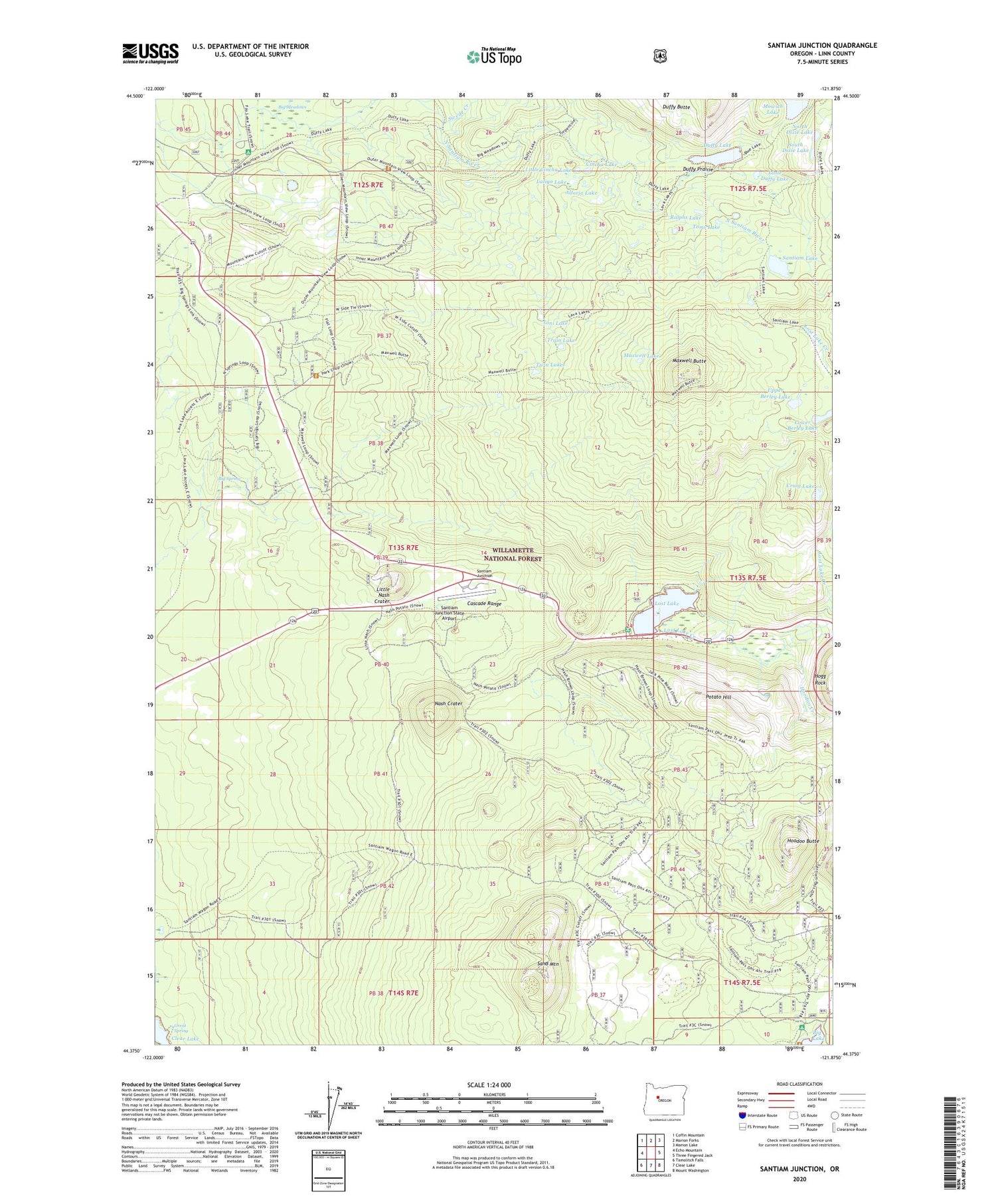
2020 topographic map quadrangle Santiam Junction in the state of Oregon. Scale: 1:24000. Based on the newly updated USGS 7.5' US Topo map series, this map is in the following counties: Linn. The map contains contour data, water features, and other items you are used to seeing on USGS maps, but also has updated roads and other features. This is the next generation of topographic maps. Printed on high-quality waterproof paper with UV fade-resistant inks.
Quads adjacent to this one:
West: Echo Mountain
Northwest: Coffin Mountain
North: Marion Forks
Northeast: Marion Lake
East: Three Fingered Jack
Southeast: Mount Washington
South: Clear Lake
Southwest: Tamolitch Falls
Contains the following named places: Alforja Lake, Big Lake West Recreation Site, Big Meadows Horse Camp, Big Spring, Cincha Lake, Craig Lake, Duffy Butte, Duffy Lake, Duffy Lake Trail, Duffy Prairie, Great Spring, Hoodoo Butte, Hoodoo Creek, Latigo Lake, Lava Trail, Little Cincha Lake, Little Duffy Lake, Little Nash Crater, Lost Lake, Lost Lake Campground, Lost Lake Campground Unimproved Boat Launch, Lost Lake Creek, Lower Berley Lake, Maxwell Butte, Maxwell Lake, Maxwell Trail, Nash Crater, North Dixie Lake, Potato Hill, Ralphs Lake, Sand Mountain, Santiam Junction, Santiam Junction State Airport, Santiam Lake, South Dixie Lake, Swede Creek, Toms Lake, Toni Lake, Train Lake, Twin Lakes, Upper Berley Lake