MyTopo
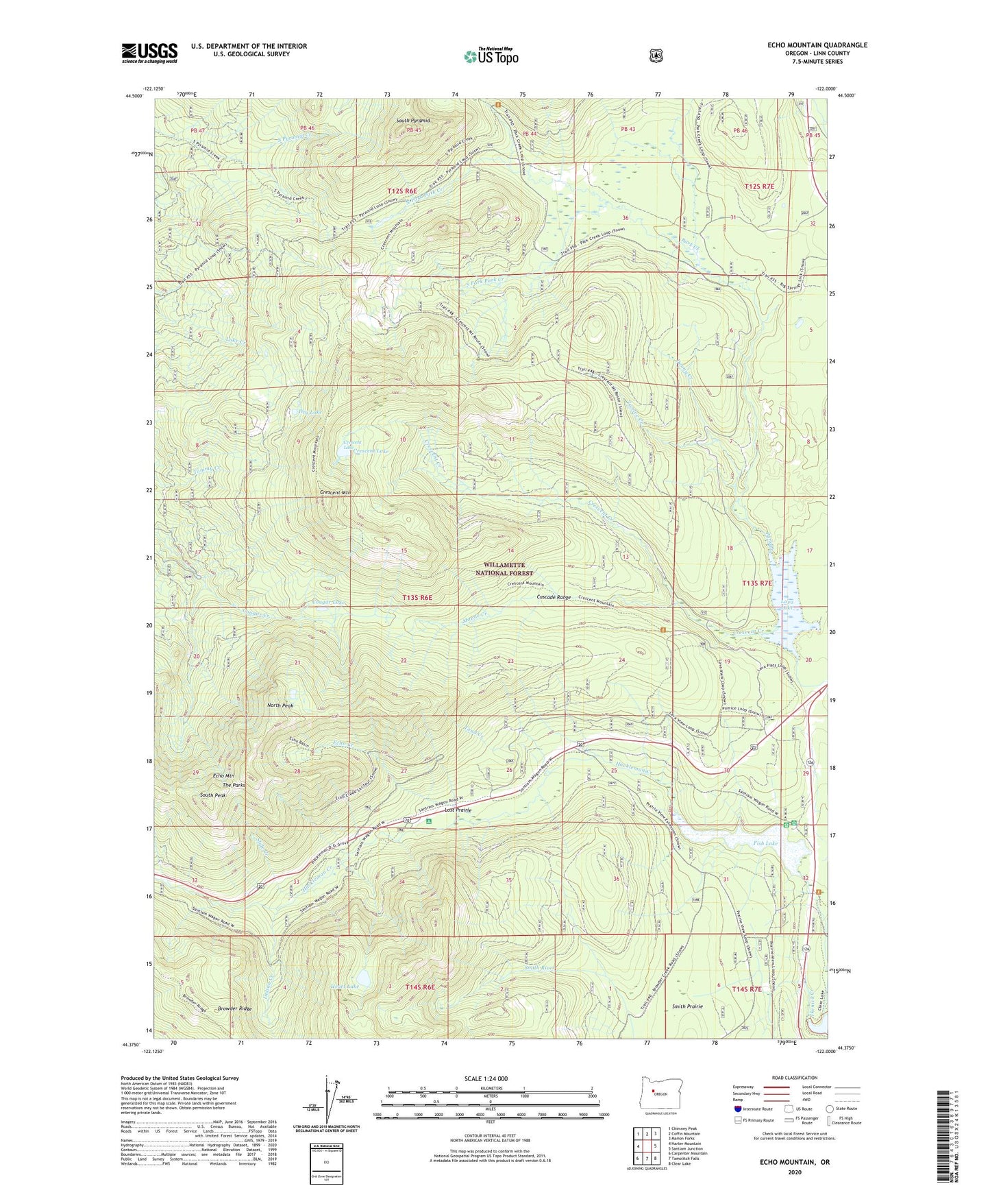
Echo Mountain Oregon US Topo Map
Couldn't load pickup availability
Also explore the Echo Mountain Forest Service Topo of this same quad for updated USFS data
2024 topographic map quadrangle Echo Mountain in the state of Oregon. Scale: 1:24000. Based on the newly updated USGS 7.5' US Topo map series, this map is in the following counties: Linn. The map contains contour data, water features, and other items you are used to seeing on USGS maps, but also has updated roads and other features. This is the next generation of topographic maps. Printed on high-quality waterproof paper with UV fade-resistant inks.
Quads adjacent to this one:
West: Harter Mountain
Northwest: Chimney Peak
North: Coffin Mountain
Northeast: Marion Forks
East: Santiam Junction
Southeast: Clear Lake
South: Tamolitch Falls
Southwest: Carpenter Mountain
This map covers the same area as the classic USGS quad with code o44122d1.
Contains the following named places: Cougar Lake, Crescent Creek, Crescent Lake, Crescent Mountain, Crescent Mountain Trail, Danny Creek, Dry Lake, Echo Creek, Echo Mountain, Fish Lake, Fish Lake Creek, Fish Lake Remount Depot, Hackleman Creek, Heart Lake, Ikenick Creek, Indian Creek, Lava Lake, Long Bow Group Camp, Lost Prairie, Lost Prairie Recreation Site, Maude Creek, North Fork Park Creek, North Peak, Park Creek, Slide Creek, Smith Prairie, South Fork Park Creek, South Peak, South Pyramid, The Parks, Three Pyramids, Toad Creek, Twelve Creek