MyTopo
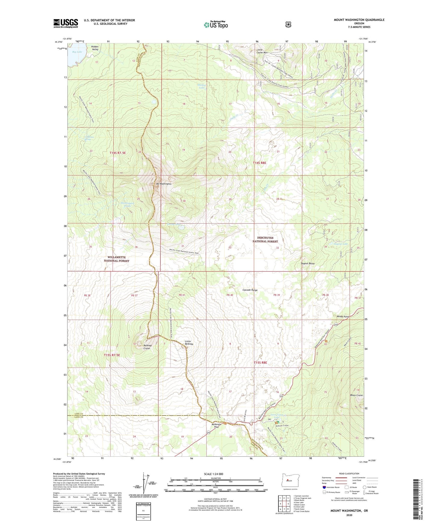
Mount Washington Oregon US Topo Map
Couldn't load pickup availability
Also explore the Mount Washington Forest Service Topo of this same quad for updated USFS data
2024 topographic map quadrangle Mount Washington in the state of Oregon. Scale: 1:24000. Based on the newly updated USGS 7.5' US Topo map series, this map is in the following counties: Deschutes, Linn, Lane. The map contains contour data, water features, and other items you are used to seeing on USGS maps, but also has updated roads and other features. This is the next generation of topographic maps. Printed on high-quality waterproof paper with UV fade-resistant inks.
Quads adjacent to this one:
West: Clear Lake
Northwest: Santiam Junction
North: Three Fingered Jack
Northeast: Black Butte
East: Black Crater
Southeast: Trout Creek Butte
South: North Sister
Southwest: Linton Lake
This map covers the same area as the classic USGS quad with code o44121c7.
Contains the following named places: Belknap Crater, Big Lake, Black Crater, Cache Creek Toll Station, Coldwater Spring, Dee Wright Observatory, Dugout Butte, Dugout Lake, George Lake, Lava Camp Lake, Lava Camp Lake Recreation Site, Little Belknap, Little Belknap Trail, Little Cache Mountain, McKenzie Pass, Mount Washington, Seventh Day Adventist Organization Camp, Shadow Lake, Washington Ponds, Windy Point