MyTopo
Scotts Valley Oregon US Topo Map
Couldn't load pickup availability
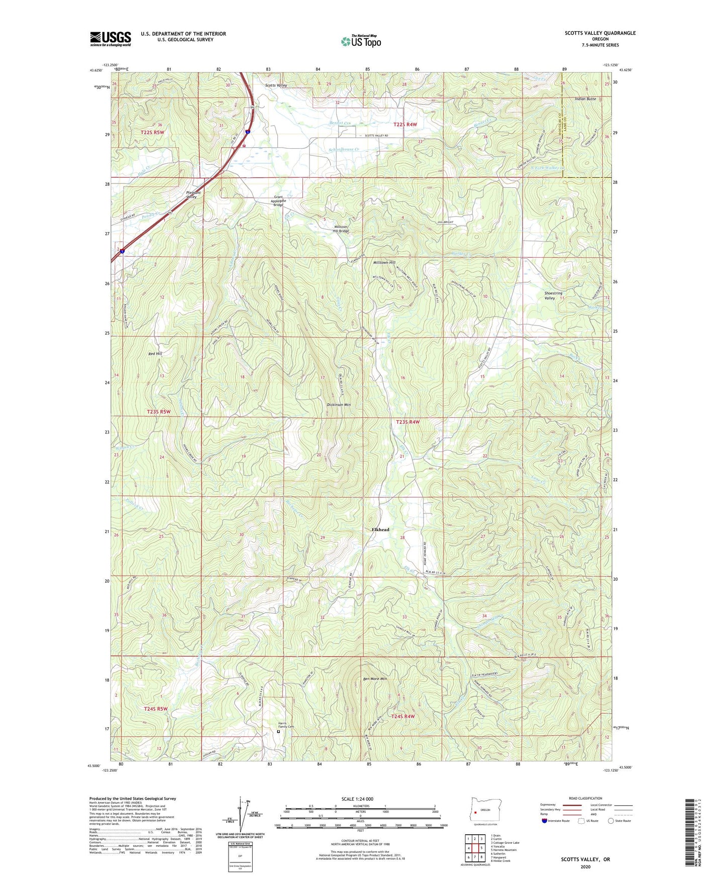
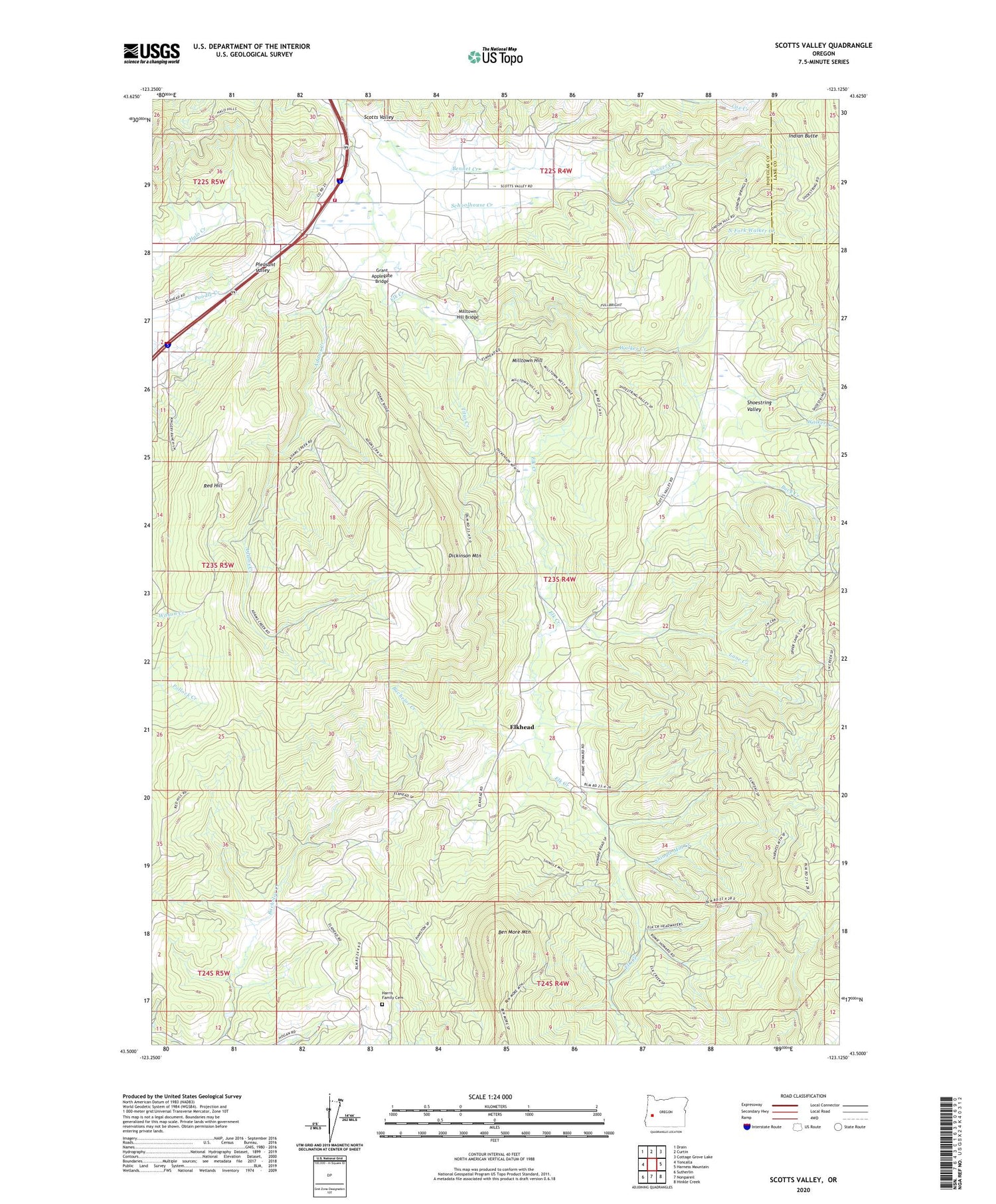
2020 topographic map quadrangle Scotts Valley in the state of Oregon. Scale: 1:24000. Based on the newly updated USGS 7.5' US Topo map series, this map is in the following counties: Douglas, Lane. The map contains contour data, water features, and other items you are used to seeing on USGS maps, but also has updated roads and other features. This is the next generation of topographic maps. Printed on high-quality waterproof paper with UV fade-resistant inks.
Quads adjacent to this one:
West: Yoncalla
Northwest: Drain
North: Curtin
Northeast: Cottage Grove Lake
East: Harness Mountain
Southeast: Hinkle Creek
South: Nonpareil
Southwest: Sutherlin
Contains the following named places: Adams Creek, Ben More Mountain, Bennet Creek, Buck Creek, Calvert, Calvert Post Office, Dickinson Mountain, Elkhead, Elkhead Mines, Elkhead Post Office, Grant Applegate Bridge, Harris Family Cemetery, Ila Post Office, Indian Butte, Lane Creek, Milltown Hill, Milltown Hill Bridge, North Douglas County Fire and Emergency Medical Services Station 5, North Fork Walker Creek, Pleasant Valley, Red Hill, Schoolhouse Creek, Scotts Valley, Shingle Mill Creek, Shoestring Valley, Stacey Post Office, Titus Creek, Walker Creek, ZIP Code: 97499