MyTopo
Drain Oregon US Topo Map
Couldn't load pickup availability
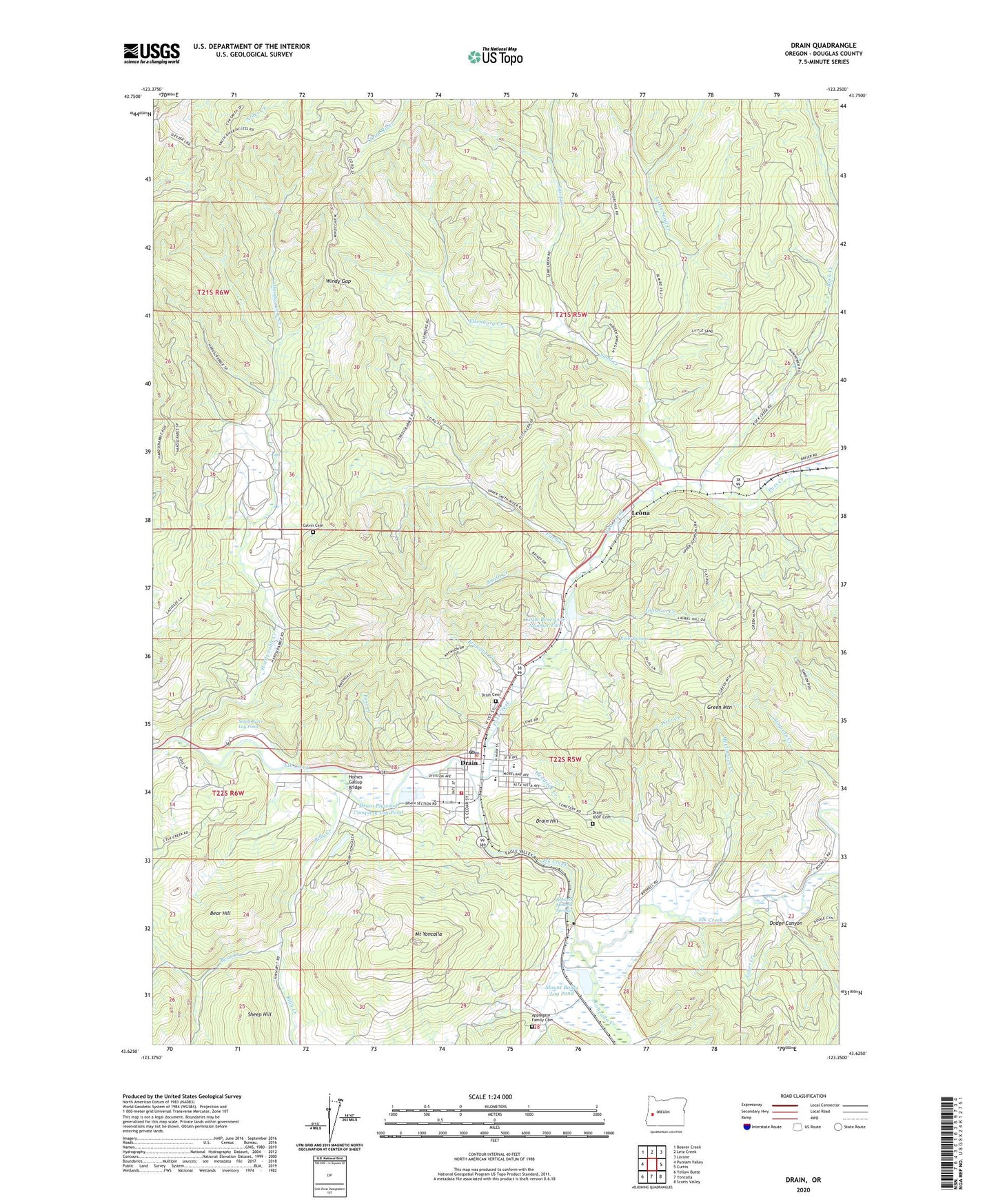
2024 topographic map quadrangle Drain in the state of Oregon. Scale: 1:24000. Based on the newly updated USGS 7.5' US Topo map series, this map is in the following counties: Douglas. The map contains contour data, water features, and other items you are used to seeing on USGS maps, but also has updated roads and other features. This is the next generation of topographic maps. Printed on high-quality waterproof paper with UV fade-resistant inks.
Quads adjacent to this one:
West: Putnam Valley
Northwest: Beaver Creek
North: Letz Creek
Northeast: Lorane
East: Curtin
Southeast: Scotts Valley
South: Yoncalla
Southwest: Yellow Butte
This map covers the same area as the classic USGS quad with code o43123f3.
Contains the following named places: Anna Drain County Park, Applegate Family Cemetery, Asker Creek, Bear Creek, Bear Hill, Billy Creek, Boswell Mineral Springs, Boswell Post Office, City of Drain, Cold Spring School, Colvin Cemetery, Dodge Canyon, Douglas County Sheriff's Office Drain Substation, Douglas Forest Protective Association North Unit, Drain, Drain Branch Mildred Whipple Library, Drain Cemetery, Drain Church of the Nazarene, Drain City Hall, Drain Hill, Drain IOOF Cemetery, Drain Justice Court, Drain Plywood Company Dam, Drain Plywood Company Log Pond, Drain Post Office, Drain Public Works, Drain Wastewater Treatment Plant, Drain Water Treatment Plant, Ellenburg Creek, First Baptist Church of Drain, Fitch Creek, Green Mountain, Hardscrable Creek, Hendrick Creek, Homes Gallup Bridge, Hudson Post Office, Jessie Applegate Historical Marker, Johnson Creek, Krewson, Krewson Creek, Leona, Leona Post Office, Little Reservoir Number Five, Little Sand Creek, McClintock Creek, Mount Baldy Log Pond, Mount Baldy Log Pond Dam, Mount Yoncalla, North Douglas County Fire and Emergency Medical Services Station 1, North Douglas Elementary School, North Douglas High School, Palmer, Pass Creek, Pass Creek Post Office, Post Creek, Reels Springs, Rock Creek, Safley, Sand Creek, Sheep Hill, Smith Creek, Smith River Log Pond, Smith River Lumber Company Dam, Windy Gap, Wise Creek, Yoncalla Creek, ZIP Code: 97435