
MyTopo
Service Creek Oregon US Topo Map
Couldn't load pickup availability
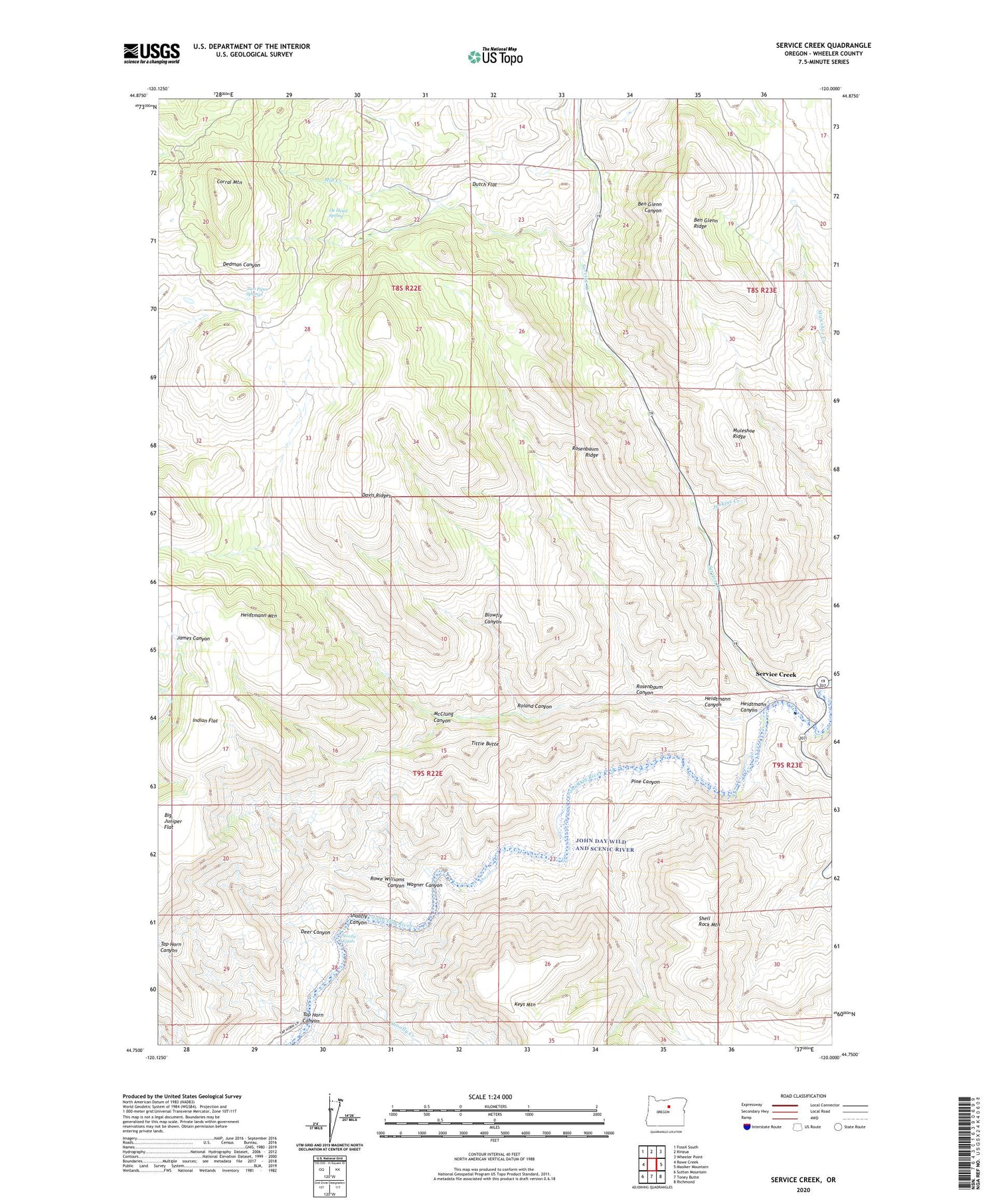
2020 topographic map quadrangle Service Creek in the state of Oregon. Scale: 1:24000. Based on the newly updated USGS 7.5' US Topo map series, this map is in the following counties: Wheeler. The map contains contour data, water features, and other items you are used to seeing on USGS maps, but also has updated roads and other features. This is the next generation of topographic maps. Printed on high-quality waterproof paper with UV fade-resistant inks.
Quads adjacent to this one:
West: Rowe Creek
Northwest: Fossil South
North: Kinzua
Northeast: Wheeler Point
East: Masiker Mountain
Southeast: Richmond
South: Toney Butte
Southwest: Sutton Mountain
Contains the following named places: Ben Glenn Ridge, Big Juniper Flat, Blowfly Canyon, Corral Mountain, Davis Ridges, Deer Canyon, Dutch Flat, Heidtmann Canyon, Heidtmann Mountain, Indian Flat, Jenkins Creek, McClung Canyon, Mill Creek, Muleshoe Ridge, Ox Head Spring, Pine Canyon, Roland Canyon, Rosenbaum Canyon, Rosenbaum Ridge, Rowe Williams Canyon, Service Creek, Service Creek Boat Launch, Service Creek Post Office, Shell Rock Mountain, Shoofly Canyon, Shoofly Creek, Shoofly Rapids, Tap Horn Canyon, Tittie Butte, Two Pipes Springs, Wagner Canyon


