MyTopo
Toney Butte Oregon US Topo Map
Couldn't load pickup availability
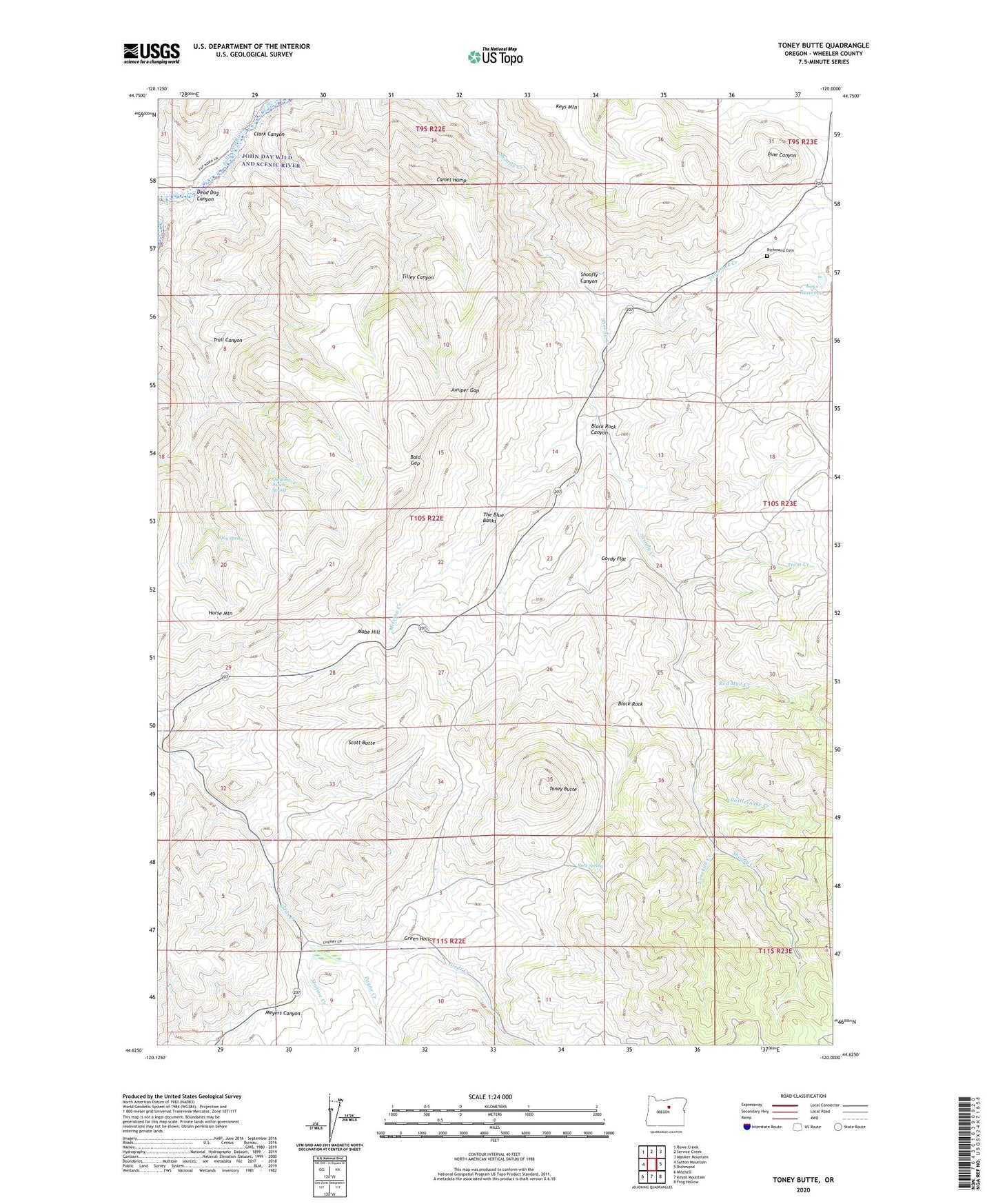
2024 topographic map quadrangle Toney Butte in the state of Oregon. Scale: 1:24000. Based on the newly updated USGS 7.5' US Topo map series, this map is in the following counties: Wheeler. The map contains contour data, water features, and other items you are used to seeing on USGS maps, but also has updated roads and other features. This is the next generation of topographic maps. Printed on high-quality waterproof paper with UV fade-resistant inks.
Quads adjacent to this one:
West: Sutton Mountain
Northwest: Rowe Creek
North: Service Creek
Northeast: Masiker Mountain
East: Richmond
Southeast: Frog Hollow
South: Keyes Mountain
Southwest: Mitchell
This map covers the same area as the classic USGS quad with code o44120f1.
Contains the following named places: Bald Gap, Black Rock, Black Rock Canyon, Camel Hump, Clark Canyon, Dead Dog Canyon, Gordy Flat, Green Hollow, Horse Mountain, Juniper Gap, Keys Mountain, Keys Reservoir, Limekiln Creek, Mabe Hill, May Spring, Melvina Creek, Monroe Creek, Old Frizzell Ranch, Payne Creek, Quaking Aspen Spring, Rattlesnake Creek, Red Mud Creek, Richmond Cemetery, Rock Spring, School Section Cabin, Scott Butte, Shoofly Ranch, Tamarack Creek, The Blue Banks, Tilley Canyon, Toney Butte, Trail Canyon, Trent Creek, Waldron, Waldron Post Office, Waldron School, Wheeler County, Wheeler Post Office